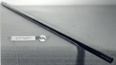
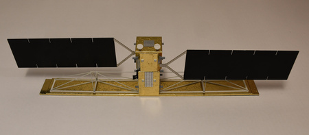
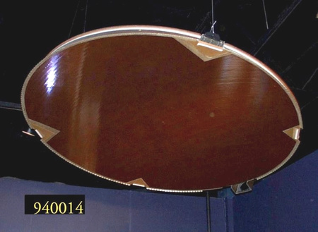
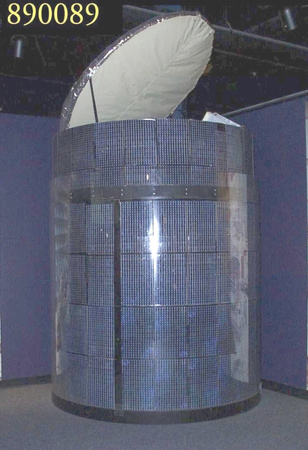
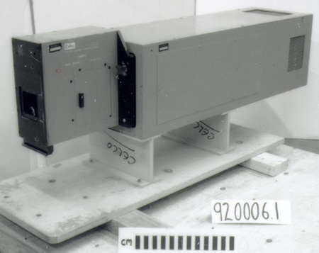
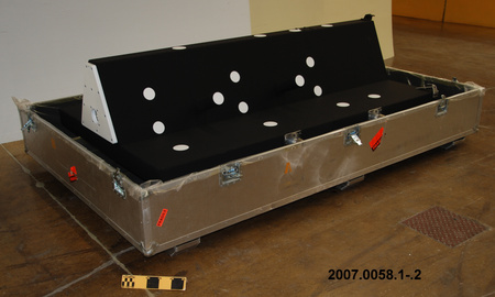
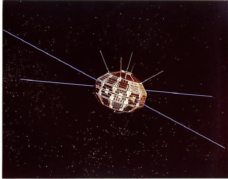
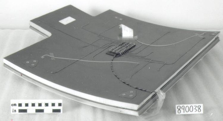
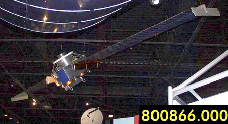
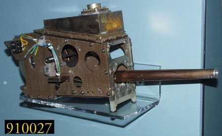
Solar array model, satellite
Utiliser cette image
Puis-je réutiliser cette image sans autorisation? Oui
Les images sur le portail de la collection d’Ingenium ont la licence Creative Commons suivante :
Copyright Ingenium / CC BY-NC-ND (Attribution-NonCommercial 4.0 International (CC BY-NC 4.0)
ATTRIBUER CETTE IMAGE
Ingenium,
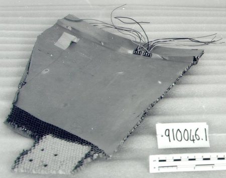
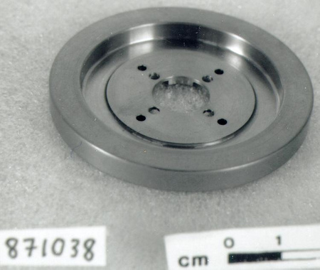
2011.0026.001
Permalien:
Ingenium diffuse cette image sous le cadre de licence Creative Commons et encourage son téléchargement et sa réutilisation à des fins non commerciales. Veuillez mentionner Ingenium et citer le numéro de l’artefact.
TÉLÉCHARGER L’IMAGEACHETER CETTE IMAGE
Cette image peut être utilisée gratuitement pour des fins non commerciales.
Pour un usage commercial, veuillez consulter nos frais de reproduction et communiquer avec nous pour acheter l’image.
- TYPE D’OBJET
- remote sensing satellite
- DATE
- 1991
- NUMÉRO DE L’ARTEFACT
- 2011.0026.001
- FABRICANT
- Spar Aerospace Ltd.
- MODÈLE
- Radarsat 1
- EMPLACEMENT
- Toronto, Ontario, Canada
Plus d’information
Renseignements généraux
- Nº de série
- 1
- Nº de partie
- 1
- Nombre total de parties
- 2
- Ou
- S/O
- Brevets
- S/O
- Description générale
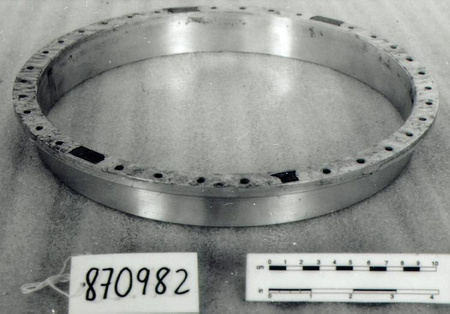
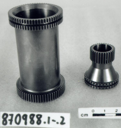
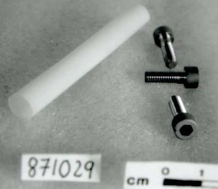
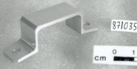
- Synthetic panels, parts, wire coverings/ Glass? solar cells/ metal parts
Dimensions
Remarque : Cette information reflète la taille générale pour l’entreposage et ne représente pas nécessairement les véritables dimensions de l’objet.
- Longueur
- 229,0 cm
- Largeur
- 154,0 cm
- Hauteur
- 68,5 cm
- Épaisseur
- S/O
- Poids
- S/O
- Diamètre
- S/O
- Volume
- S/O
Lexique
- Groupe
- Technologie de l'espace
- Catégorie
- Observation de la terre
- Sous-catégorie
- S/O
Fabricant
- Ou
- Spar
- Pays
- Canada
- État/province
- Ontario
- Ville
- Toronto
Contexte
- Pays
- Canada
- État/province
- Ontario
- Période
- Circa 1991+
- Canada
-
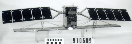
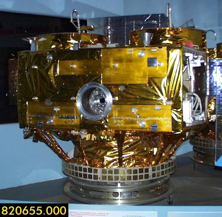
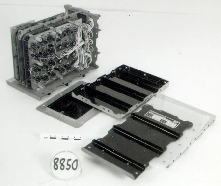
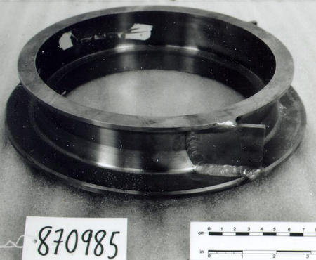
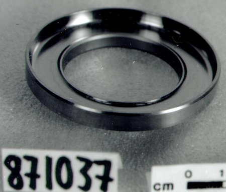
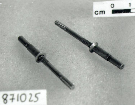
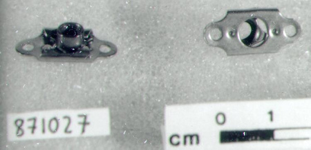
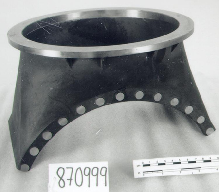
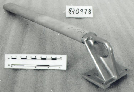
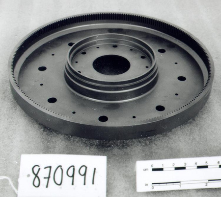
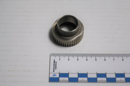
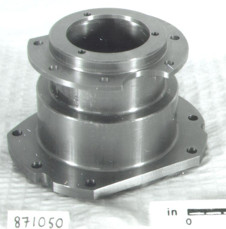
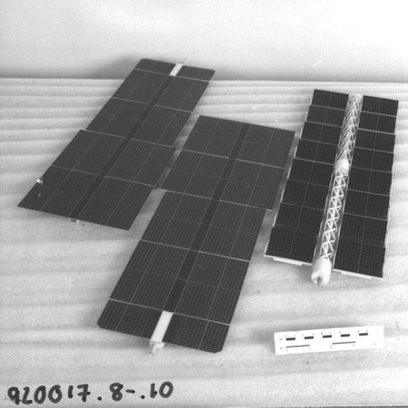
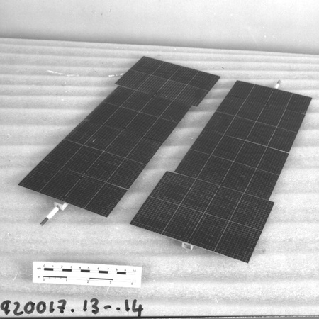
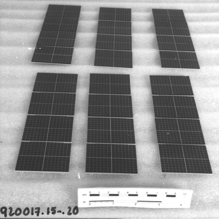
A full-scale deployable engineering model used at David Florida Laboratory (DFL) during the test phase of Radarsat 1, Canada’s first remote sensing satellite. Specifically, it was used to test the deployment mechanism at the spacecraft assembly, integration and testing facility. Canada’s large land mass, wide variety of landscapes, topography and climate make environmental monitoring and study challenging. In the early 1980’s, a special project office was created at the Canadian Centre for Remote Sensing (CCRS) to study the benefits and requirements for a remote sensing satellite that could acquire images day or night, and through cloud cover. Such a satellite would provide commercial and scientific users with imagery in a number of areas such as disaster management, agriculture, cartography, hydrology, forestry, oceanography, ice studies and coastal monitoring. Radarsat1, Canada’s first remote sensing satellite was developed by the Canadian Space Agency in cooperation with provincial governments and the private sector. The federal government provided approx. $500 million, the four participating provinces (Quebec, Ontario, Saskatchewan and British Columbia) provided approx. $57 million, and all provinces participated by pre-purchasing data. SPAR Aerospace Ltd. was selected as the prime contractor, and in total, about 100 Canadian and international organizations participated in the project. Noted for its synthetic aperture radar (SAR), R-1 was launched by a Delta II rocket November 4, 1995 from Vandenburg Airforce Base in California. The first image was of Cape Breton Island taken November 4, 1995. Radarsat 2, launched in 2007, adds powerful technical advancements, notably increased resolution and right or left looking beam modes that allow for shorter re-visit times for some latitudes. At a time when territorial claims in the high Arctic are being contested [by Canada, the U.S., Russia, Denmark and Norway], the multipurpose nature of the Radarsat line of remote sensing satellite gives Canada unprecedented mapping, environmental monitoring and surveillance capabilities – in fine resolution mode, Radarsat-2 can acquire images at a resolution of 3 meters. One article from the Globe and Mail noted that data from Radarsat-2 could potentially be used in the event of a territorial claim. A constellation of three identical satellites is planned for launches in 2014 and 2015 to provide complete coverage of Canada's land and oceans, in addition to daily access to 95% of the world to Canadian and international users. - Fonction
-
Used in the test phase of the Radarsat-1 project, the solar array structural engineering model was used to test if the solar array could deploy in space. - Technique
-
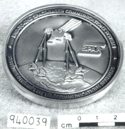
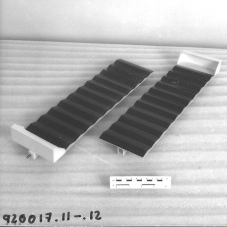
This solar array structural model is the first deployable solar panel developed in Canada for specific use on Radarsat-1. It is notable as one of the few remaining Radarsat-1 objects – it is complete, full scale, free of dust, and undamaged. As Canada’s first remote sensing satellite, Radarsat-1’s technical achievement is the first operational use of synthetic aperture radar (SAR) in orbit, giving it the ability to image day and night, and through cloud cover. SAR is “side-looking” radar technology developed in the 1950’s that uses the flight path of an aircraft to simulate an extremely large antenna or aperture electronically in order to generate high-resolution remote sensing imagery. In a wide beam mode (low rez), Canada can be imaged every 72 hrs, and the Arctic daily. Imagery can be provided within 4 hrs of data collection (1996). Ships larger than 3 m in length can be detected in the Northwest Passage. The prime contractor for Radarsat-1 was SPAR Aerospace Ltd. Transformations and corporate takeovers denotes the history of the one-time Canadian success story. Originally based in Edmonton, SPAR was formed by the merger of de Havilland Canada’s Special Products division (i.e. Alouette 1) and Avro Canada's Applied Research unit (CF-105 Arrow). Expansion and growth followed as a producer of equipment for the Canadian Space Agency in cooperation with NASA’s space shuttle program and International Space Station. Today, SPAR’s lineage can be traced back to MD Robotics, a subsidiary of MacDonald Detweiller and Associates (MDA). SPAR's Edmonton facilities were permanently shut down in the summer 2009 after 4 decades of production and service. - Notes sur la région
-
Inconnu
Détails
- Marques
- None
- Manque
- Appears complete
- Fini
- Black panels with orange solar cells/ Black synthetic covered base/ Multicoloured synthetic parts and wire coverings/ Plated and metallic parts
- Décoration
- S/O
FAIRE RÉFÉRENCE À CET OBJET
Si vous souhaitez publier de l’information sur cet objet de collection, veuillez indiquer ce qui suit :
Spar Aerospace Ltd., Solar array model, satellite, vers 1991, Numéro de l'artefact 2011.0026, Ingenium - Musées des sciences et de l'innovation du Canada, http://collection.ingenium.ca/fr/id/2011.0026.001/
RÉTROACTION
Envoyer une question ou un commentaire sur cet artefact.
Plus comme ceci


2011.0026.001