Carte
Utiliser cette image
Puis-je réutiliser cette image sans autorisation? Oui
Les images sur le portail de la collection d’Ingenium ont la licence Creative Commons suivante :
Copyright Ingenium / CC BY-NC-ND (Attribution-NonCommercial 4.0 International (CC BY-NC 4.0)
ATTRIBUER CETTE IMAGE
Ingenium,
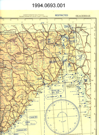
2009.0346.002
Permalien:
Ingenium diffuse cette image sous le cadre de licence Creative Commons et encourage son téléchargement et sa réutilisation à des fins non commerciales. Veuillez mentionner Ingenium et citer le numéro de l’artefact.
TÉLÉCHARGER L’IMAGEACHETER CETTE IMAGE
Cette image peut être utilisée gratuitement pour des fins non commerciales.
Pour un usage commercial, veuillez consulter nos frais de reproduction et communiquer avec nous pour acheter l’image.
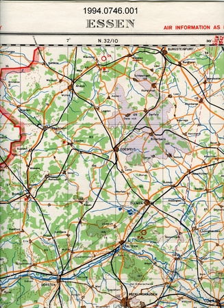
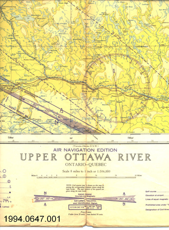
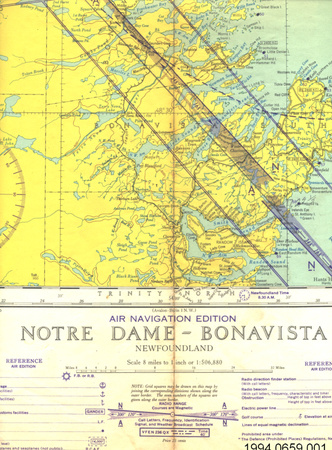
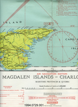
- TYPE D’OBJET
- aerial/satellite
- DATE
- 1975
- NUMÉRO DE L’ARTEFACT
- 2009.0346.002
- FABRICANT
- Cartographic Information & Distribution Centre
- MODÈLE
- Inconnu
- EMPLACEMENT
- Inconnu
Plus d’information
Renseignements généraux
- Nº de série
- S/O
- Nº de partie
- 2
- Nombre total de parties
- 2
- Ou
- S/O
- Brevets
- S/O
- Description générale
- It is done on paper with a high glossy finish.
Dimensions
Remarque : Cette information reflète la taille générale pour l’entreposage et ne représente pas nécessairement les véritables dimensions de l’objet.
- Longueur
- 83,0 cm
- Largeur
- 65,5 cm
- Hauteur
- S/O
- Épaisseur
- S/O
- Poids
- S/O
- Diamètre
- S/O
- Volume
- S/O
Lexique
- Groupe
- Technologie de l'espace
- Catégorie
- Observation de la terre
- Sous-catégorie
- S/O
Fabricant
- Ou
- Cartographic
- Pays
- Inconnu
- État/province
- Inconnu
- Ville
- Inconnu
Contexte
- Pays
- Canada
- État/province
- Ontario
- Période
- Inconnu
- Canada
-
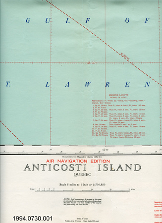
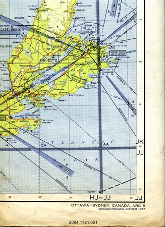
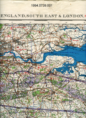
Satellite photo of Ottawa, Ontario. - Fonction
-
It shows the physical characteristic of the Earth, a seen by a satellite. - Technique
-
Previously aerial images were taken using airplanes or balloons. This one is generated from data gathered from the Landsat satellite. - Notes sur la région
-
Inconnu
Détails
- Marques
- Mfr's:"[Canada wordmark]Energy, Mines and Resources/©CNES/Original image provided by the Canada Centre for Remote Sensing, Energy, Mines, and Resources, Canada./OTTAWA/ONTARIO/Scale 1:50 000/Metres 1000 [scale]/Miles 1[scales]/Revised and Published in September 1990/EXPERIMENTAL IMAGE MAP/Produced by the Cartographic Information and Distribution Centre in/conjunction with Scitex America Corporation./Image processing provided by the Canada Centre for Remote Sensing./National Topographic System Data Base 1:50 000 road network provided by the Canada Centre for Mapping/DISTRIBUTED BY/ SATMAP INC./OTTAWA, CANADA (613) 726-9330."[French text also present]]
- Manque
- Nothing is missing.
- Fini
- It is done on paper with a high gloss finish.
- Décoration
- None
FAIRE RÉFÉRENCE À CET OBJET
Si vous souhaitez publier de l’information sur cet objet de collection, veuillez indiquer ce qui suit :
Cartographic Information & Distribution Centre, Carte, vers 1975, Numéro de l'artefact 2009.0346, Ingenium - Musées des sciences et de l'innovation du Canada, http://collection.ingenium.ca/fr/id/2009.0346.002/
RÉTROACTION
Envoyer une question ou un commentaire sur cet artefact.
Plus comme ceci


2009.0346.002