Carte

Utiliser cette image
Puis-je réutiliser cette image sans autorisation? Oui
Les images sur le portail de la collection d’Ingenium ont la licence Creative Commons suivante :
Copyright Ingenium / CC BY-NC-ND (Attribution-NonCommercial 4.0 International (CC BY-NC 4.0)
ATTRIBUER CETTE IMAGE
Ingenium,
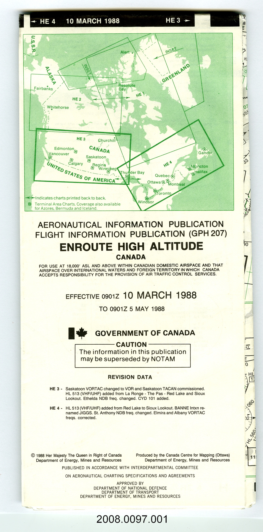
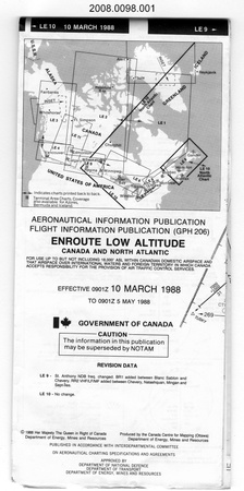
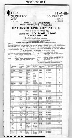
2008.0097.001
Permalien:
Ingenium diffuse cette image sous le cadre de licence Creative Commons et encourage son téléchargement et sa réutilisation à des fins non commerciales. Veuillez mentionner Ingenium et citer le numéro de l’artefact.
TÉLÉCHARGER L’IMAGEACHETER CETTE IMAGE
Cette image peut être utilisée gratuitement pour des fins non commerciales.
Pour un usage commercial, veuillez consulter nos frais de reproduction et communiquer avec nous pour acheter l’image.
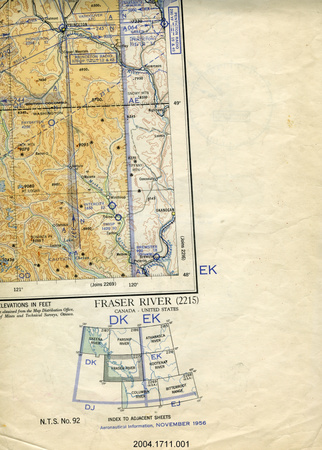
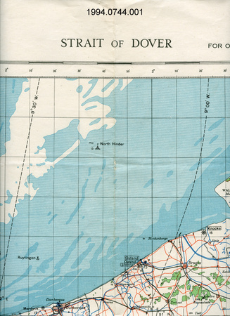
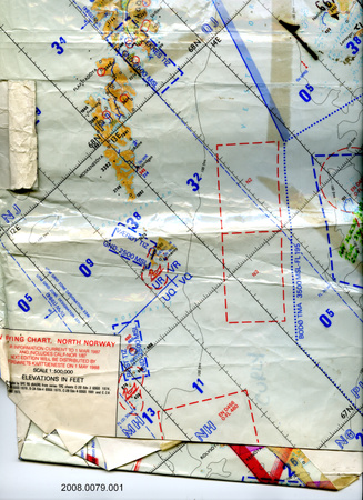
- TYPE D’OBJET
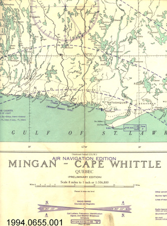
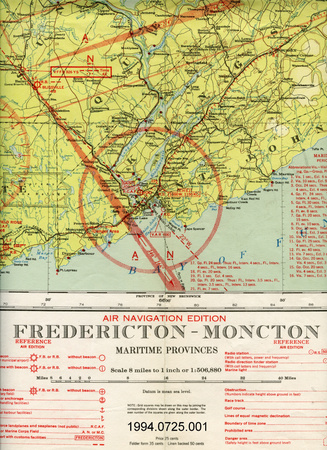
- topographical/aeronautical/folding
- DATE
- 1988
- NUMÉRO DE L’ARTEFACT
- 2008.0097.001
- FABRICANT
- Canada Centre for Mapping
- MODÈLE
- HE3/HE4
- EMPLACEMENT
- Ottawa, Ontario, Canada
Plus d’information
Renseignements généraux
- Nº de série
- S/O
- Nº de partie
- 1
- Nombre total de parties
- 1
- Ou
- S/O
- Brevets
- S/O
- Description générale
- paper
Dimensions
Remarque : Cette information reflète la taille générale pour l’entreposage et ne représente pas nécessairement les véritables dimensions de l’objet.
- Longueur
- 114,0 cm
- Largeur
- 51,0 cm
- Hauteur
- S/O
- Épaisseur
- S/O
- Poids
- S/O
- Diamètre
- S/O
- Volume
- S/O
Lexique
- Groupe
- Aviation
- Catégorie
- Instruments et équipement de navigation
- Sous-catégorie
- S/O
Fabricant
- Ou
- EMR CA
- Pays
- Canada
- État/province
- Ontario
- Ville
- Ottawa
Contexte
- Pays
- Canada
- État/province
- Inconnu
- Période
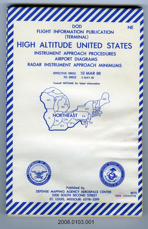
- map information effective March 10, 1988 to May 5, 1988
- Canada
-
Inconnu - Fonction
-
two-dimensional representation of a portion of the earth's surface/ aerial navigation - Technique
-
Inconnu - Notes sur la région
-
Inconnu
Détails
- Marques
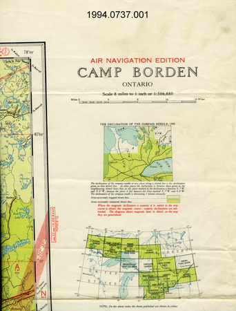
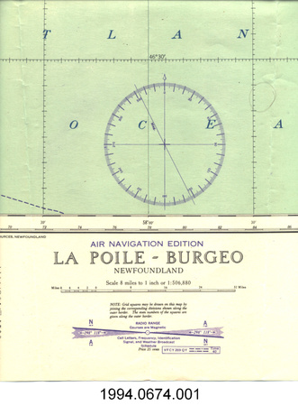
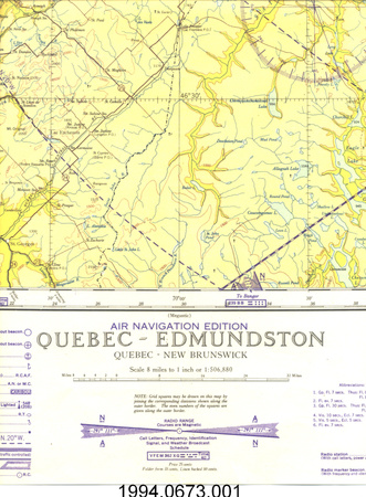
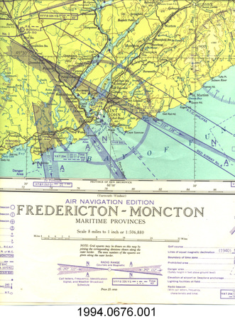
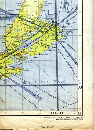
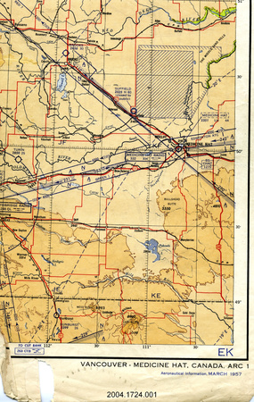
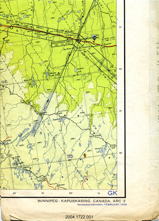
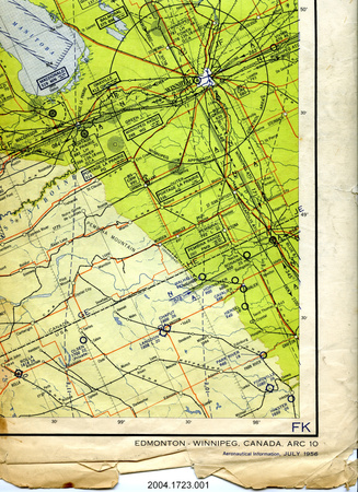
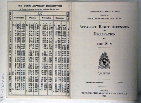
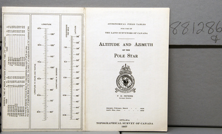
- printed text on cover includes: "HE 4 10 MARCH 1988 HE 3/AERONAUTICAL INFORMATION PUBLICATION/FLIGHT INFORMATION PUBLICATION (GPH 207)/ENROUTE HIGH ALTITUDE/CANADA/FOR USE AT 18,000' ASL AND ABOVE WITHIN CANADIAN DOMESTIC AIRSPACE AND THAT/AIRSPACE OVER INTERNATIONAL WATERS AND FOREIGN TERRITORY IN WHICH CANADA/ACCEPTS RESPONSIBILITY FOR THE PROVISION OF AIR TRANSPORT CONTROL SERVICES./EFFECTIVE 0901Z 10 MARCH 1988/TO 0901Z 5 MAY 1988/[flag]GOVERNMENT OF CANADA/CAUTION/The information of this publication/may be superseded by NOTAM/.../(C) 1988 Her Majesty The Queen in Right of Canada/Department of Energy, Mines and Resources/Produced by the Canada Centre for Mapping (Ottawa)/Department of Energy, Mines and Resources/PUBLISHED IN ACCORDANCE WITH INTERDEPARTMENTAL COMMITTEE/ON AERONAUTICAL CHARTING SPECIFICATIONS AND AGREEMENTS/APPROVED BY/DEPARTMENT OF NATIONAL DEFENCE/DEPARTMENT OF TRANSPORT/DEPARTMENT OF ENERGY, MINES AND RESOURCES"
- Manque
- S/O
- Fini
- black, gray & green cartographic data; black printed text on white sheet
- Décoration
- none
FAIRE RÉFÉRENCE À CET OBJET
Si vous souhaitez publier de l’information sur cet objet de collection, veuillez indiquer ce qui suit :
Canada Centre for Mapping, Carte, 1988, Numéro de l'artefact 2008.0097, Ingenium - Musées des sciences et de l'innovation du Canada, http://collection.ingenium.ca/fr/id/2008.0097.001/
RÉTROACTION
Envoyer une question ou un commentaire sur cet artefact.
Plus comme ceci


2008.0097.001