Carte

Utiliser cette image
Puis-je réutiliser cette image sans autorisation? Oui
Les images sur le portail de la collection d’Ingenium ont la licence Creative Commons suivante :
Copyright Ingenium / CC BY-NC-ND (Attribution-NonCommercial 4.0 International (CC BY-NC 4.0)
ATTRIBUER CETTE IMAGE
Ingenium,
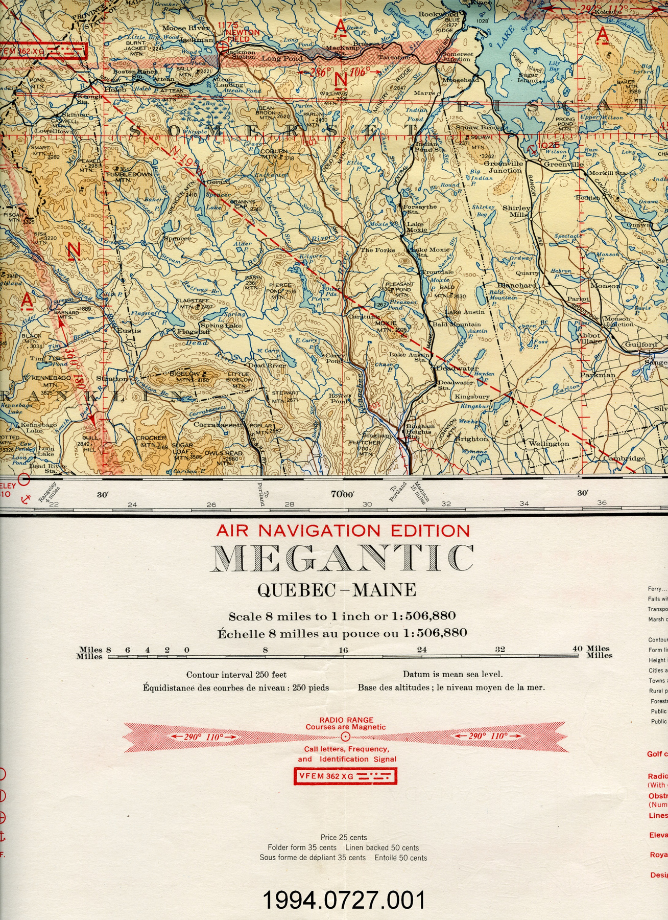
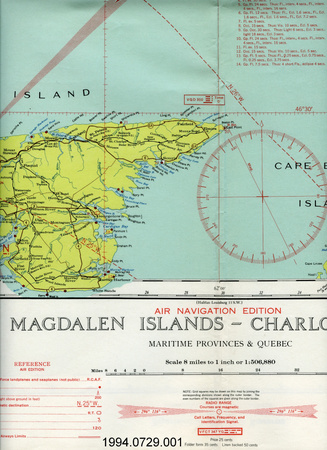
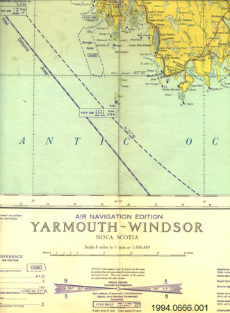
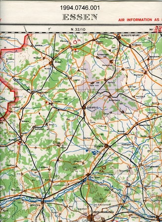
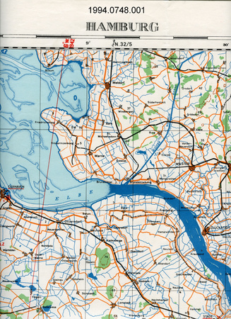
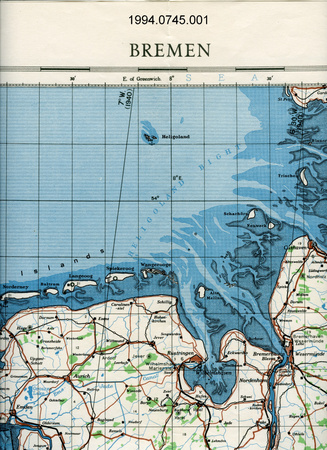
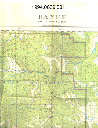
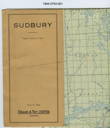
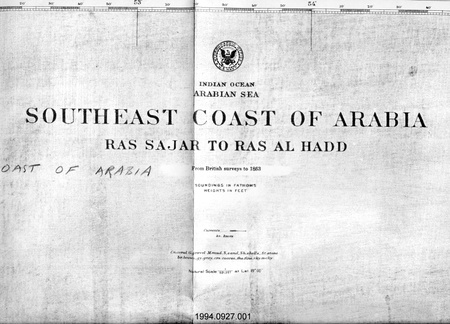
1994.0727.001
Permalien:
Ingenium diffuse cette image sous le cadre de licence Creative Commons et encourage son téléchargement et sa réutilisation à des fins non commerciales. Veuillez mentionner Ingenium et citer le numéro de l’artefact.
TÉLÉCHARGER L’IMAGEACHETER CETTE IMAGE
Cette image peut être utilisée gratuitement pour des fins non commerciales.
Pour un usage commercial, veuillez consulter nos frais de reproduction et communiquer avec nous pour acheter l’image.
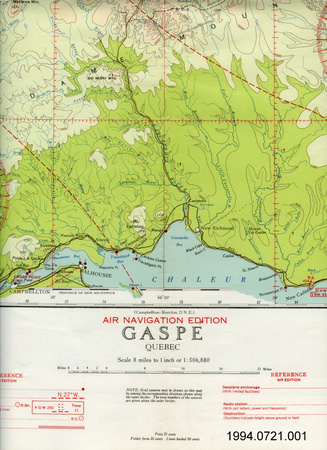
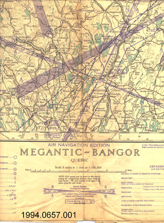
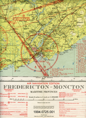
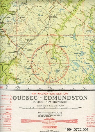
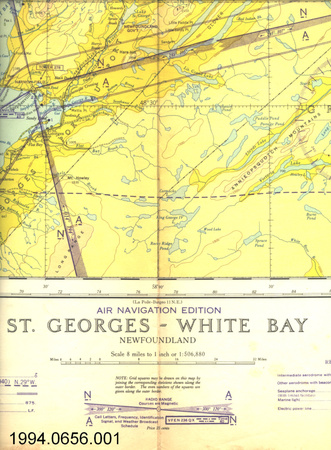
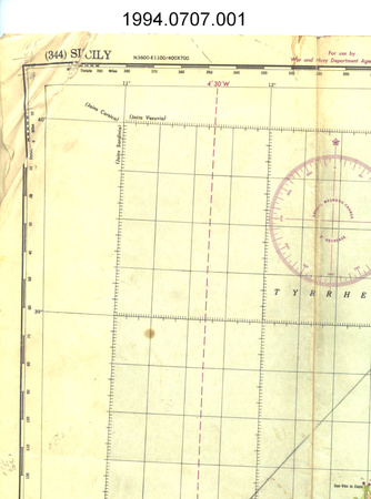
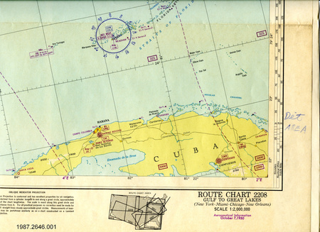
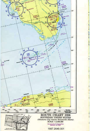
- TYPE D’OBJET
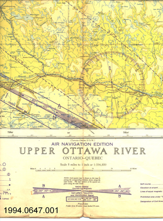
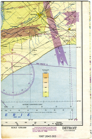
- topographical/aeronautical
- DATE
- 1941
- NUMÉRO DE L’ARTEFACT
- 1994.0727.001
- FABRICANT
- Dept. of Mines & Resources
- MODÈLE
- Megantic
- EMPLACEMENT
- Ottawa, Ontario, Canada
Plus d’information
Renseignements généraux
- Nº de série
- S/O
- Nº de partie
- 1
- Nombre total de parties
- 1
- Ou
- S/O
- Brevets
- S/O
- Description générale
- paper
Dimensions
Remarque : Cette information reflète la taille générale pour l’entreposage et ne représente pas nécessairement les véritables dimensions de l’objet.
- Longueur
- 76,6 cm
- Largeur
- 61,5 cm
- Hauteur
- S/O
- Épaisseur
- S/O
- Poids
- S/O
- Diamètre
- S/O
- Volume
- S/O
Lexique
- Groupe
- Aviation
- Catégorie
- Instruments et équipement de navigation
- Sous-catégorie
- S/O
Fabricant
- Ou
- Mines Resources CA
- Pays
- Canada
- État/province
- Ontario
- Ville
- Ottawa
Contexte
- Pays
- Canada
- État/province
- Québec
- Période
- WWII (1939-1945)/ this map is a June 1941 reprint of an original published in 1934
- Canada
-
Inconnu - Fonction
-
two dimensional graphic representation of a section of the earth's surface/used for aerial navigation - Technique
-
Inconnu - Notes sur la région
-
Inconnu
Détails
- Marques
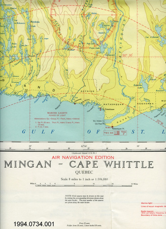
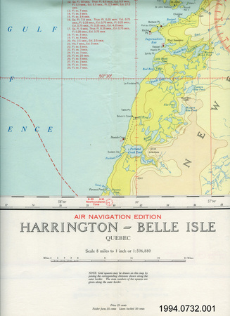
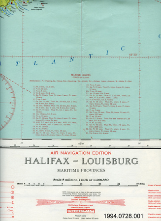
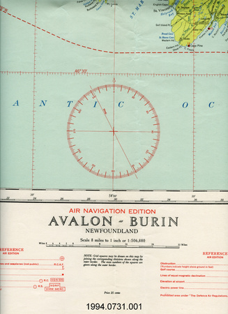
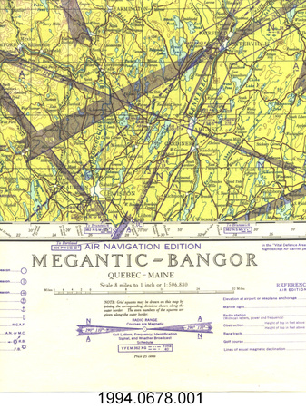
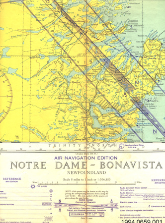
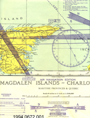
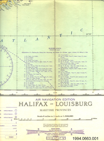
- lettering printed on border above map reads: "NATIONAL TOPOGRAPHIC SERIES/Canada/Department of Mines and Resources/SURVEYS AND ENGINEERING BRANCH/HYDROGRAPHIC AND MAP SERVICE/FOR OFFICIAL USE ONLY/SHEET No 21 S.W. (NORTH HALF)"; lettering printed on border below map reads: "THE VARIATION OF THE COMPASS NEEDLE, JANUARY 1932/VARIATION DE L'AIGUILLE MAGNETIQUE, JANVIER, 1932/AIR NAVIGATION EDITION/MEGANTIC/QUEBEC-MAINE/Scale 8 miles to 1 inch or 1:506,880/Echelle 8 milles au pouce ou 1:506,880/Price 25 cents/Folder form 35 cents Linen backed 50 cents/Sous forme de depliant 35 cents Entoile 50 cents/Compiled, drawn and printed by the Geographical section, General Staff, Department of National Defence, 1934;/Canadian topography from maps of National Topographic Series; topography in United States from maps and/information furnished by U.S. Geological survey; and U.S. Coast and Geodetic Survey./Reprinted at the Hydrographic and Map Service, Labelle Building, Ottawa, 1940, where additional copies may/be obtained./Changes occurring in aeronautical information after date of/publication have not been made on this chart. Consult/Department of Transport, Civil and Radio Aviation circulars./June 1941"
- Manque
- S/O
- Fini
- colour map on white background
- Décoration
- none
FAIRE RÉFÉRENCE À CET OBJET
Si vous souhaitez publier de l’information sur cet objet de collection, veuillez indiquer ce qui suit :
Dept. of Mines & Resources, Carte, 1941, Numéro de l'artefact 1994.0727, Ingenium - Musées des sciences et de l'innovation du Canada, http://collection.ingenium.ca/fr/id/1994.0727.001/
RÉTROACTION
Envoyer une question ou un commentaire sur cet artefact.
Plus comme ceci


1994.0727.001