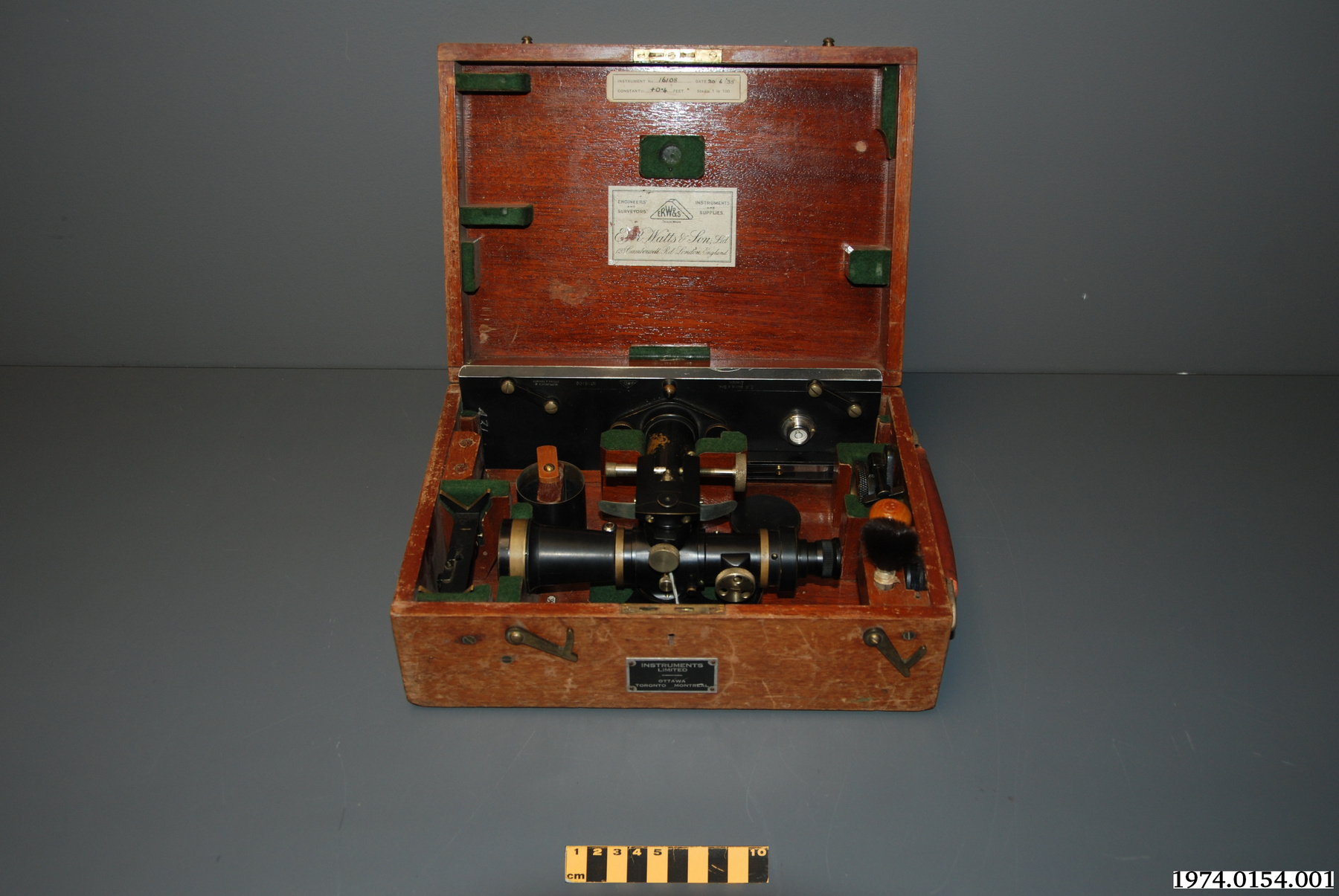
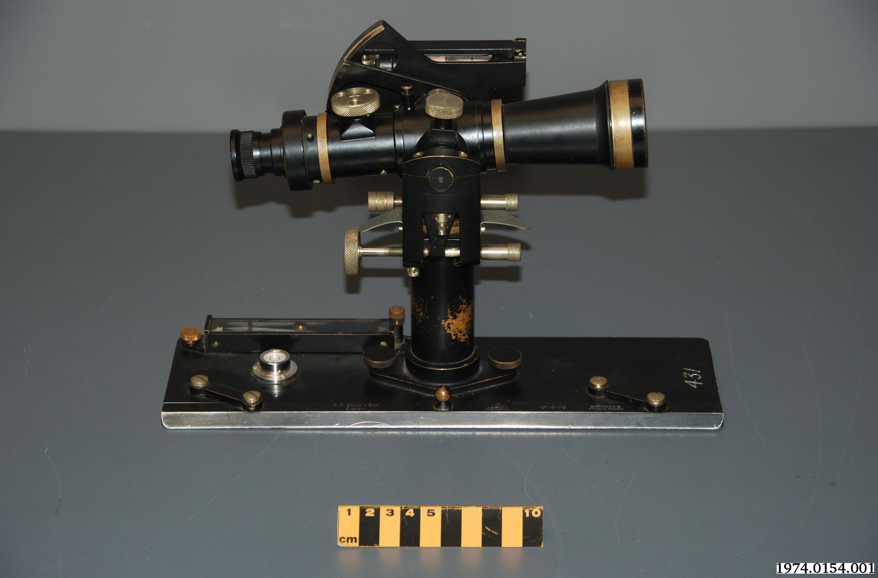
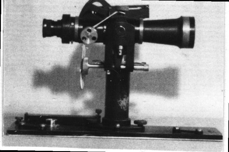
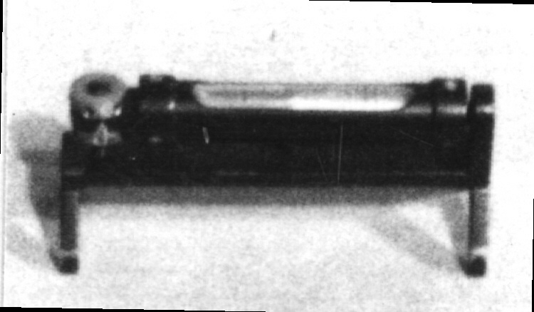
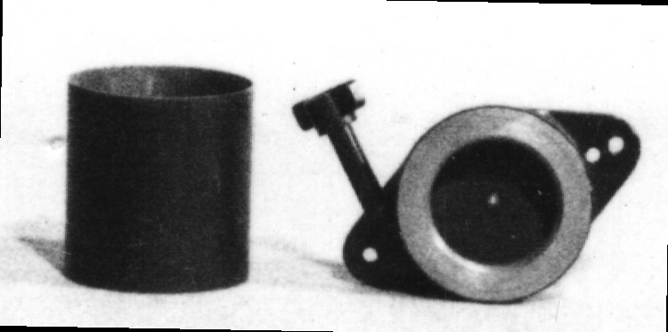
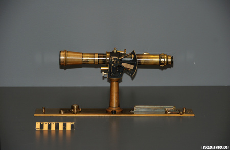
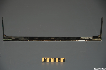
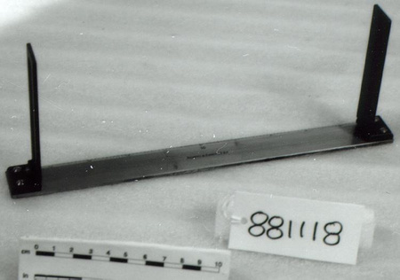
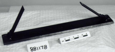
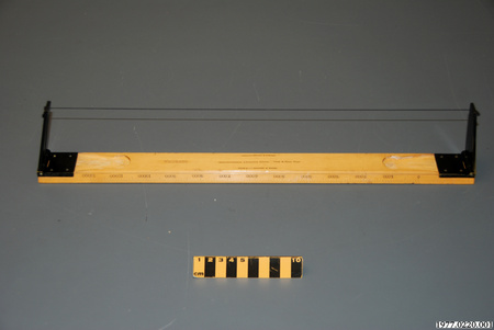
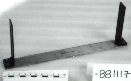
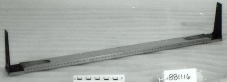
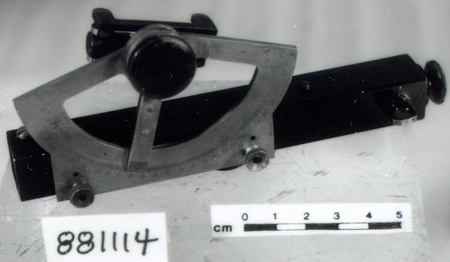
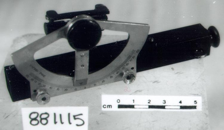
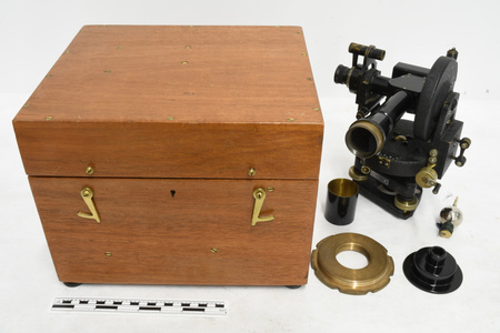
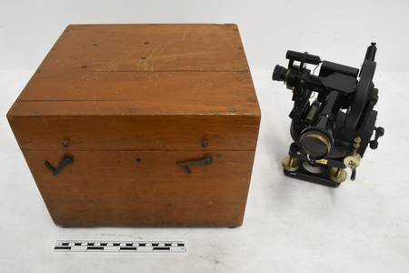
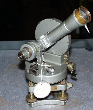
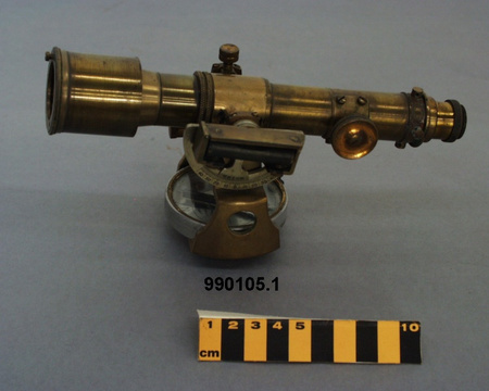
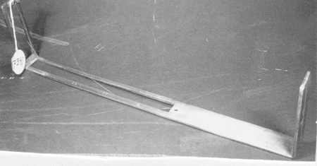
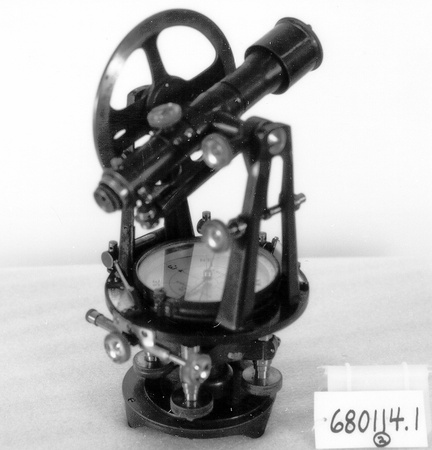
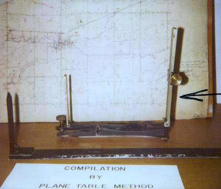
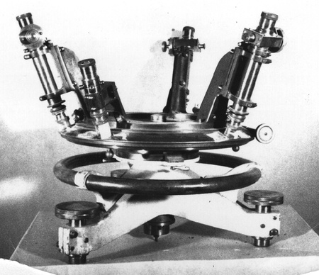
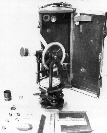
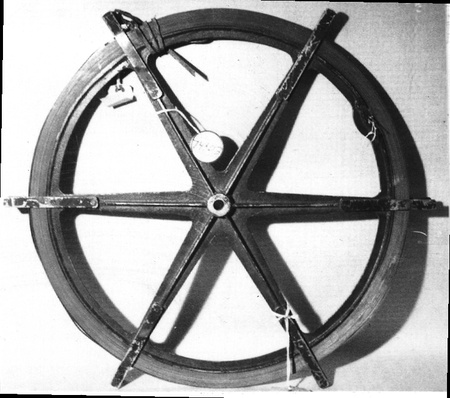
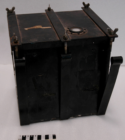
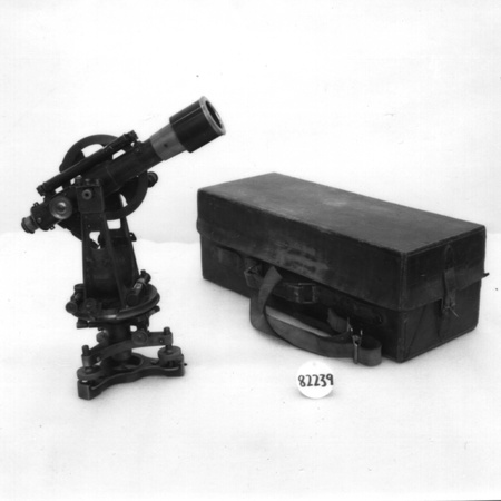
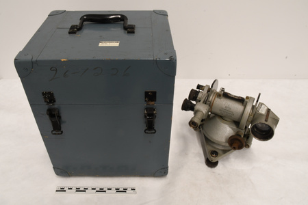
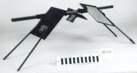
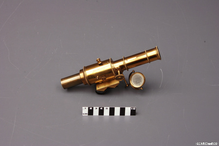
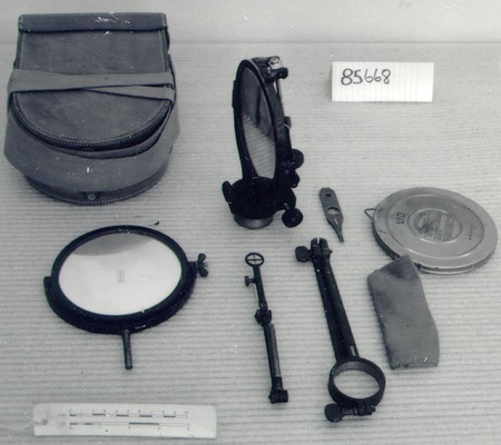
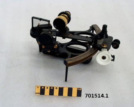
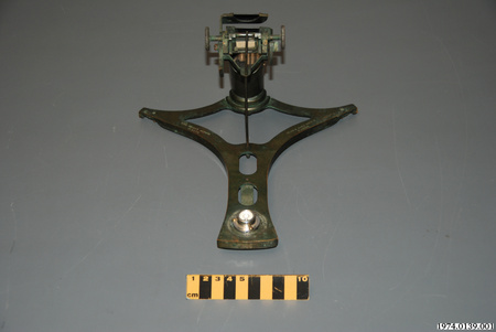
Alidade


Utiliser cette image
Puis-je réutiliser cette image sans autorisation? Oui
Les images sur le portail de la collection d’Ingenium ont la licence Creative Commons suivante :
Copyright Ingenium / CC BY-NC-ND (Attribution-NonCommercial 4.0 International (CC BY-NC 4.0)
ATTRIBUER CETTE IMAGE
Ingenium,
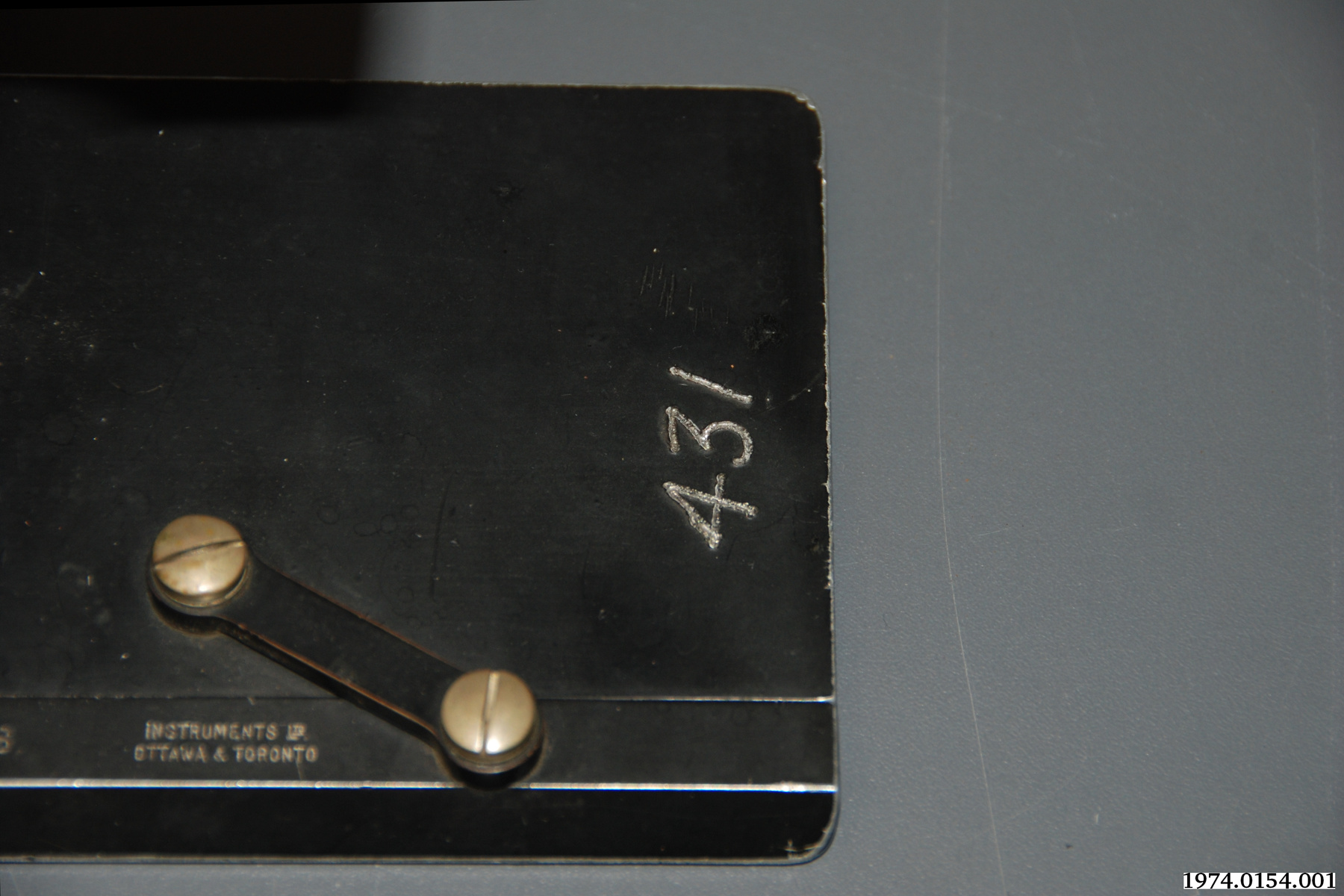
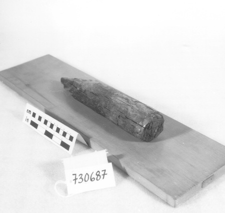
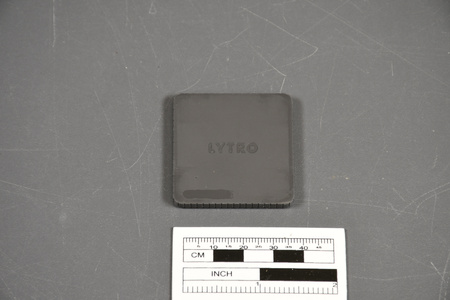
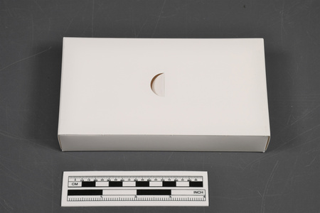
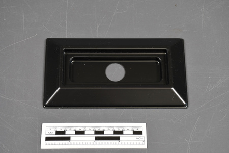
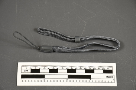
1974.0154.001
Permalien:
Ingenium diffuse cette image sous le cadre de licence Creative Commons et encourage son téléchargement et sa réutilisation à des fins non commerciales. Veuillez mentionner Ingenium et citer le numéro de l’artefact.
TÉLÉCHARGER L’IMAGEACHETER CETTE IMAGE
Cette image peut être utilisée gratuitement pour des fins non commerciales.
Pour un usage commercial, veuillez consulter nos frais de reproduction et communiquer avec nous pour acheter l’image.
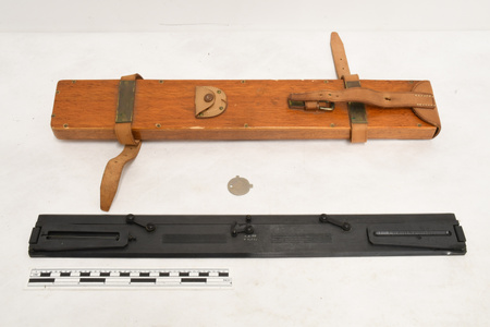
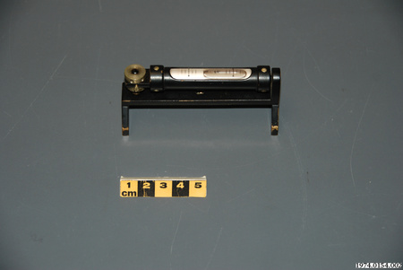
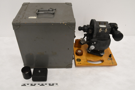
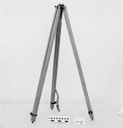
- TYPE D’OBJET
- Telescopic
- DATE
- 1935
- NUMÉRO DE L’ARTEFACT
- 1974.0154.001
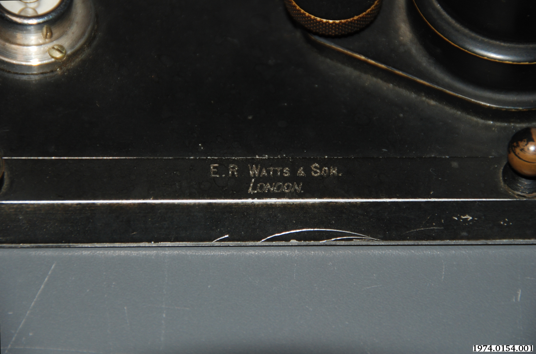
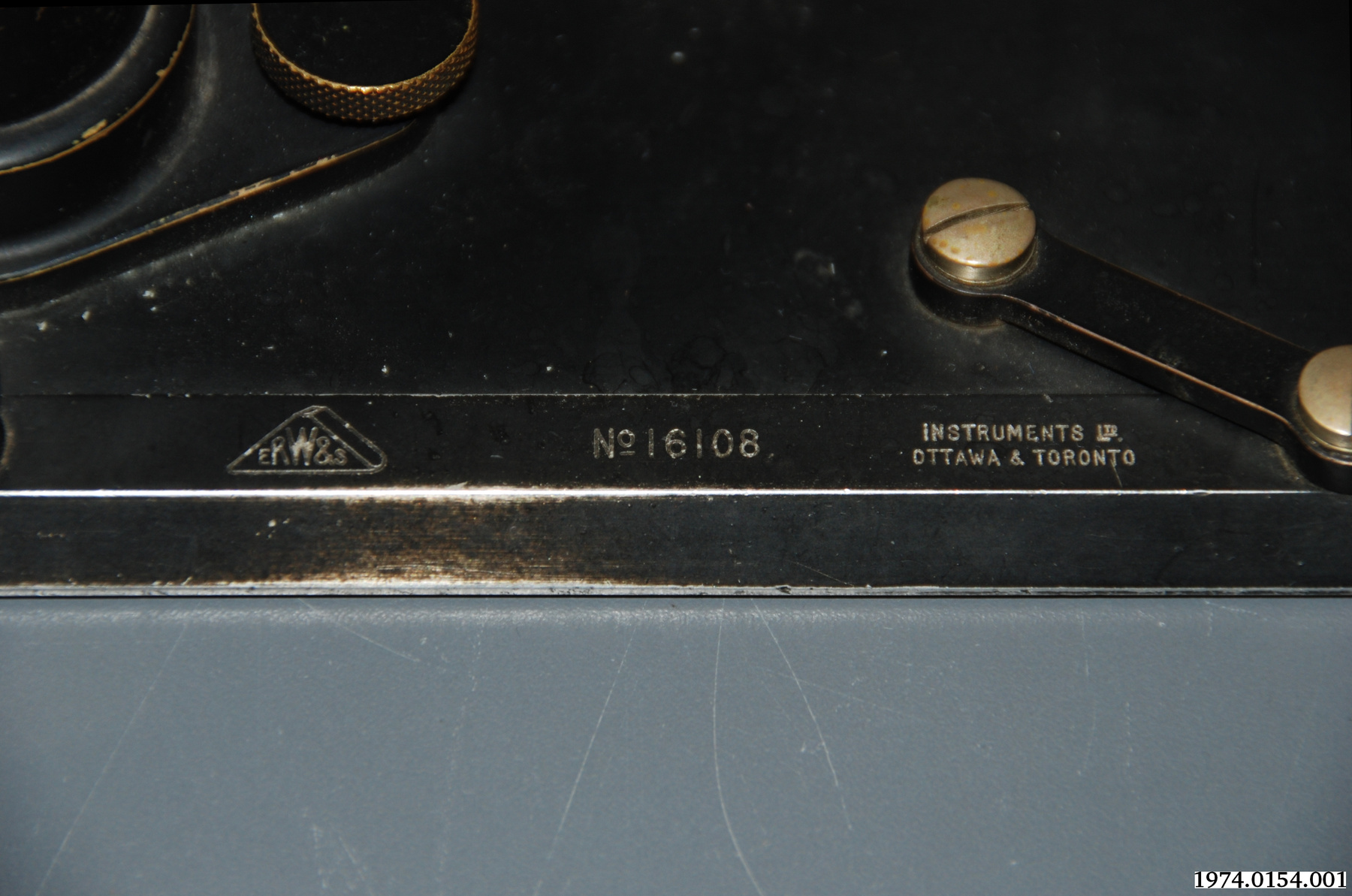
- FABRICANT
- Watts, E.R. & Son
- MODÈLE
- Inconnu
- EMPLACEMENT
- London, England
Plus d’information
Renseignements généraux
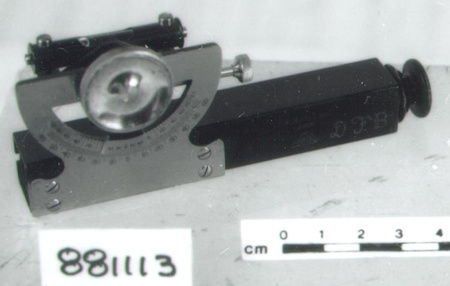
- Nº de série
- 16108
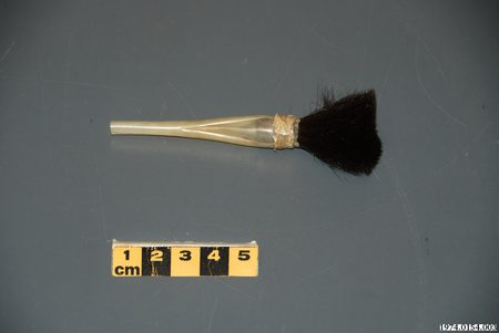
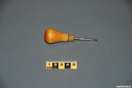
- Nº de partie
- 1
- Nombre total de parties
- 10
- Ou
- S/O
- Brevets
- S/O
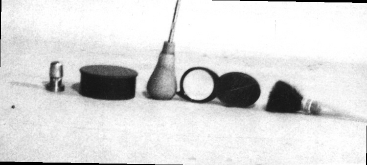
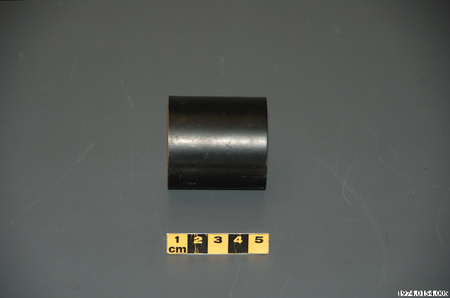
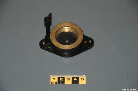
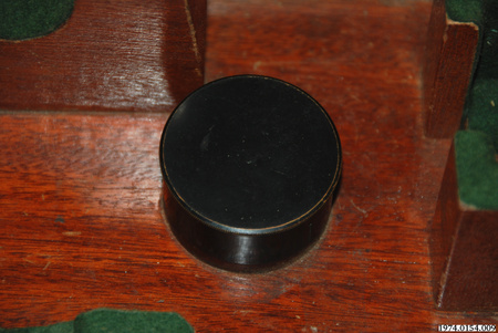
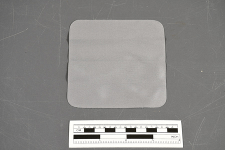
- Description générale
- Metal/ Wood/Synthetic
Dimensions
Remarque : Cette information reflète la taille générale pour l’entreposage et ne représente pas nécessairement les véritables dimensions de l’objet.
- Longueur
- 33,6 cm
- Largeur
- 24,1 cm
- Hauteur
- 12,0 cm
- Épaisseur
- S/O
- Poids
- S/O
- Diamètre
- S/O
- Volume
- S/O
Lexique
- Groupe
- Exploration et levé
- Catégorie
- Mesure-direction
- Sous-catégorie
- S/O
Fabricant
- Ou
- Watts
- Pays
- England
- État/province
- Inconnu
- Ville
- London
Contexte
- Pays
- Inconnu
- État/province
- Inconnu
- Période
- Inconnu
- Canada
-
Used by Canadian surveyor from EMR (now Natural Resources Canada) to make maps of low order precision over large areas - typically 1 km. between points. - Fonction
-
Allows the operator to sight a distant object and use the line of sight to either draw a line in the direction of the object or to measure the angle to the object from a specific point of reference. This device is usually used in conjunction with a plane table and is used to plot a point on a map or to create a map. - Technique
-
Mid 19th century technology based on simple alidades but allowing map making with a plane table over much larger areas with similar accuracy as with simple alidade. - Notes sur la région
-
Inconnu
Détails
- Marques
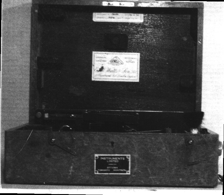
- .001 (Alidade) Mfr. Information: 'E.R. WATTS & SON./ LONDON.' ; '[Company logo] ERW&S' ; 'No 16108' ; INSTRUMENTS LTD./ OTTAWA & TORONTO' Bears mark '431'.
- Manque
- None
- Fini
- Inconnu
- Décoration
- S/O
FAIRE RÉFÉRENCE À CET OBJET
Si vous souhaitez publier de l’information sur cet objet de collection, veuillez indiquer ce qui suit :
Watts, E.R. & Son, Alidade, vers 1935, Numéro de l'artefact 1974.0154, Ingenium - Musées des sciences et de l'innovation du Canada, http://collection.ingenium.ca/fr/id/1974.0154.001/
RÉTROACTION
Envoyer une question ou un commentaire sur cet artefact.
Plus comme ceci


1974.0154.001