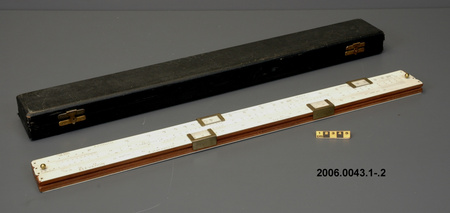
Scale, wind

Use this image
Can I reuse this image without permission? Yes
Object images on the Ingenium Collection’s portal have the following Creative Commons license:
Copyright Ingenium / CC BY-NC-ND (Attribution-NonCommercial 4.0 International (CC BY-NC 4.0)
ATTRIBUTE THIS IMAGE
Ingenium,
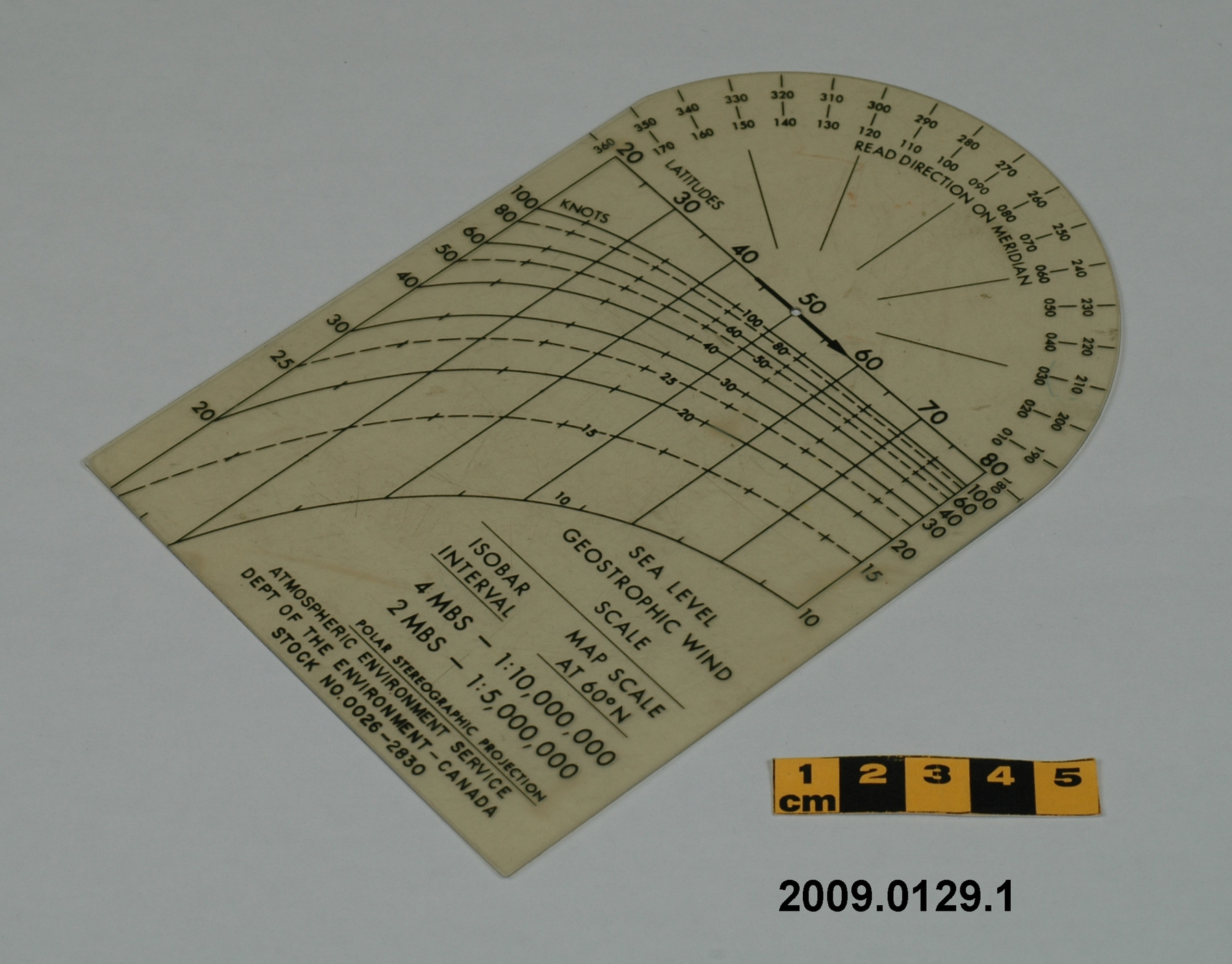
2009.0129.001
Permalink:
Ingenium is releasing this image under the Creative Commons licensing framework, and encourages downloading and reuse for non-commercial purposes. Please acknowledge Ingenium and cite the artifact number.
DOWNLOAD IMAGEPURCHASE THIS IMAGE
This image is free for non-commercial use.
For commercial use, please consult our Reproduction Fees and contact us to purchase the image.
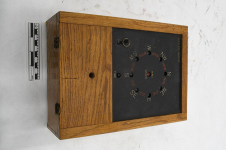
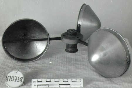
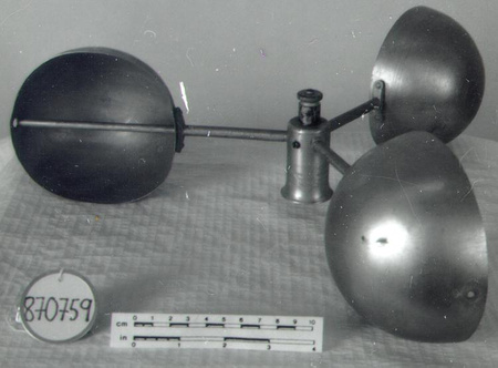
- OBJECT TYPE
- N/A
- DATE
- 1971–2000
- ARTIFACT NUMBER
- 2009.0129.001
- MANUFACTURER
- EC Atmospheric Environment Service
- MODEL
- Sea Level Geostrophic Wind Scale/26-2830
- LOCATION
- Canada
More Information
General Information
- Serial #
- N/A
- Part Number
- 1
- Total Parts
- 1
- AKA
- N/A
- Patents
- N/A
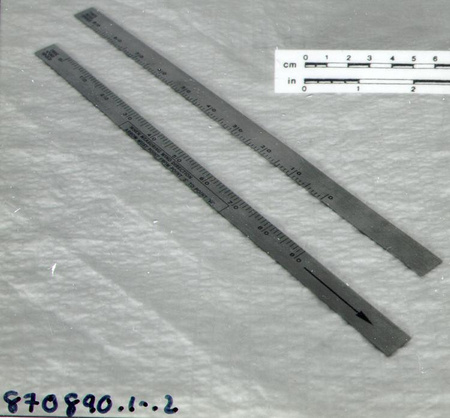
- General Description
- Synthetic
Dimensions
Note: These reflect the general size for storage and are not necessarily representative of the object's true dimensions.
- Length
- 16.4 cm
- Width
- 10.7 cm
- Height
- N/A
- Thickness
- N/A
- Weight
- N/A
- Diameter
- N/A
- Volume
- N/A
Lexicon
- Group
- Meteorology
- Category
- Surface wind speed & direction measurement
- Sub-Category
- N/A
Manufacturer
- AKA
- Environment CA
- Country
- Canada
- State/Province
- Unknown
- City
- Unknown
Context
- Country
- Canada
- State/Province
- Unknown
- Period
- Unknown
- Canada
-
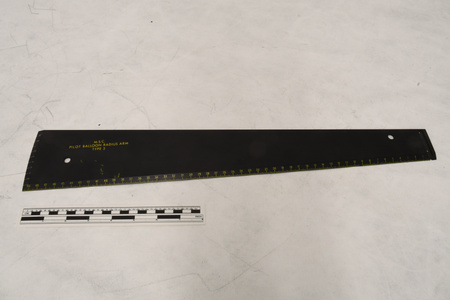
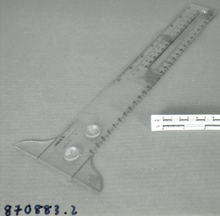
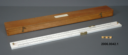
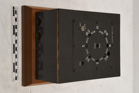
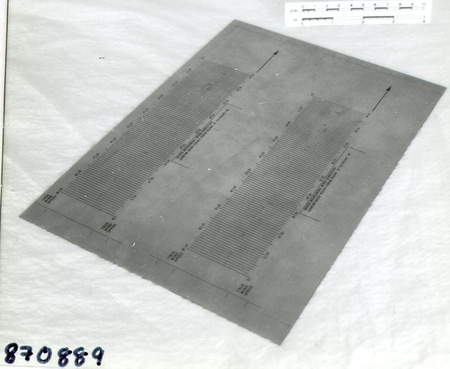
An example of tool used by Canadian Meteorological Service. A piece of meteorological equipment from a large collection of meteorological instruments used by the Meteorological Service of Canada (previously Atmospheric Environment Service) and acquired by the CSTM since 1967. MSC is the government agency responsible for collecting and disseminating meteorological data and forecasts in Canada. It was founded in 1871 in Toronto where it is still headquartered. The MSC was originally on the University of Toronto downtown campus but moved to Downsview in 1971 on land owned by UofT. The headquarters houses laboratories, research facilities and calibration and instrument maintenance facilities (now largely contracted out). - Function
-
A protractor-like instrument used to compute geostrophic wind level using isobaric contours shown of surface weather maps in order to determine winds for aircraft operations or to determine maximum surface wind or gust. - Technical
-
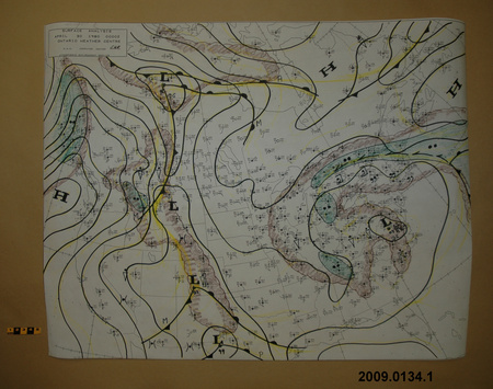
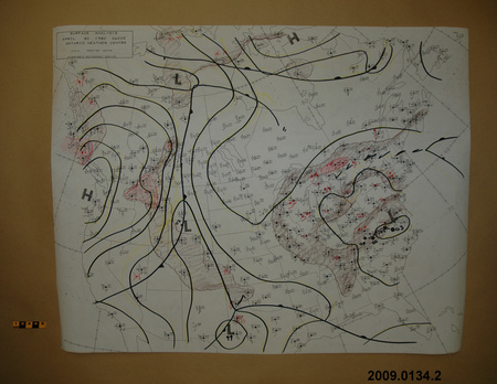
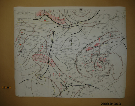
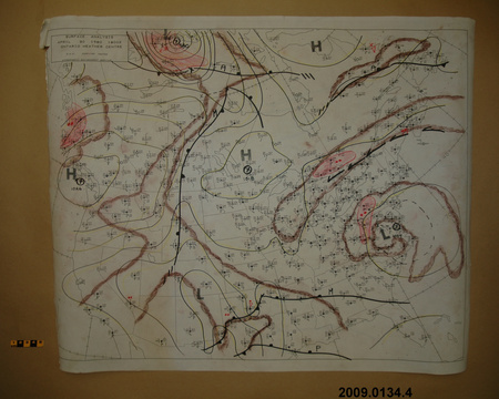
This plastic geostrophic wind scale is used with a surface weather map. [The donor provided four of these maps to the museum in the same accession lot as this wind scale.] On these maps [there are . . .] isobars which are lines of equal pressure based on the sa level pressure. The station pressures are converted to sea level pressure (MSL) and plotted to the right and just above the station location. The forecaster uses these pressures to draw the isobars. Other factors are used to produce the exact placement of the lines. These isobars are drawn every 4 millibars, i.e. 996, 1000, 1004 etc. Those pressures would be plotted beside the station as 960, 000, and 040, i.e. the MSL pressure to the nearest 1/10 of a millibar. The nomial sea level pressure is 1010 millibars. Thus the pressure difference between any two isobards is four millibars. The winds above the planetary boundary layer, i.e. 3000 feet, follow the isobars. The direction is parallel to the isobars. According to Buy-Ballots Law, if the lowest pressure is on your left then the wind is at your back. The wind flow is counter clockwise around a low in the northern hemisphere. Based on these principles the protractor [found on the wind scale] is used to determine the 3000' wind direction. The distance between the isobars is inversely proportional to the wind speed at 3000' feet. But it also varies with latitude (coriolis force) which is why latitude and speed in knots are combined on the scale. The forecaster merely lays the transparent scale on the map and moves it as necessary to determine these winds [ Ken Devine, email correspondence]. - Area Notes
-
Unknown
Details
- Markings
- Black lettering reads 'SEA LEVEL/ GEOSTROPHIC WIND/ SCALE' and 'ATMOSPHERIC ENVIRONMENT SERVICE/ DEPT. OF THE ENVIRONMENT - CANADA/ STOCK NO. 0026-2830'/ black markings for two scales
- Missing
- Complete
- Finish
- Colourless and transparent, yellowed
- Decoration
- N/A
CITE THIS OBJECT
If you choose to share our information about this collection object, please cite:
EC Atmospheric Environment Service, Scale, wind, between 1971–2000, Artifact no. 2009.0129, Ingenium – Canada’s Museums of Science and Innovation, http://collection.ingenium.ca/en/id/2009.0129.001/
FEEDBACK
Submit a question or comment about this artifact.
More Like This


2009.0129.001