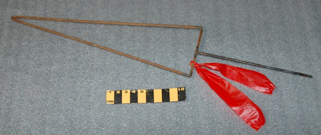
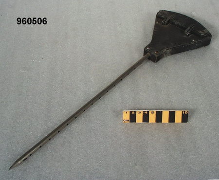
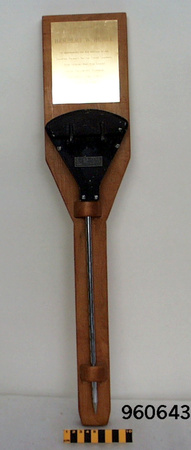
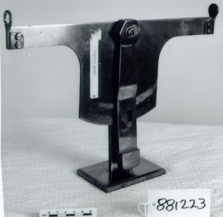
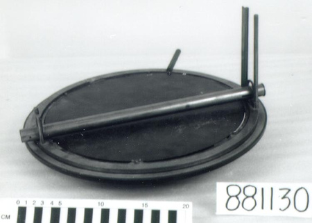
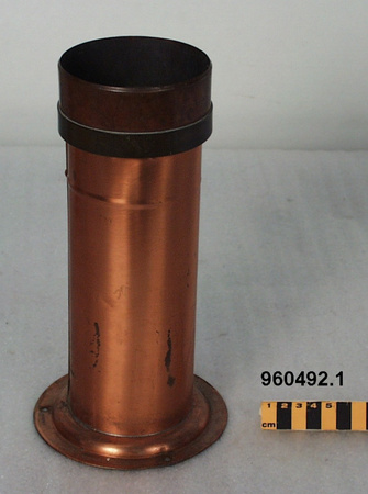
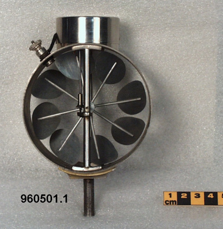
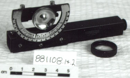
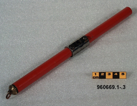
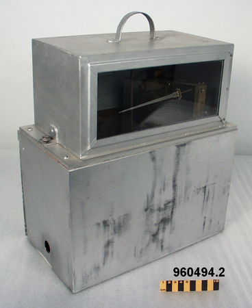
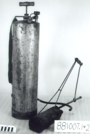
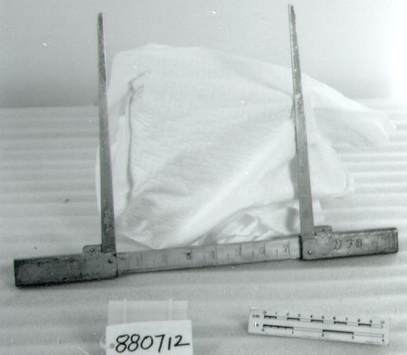
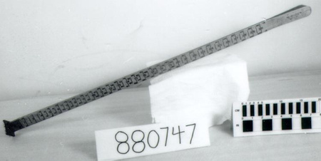
Pin, depth-of-burn
Use this image
Can I reuse this image without permission? Yes
Object images on the Ingenium Collection’s portal have the following Creative Commons license:
Copyright Ingenium / CC BY-NC-ND (Attribution-NonCommercial 4.0 International (CC BY-NC 4.0)
ATTRIBUTE THIS IMAGE
Ingenium,
2005.0014.001
Permalink:
Ingenium is releasing this image under the Creative Commons licensing framework, and encourages downloading and reuse for non-commercial purposes. Please acknowledge Ingenium and cite the artifact number.
DOWNLOAD IMAGEPURCHASE THIS IMAGE
This image is free for non-commercial use.
For commercial use, please consult our Reproduction Fees and contact us to purchase the image.
- OBJECT TYPE
- N/A
- DATE
- 1983–1987
- ARTIFACT NUMBER
- 2005.0014.001
- MANUFACTURER
- Great Lakes Forestry Centre Fire Research Group
- MODEL
- Unknown
- LOCATION
- Sault Ste. Marie, Ontario, Canada
More Information
General Information
- Serial #
- N/A
- Part Number
- 1
- Total Parts
- 1
- AKA
- N/A
- Patents
- N/A
- General Description
- Unknown
Dimensions
Note: These reflect the general size for storage and are not necessarily representative of the object's true dimensions.
- Length
- N/A
- Width
- N/A
- Height
- N/A
- Thickness
- N/A
- Weight
- N/A
- Diameter
- N/A
- Volume
- N/A
Lexicon
- Group
- Forestry
- Category
- Fire fighting
- Sub-Category
- N/A
Manufacturer
- AKA
- Great Lakes
- Country
- Canada
- State/Province
- Ontario
- City
- Sault Ste. Marie
Context
- Country
- Canada
- State/Province
- Ontario
- Period
- Used 1985 to present.
- Canada
-
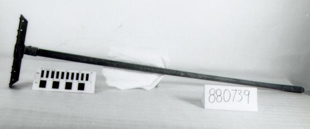
This type of pin was designed by Canadian Forest Service, Natural Resources Canada and was made and used in Canada, in experimental and wild fires. (ref. 1) - Function
-
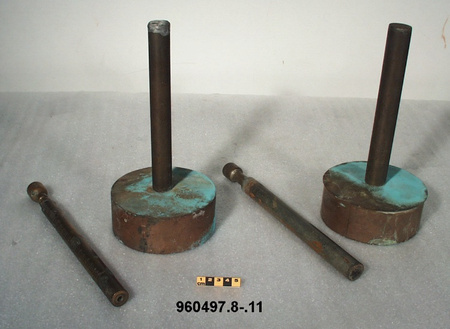
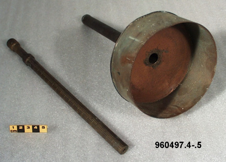
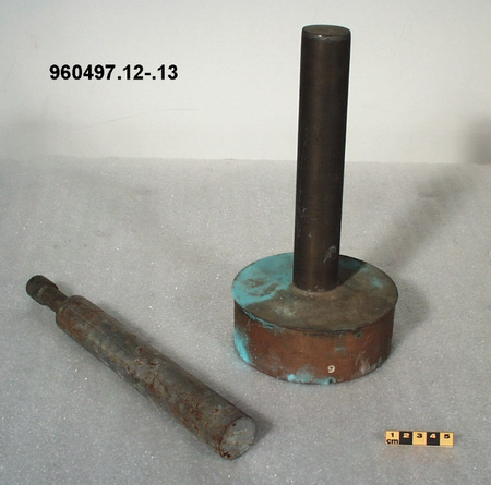
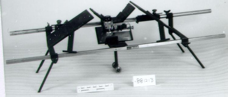
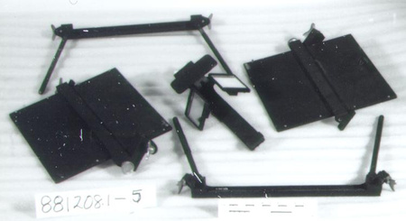
Marker used to determine the degree of forest floor consumption by fire. - Technical
-
Depth-of-burn pins used to determine the degree of the forest floor consumption by fire. The pins are placed on grid throughout plot: 100 pins on a 1-ha burn. The pins is anchored in the mineral soil, so that the T-bar is flush with the top of the duff level [decaying vegetation covering forest floor]. After the burn has taken place, the new distance between the duff and the T-bar is measured. An average over the entire plot is calculated to determine the depth of bum which in turn is converted to fuel consumption through bulk density, measured in kg/m [squared]. Duff samples collected before the burn allow observers to measure fuel weights for different layers of the forest floor. (ref. 1) - Area Notes
-
Unknown
Details
- Markings
- None evident.
- Missing
- None.
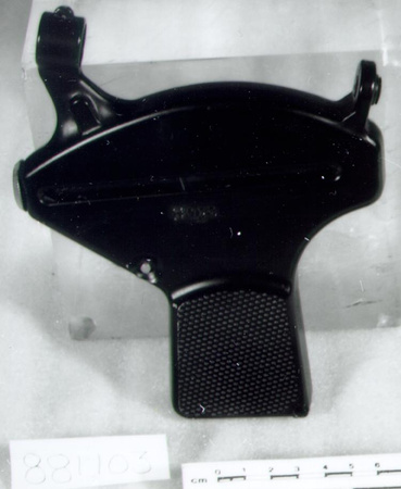
- Finish
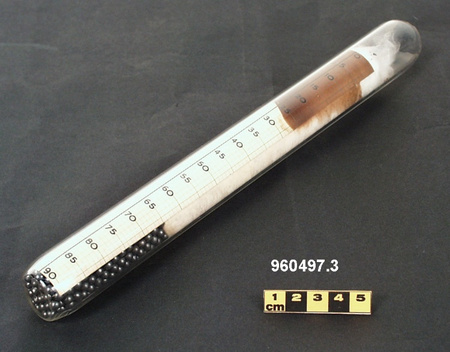
- Natural metal finish. Red synthetic strip tied to pin [function/relationship to pin is unknown].
- Decoration
- N/A
CITE THIS OBJECT
If you choose to share our information about this collection object, please cite:
Great Lakes Forestry Centre Fire Research Group, Pin, depth-of-burn, circa 1983–1987, Artifact no. 2005.0014, Ingenium – Canada’s Museums of Science and Innovation, http://collection.ingenium.ca/en/id/2005.0014.001/
FEEDBACK
Submit a question or comment about this artifact.
More Like This


2005.0014.001
