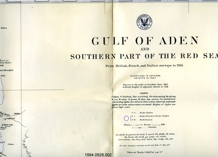
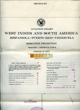
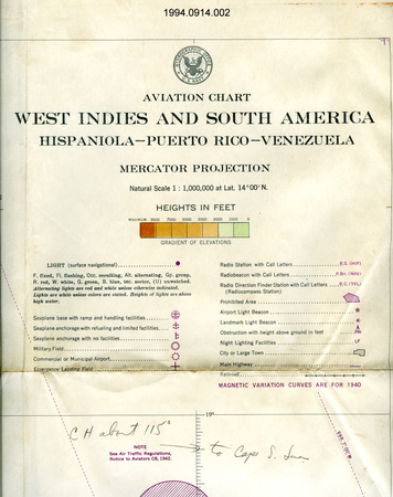
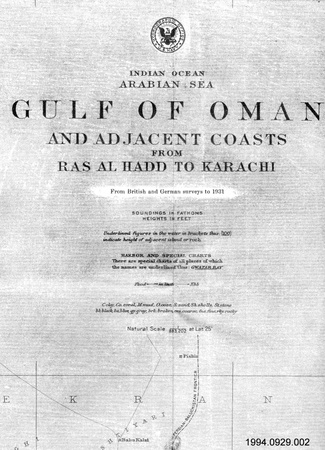
Map

Use this image
Can I reuse this image without permission? Yes
Object images on the Ingenium Collection’s portal have the following Creative Commons license:
Copyright Ingenium / CC BY-NC-ND (Attribution-NonCommercial 4.0 International (CC BY-NC 4.0)
ATTRIBUTE THIS IMAGE
Ingenium,
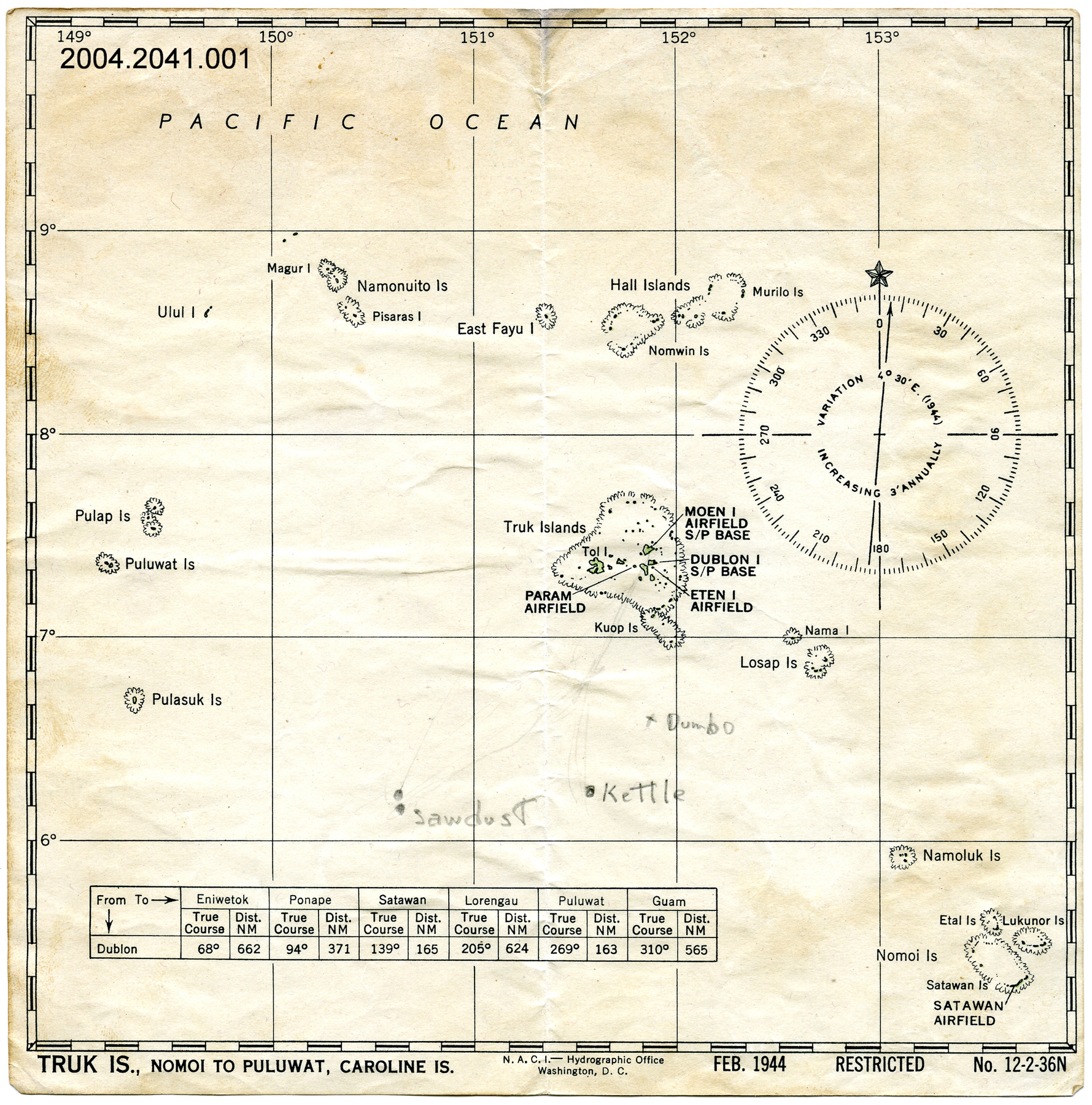
2004.2041.001
Permalink:
Ingenium is releasing this image under the Creative Commons licensing framework, and encourages downloading and reuse for non-commercial purposes. Please acknowledge Ingenium and cite the artifact number.
DOWNLOAD IMAGEPURCHASE THIS IMAGE
This image is free for non-commercial use.
For commercial use, please consult our Reproduction Fees and contact us to purchase the image.
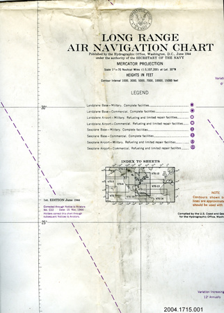
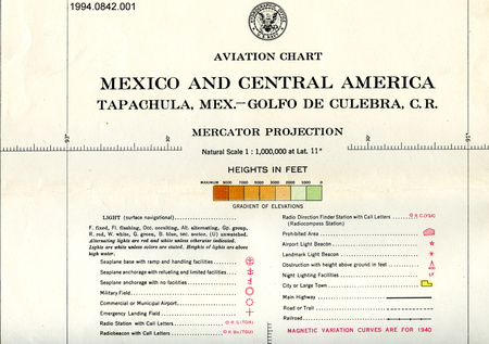
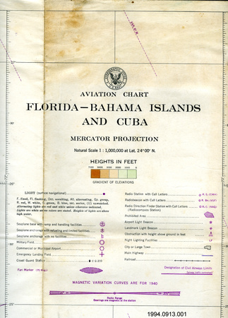
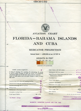
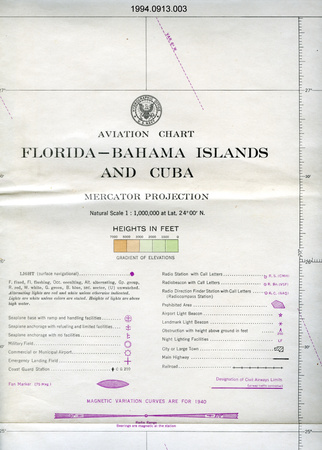
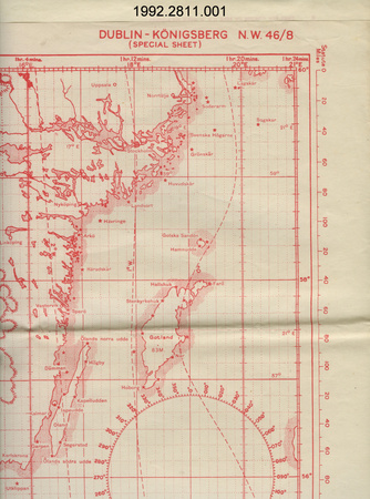
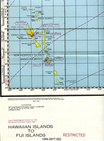
- OBJECT TYPE
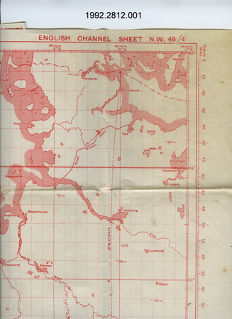
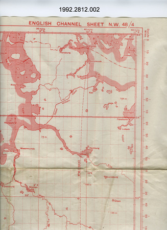
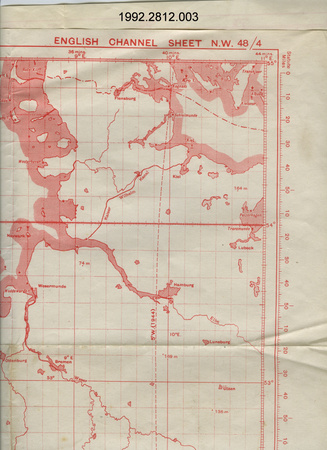
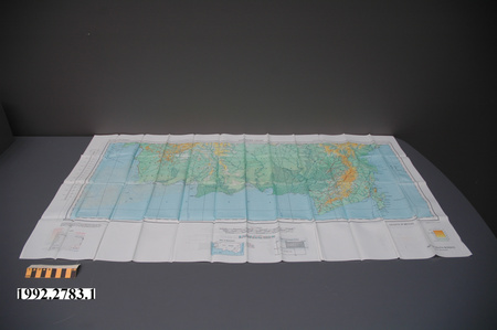
- Topographical
- DATE
- 1944
- ARTIFACT NUMBER
- 2004.2041.001
- MANUFACTURER
- U.S. Navy Hydrographic Office
- MODEL
- Truk Is., Nomoi to Puluwat, Caroline Is.
- LOCATION
- Washington, District of Columbia, United States of America
More Information
General Information
- Serial #
- N/A
- Part Number
- 1
- Total Parts
- 1
- AKA
- N/A
- Patents
- N/A
- General Description
- Paper.
Dimensions
Note: These reflect the general size for storage and are not necessarily representative of the object's true dimensions.
- Length
- 20.5 cm
- Width
- 20.5 cm
- Height
- N/A
- Thickness
- N/A
- Weight
- N/A
- Diameter
- N/A
- Volume
- N/A
Lexicon
- Group
- Aviation
- Category
- Navigation instruments & equipment
- Sub-Category
- N/A
Manufacturer
- AKA
- Defense US
- Country
- United States of America
- State/Province
- District of Columbia
- City
- Washington
Context
- Country
- Worldwide
- State/Province
- Unknown
- Period
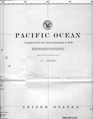
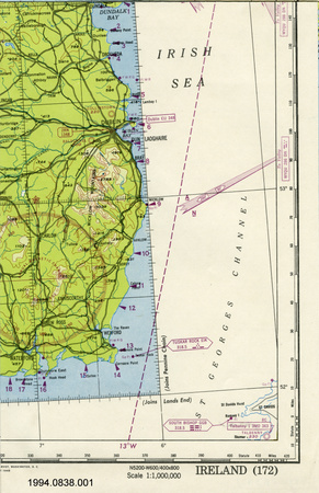
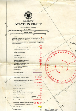
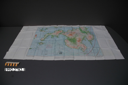
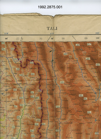
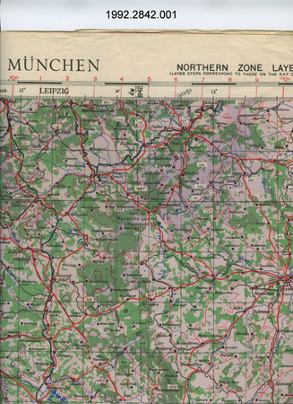
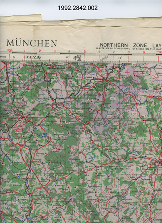
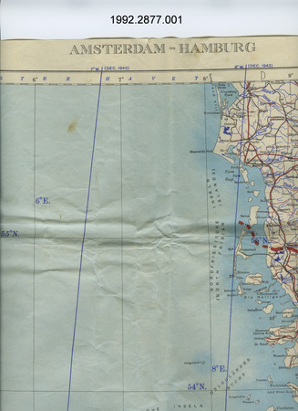
- Lieutenant Commander Nevill John Geary's career lasted over over 20 years (1943-1965). This map is dated Feb. 1944.
- Canada
-
Lt. Cdr. Geary was a Canadian pilot & naval officer. As a member of the Royal Navy Fleet Air Arm during WWII he trained in Canada, and was one of the few Canadian RN fighter pilots to serve against Japan in the Pacific. He was one of the first to transfer into the Royal Canadian Navy's Naval Aviation Branch when it was formed in 1946, where he served aboard the aircraft carriers NMCS Warrior, HMCS Magnificent and HMCS Bonaventure, and ashore at HMCS Shearwater. His career coincides with the growth and development of Canadian naval aviation from its earliest days to CF unification. - Function
-
This collection helps document the career of Lieutenant Commander Nevill John Geary. This is a map of an area in which Lt. Cdr. Geary served during WWII. - Technical
-
Unknown - Area Notes
-
Unknown
Details
- Markings
- Lettering along the bottom border reads: "TRUK IS., NOMOI TO PULUWAT, CAROLINE IS./N.A.C.I. --- Hydrographic Office/Washington, D.C./FEB. 1944 RESTRICTED No. 12-2-36N".
- Missing
- N/A
- Finish
- Black detail on white background.
- Decoration
- None.
CITE THIS OBJECT
If you choose to share our information about this collection object, please cite:
U.S. Navy Hydrographic Office, Map, 1944, Artifact no. 2004.2041, Ingenium – Canada’s Museums of Science and Innovation, http://collection.ingenium.ca/en/id/2004.2041.001/
FEEDBACK
Submit a question or comment about this artifact.
More Like This


2004.2041.001