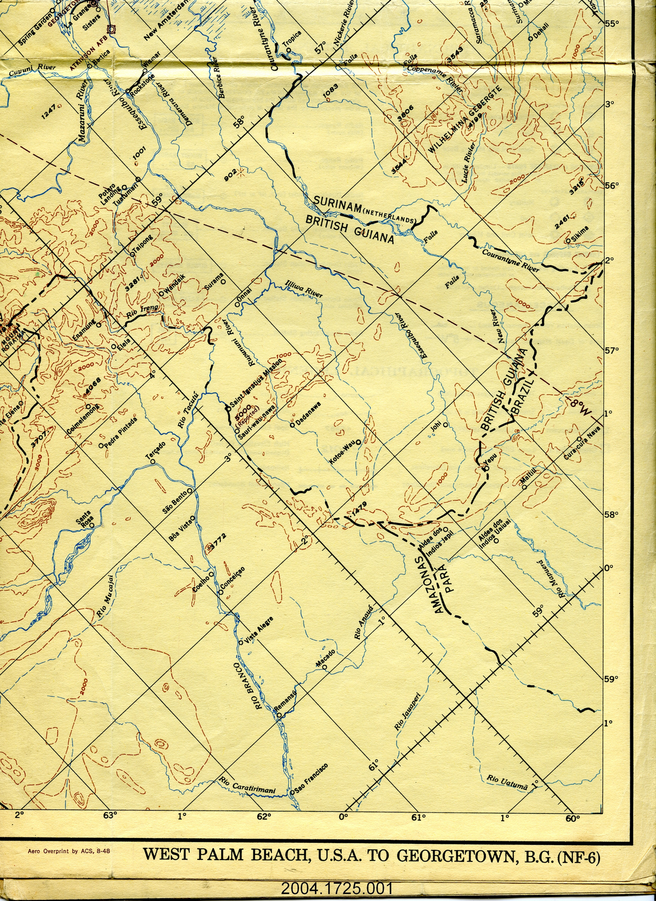
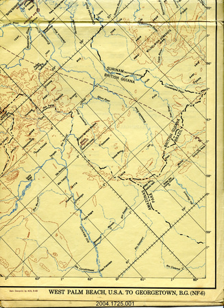
Map
Use this image
Can I reuse this image without permission? Yes
Object images on the Ingenium Collection’s portal have the following Creative Commons license:
Copyright Ingenium / CC BY-NC-ND (Attribution-NonCommercial 4.0 International (CC BY-NC 4.0)
ATTRIBUTE THIS IMAGE
Ingenium,
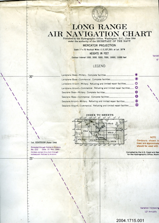
2004.1725.001
Permalink:
Ingenium is releasing this image under the Creative Commons licensing framework, and encourages downloading and reuse for non-commercial purposes. Please acknowledge Ingenium and cite the artifact number.
DOWNLOAD IMAGEPURCHASE THIS IMAGE
This image is free for non-commercial use.
For commercial use, please consult our Reproduction Fees and contact us to purchase the image.
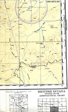
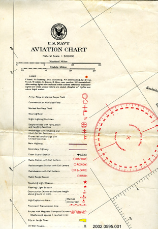
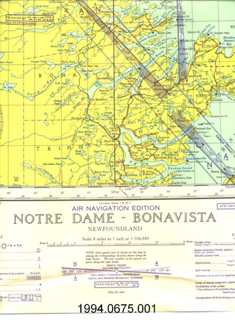
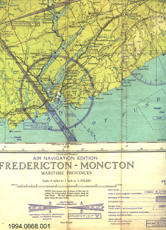
- OBJECT TYPE
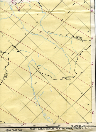
- topographical/aeronautical/folding
- DATE
- 1948
- ARTIFACT NUMBER
- 2004.1725.001
- MANUFACTURER
- Aeronautical Chart Service, Army Air Forces
- MODEL
- West Palm Beach, U.S.A. to Georgetown B.G.
- LOCATION
- Washington, District of Columbia, United States of America
More Information
General Information
- Serial #
- N/A
- Part Number
- 1
- Total Parts
- 1
- AKA
- N/A
- Patents
- N/A
- General Description
- paper
Dimensions
Note: These reflect the general size for storage and are not necessarily representative of the object's true dimensions.
- Length
- 137.0 cm
- Width
- 54.5 cm
- Height
- N/A
- Thickness
- N/A
- Weight
- N/A
- Diameter
- N/A
- Volume
- N/A
Lexicon
- Group
- Aviation
- Category
- Navigation instruments & equipment
- Sub-Category
- N/A
Manufacturer
- AKA
- Defense US
- Country
- United States of America
- State/Province
- District of Columbia
- City
- Washington
Context
- Country
- Central America
- State/Province
- Unknown
- Period
- 7th edition Aug. 1948 (from revised edition Feb. 1948 of original Dec. 1944)
- Canada
-
Unknown - Function
-
aerial navigation - Technical
-
Unknown - Area Notes
-
Unknown
Details
- Markings
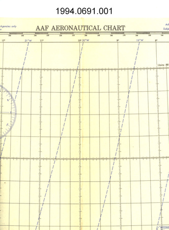
- lettering along top border reads: "(NF-6) WEST PALM BEACH, U.S.A. TO GEORGETOWN, B.G./ PUBLISHED BY THE AERONAUTICAL CHART SERVICE/TO JOINT AIR FORCE-NAVY SPECIFICATIONS/AF AERONAUTICAL FLIGHT CHART/Mercator Projection/True Scale 1:3,000,000 at the Equator/(NF-6)"; lettering along bottom border reads: "(NF-6)/Published by the AERONAUTICAL CHART SERVICE, U. S. AIR FORCE, WASHINGTON, D.C.,/BASED ON PARTIAL COVERAGE AERIAL PHOTOGRAPHY,/DECEMBER 1944 (C & GS) Revised FEBRUARY 1948 (C & GS) BASE NO. 2 R/Lines of equal magnetic variation for 1945/CAUTION - DASHED CONTOUR LINES INDICATE APPROXIMATE RELIEF ONLY/CONTOUR INTERVAL 1000 FEET/PREPARED AND PRINTED BY THE/U.S. COAST AND GEODETIC SURVEY/SCALE 1:3,000,000/SEVENTH EDITION - AUGUST 48/Aero Overprint by ACS, 8-48/WEST PALM BEACH, U.S.A. TO GEORGETOWN, B.G. (NF-6)"
- Missing
- N/A
- Finish
- colour map
- Decoration
- none
CITE THIS OBJECT
If you choose to share our information about this collection object, please cite:
Aeronautical Chart Service, Army Air Forces, Map, 1948, Artifact no. 2004.1725, Ingenium – Canada’s Museums of Science and Innovation, http://collection.ingenium.ca/en/id/2004.1725.001/
FEEDBACK
Submit a question or comment about this artifact.
More Like This


2004.1725.001