Map

Use this image
Can I reuse this image without permission? Yes
Object images on the Ingenium Collection’s portal have the following Creative Commons license:
Copyright Ingenium / CC BY-NC-ND (Attribution-NonCommercial 4.0 International (CC BY-NC 4.0)
ATTRIBUTE THIS IMAGE
Ingenium,
1994.0793.001
Permalink:
Ingenium is releasing this image under the Creative Commons licensing framework, and encourages downloading and reuse for non-commercial purposes. Please acknowledge Ingenium and cite the artifact number.
DOWNLOAD IMAGEPURCHASE THIS IMAGE
This image is free for non-commercial use.
For commercial use, please consult our Reproduction Fees and contact us to purchase the image.
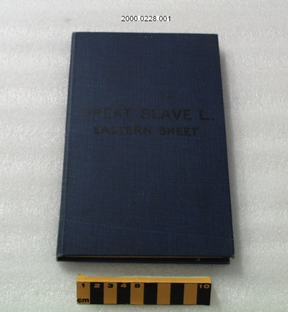
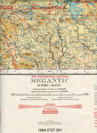
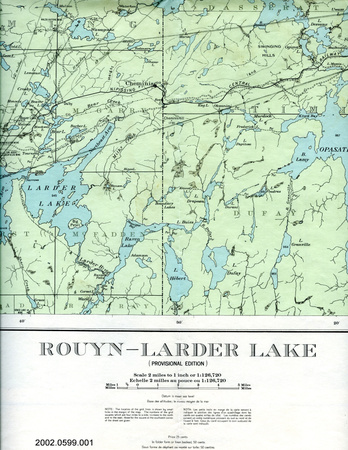
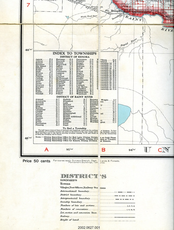
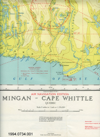
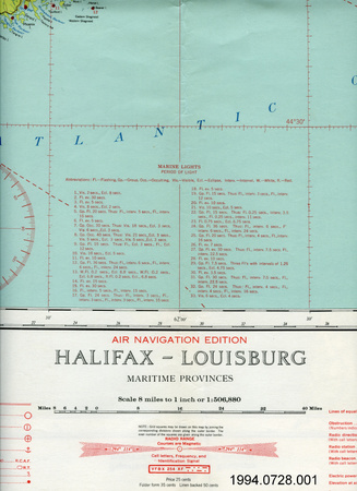
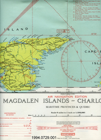
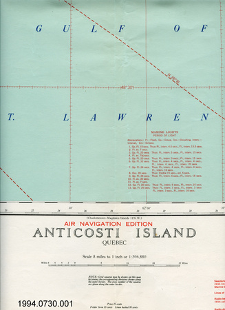
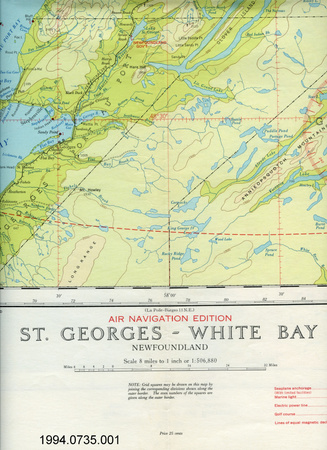
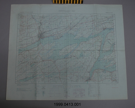
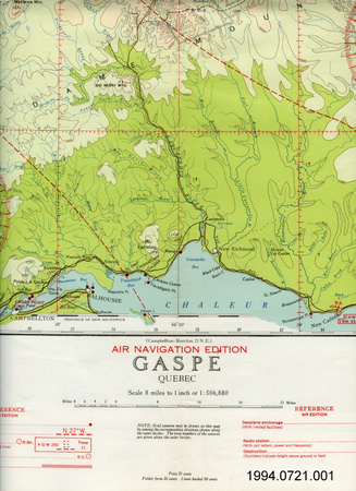
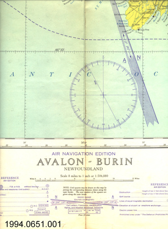
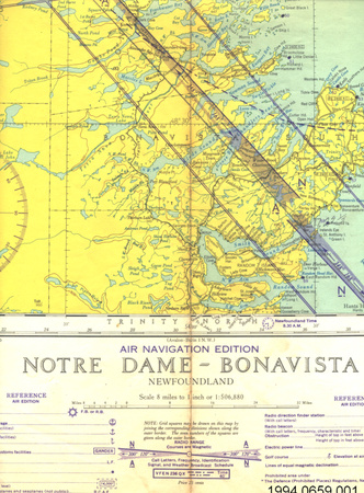
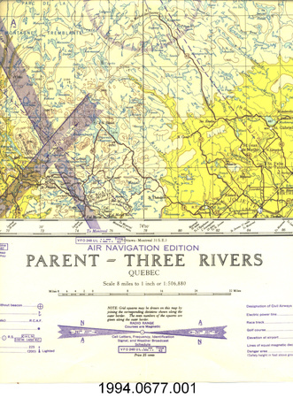
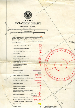
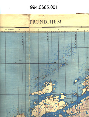
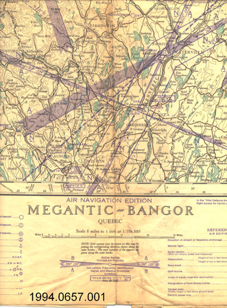
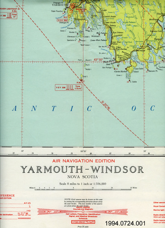
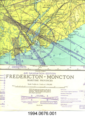
- OBJECT TYPE
- topographical/aeronautical/folding
- DATE
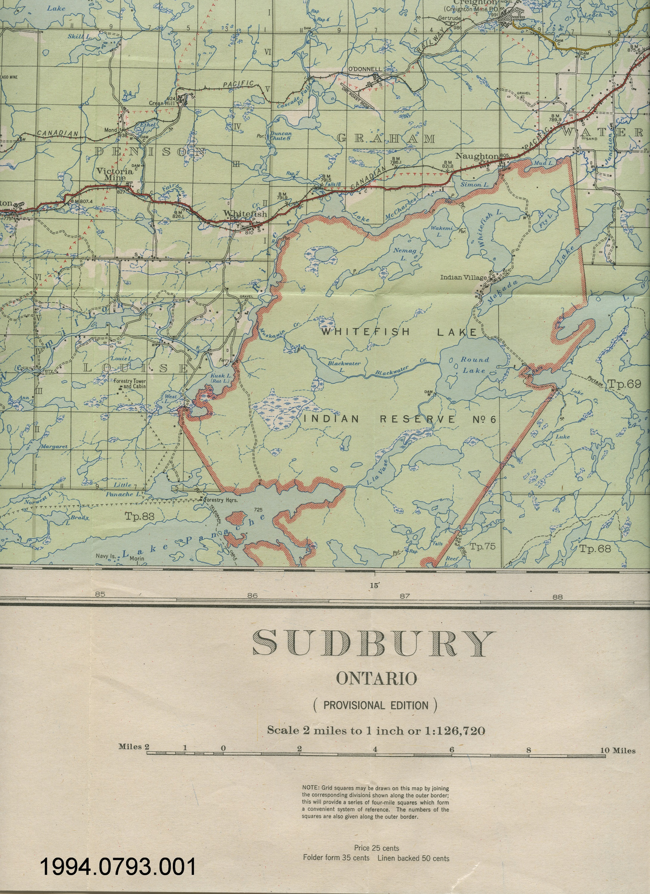
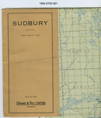
- 1933
- ARTIFACT NUMBER
- 1994.0793.001
- MANUFACTURER
- Office of the Surveyor General
- MODEL
- Sudbury
- LOCATION
- Ottawa, Ontario, Canada
More Information
General Information
- Serial #
- N/A
- Part Number
- 1
- Total Parts
- 1
- AKA
- N/A
- Patents
- N/A
- General Description
- paper; card stock cover
Dimensions
Note: These reflect the general size for storage and are not necessarily representative of the object's true dimensions.
- Length
- 76.0 cm
- Width
- 61.3 cm
- Height
- N/A
- Thickness
- N/A
- Weight
- N/A
- Diameter
- N/A
- Volume
- N/A
Lexicon
- Group
- Aviation
- Category
- Navigation instruments & equipment
- Sub-Category
- N/A
Manufacturer
- AKA
- Survey CA
- Country
- Canada
- State/Province
- Ontario
- City
- Ottawa
Context
- Country
- Canada
- State/Province
- Ontario
- Period
- WWII (1939-1945)/ this map produced in 1933
- Canada
-
Unknown - Function
-
two dimensional graphic representation of a section of the earth's surface/used for aerial navigation - Technical
-
Unknown - Area Notes
-
Unknown
Details
- Markings
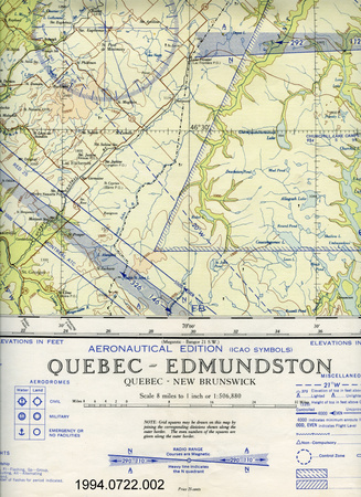
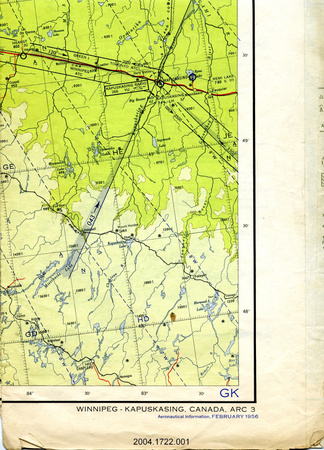
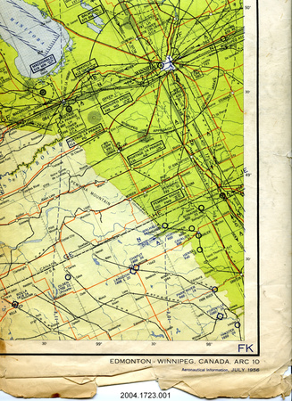
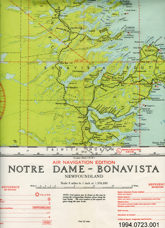
- lettering on folder cover reads: "SUDBURY/Scale 2 miles to 1 inch/Price 35 Cents/GRAND & TOY LIMITED/TORONTO"; lettering printed on border above map reads: "Department of the Interior/HON. THOMAS G. MURPHY, Minister; H.H. ROWATT, Deputy Minister/TOPOGRAPHICAL SURVEY OF CANADA"; lettering printed on border below map reads: "PRODUCED IN COOPERATION WITH THE DEPARTMENT OF SURVEYS, PROVINCE OF ONTARIO/SUDBURY/ONTARIO/(PROVISIONAL EDITION)/Scale 2 miles to 1 inch or 1:126,720/Price 25 cents/Folder form 35 cents Linen backed 50 cents/Compiled, drawn, and printed at the office of the Surveyor General, Ottawa,/August, 1933 from surveys by the Topographical Survey of Canada; from/information supplied by the Department of Surveys, Ontario, and the Geologi-/cal Survey of Canada, and from aerial photographs by the Royal Canadian/Air Force./Geographical positions and elevations (datum mean sea level) based on data/furnished by the Geodetic Survey of Canada."
- Missing
- N/A
- Finish
- colour map on white background
- Decoration
- none
CITE THIS OBJECT
If you choose to share our information about this collection object, please cite:
Office of the Surveyor General, Map, 1933, Artifact no. 1994.0793, Ingenium – Canada’s Museums of Science and Innovation, http://collection.ingenium.ca/en/id/1994.0793.001/
FEEDBACK
Submit a question or comment about this artifact.
More Like This


1994.0793.001