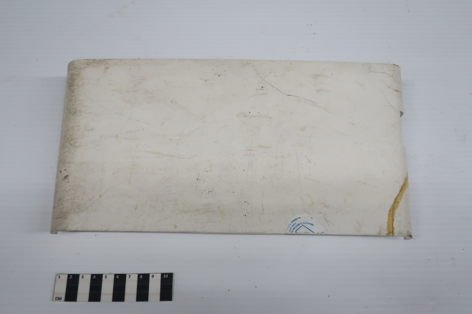
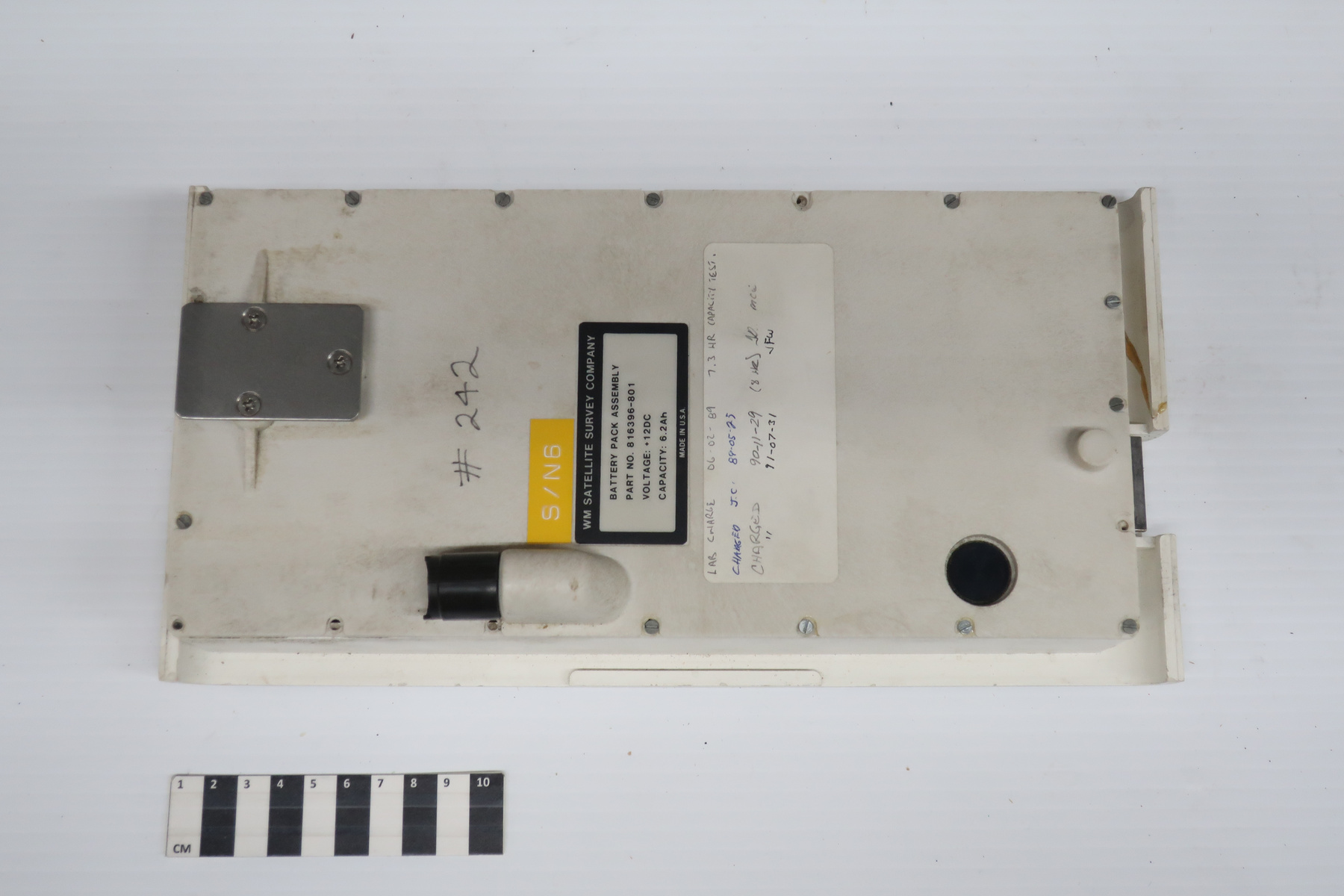
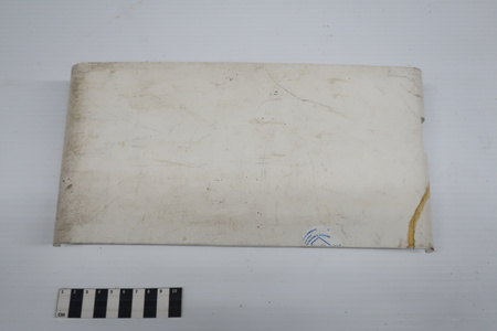
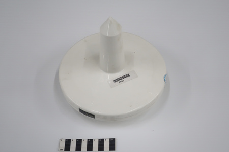
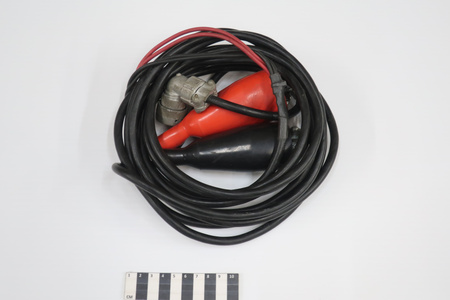
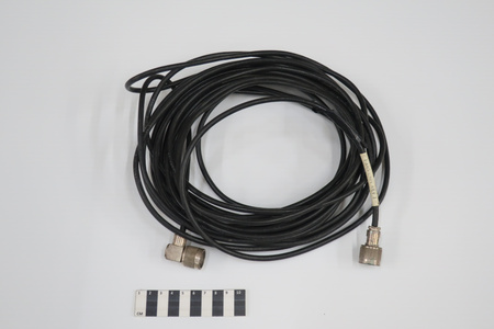
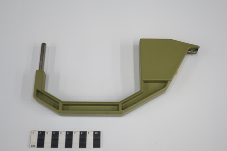
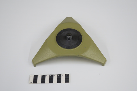
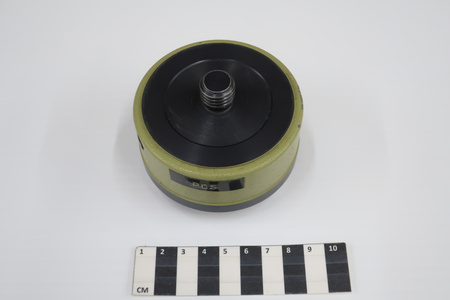
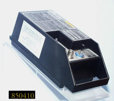
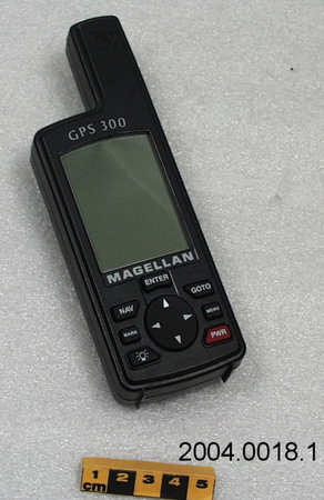
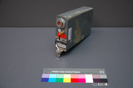
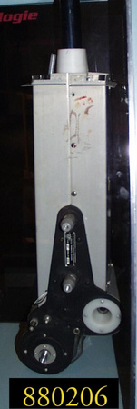
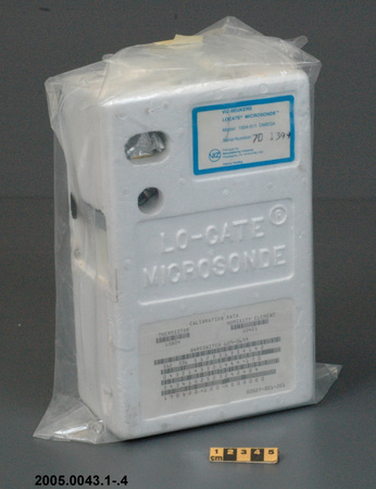
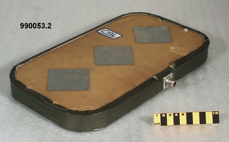
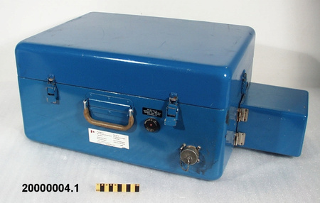
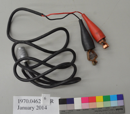
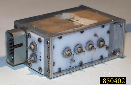
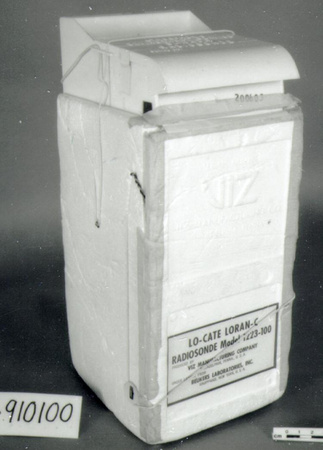
Battery

Use this image
Can I reuse this image without permission? Yes
Object images on the Ingenium Collection’s portal have the following Creative Commons license:
Copyright Ingenium / CC BY-NC-ND (Attribution-NonCommercial 4.0 International (CC BY-NC 4.0)
ATTRIBUTE THIS IMAGE
Ingenium,
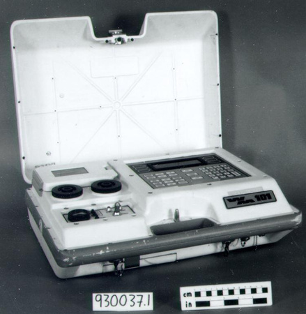
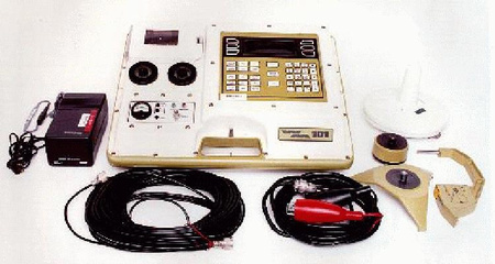
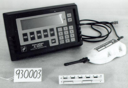
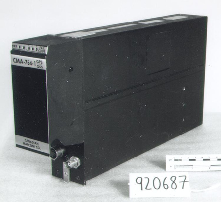
1993.0037.009
Permalink:
Ingenium is releasing this image under the Creative Commons licensing framework, and encourages downloading and reuse for non-commercial purposes. Please acknowledge Ingenium and cite the artifact number.
DOWNLOAD IMAGEPURCHASE THIS IMAGE
This image is free for non-commercial use.
For commercial use, please consult our Reproduction Fees and contact us to purchase the image.
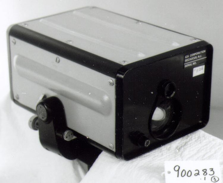
- OBJECT TYPE
- 12V/6.2Ah
- DATE
- 1986
- ARTIFACT NUMBER
- 1993.0037.009
- MANUFACTURER
- Unknown
- MODEL
- Unknown
- LOCATION
- Unknown
More Information
General Information
- Serial #
- N/A
- Part Number
- 9
- Total Parts
- 9
- AKA
- N/A
- Patents
- N/A
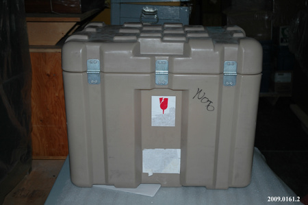
- General Description
- Synthetic casing with metal components
Dimensions
Note: These reflect the general size for storage and are not necessarily representative of the object's true dimensions.
- Length
- N/A
- Width
- N/A
- Height
- N/A
- Thickness
- N/A
- Weight
- N/A
- Diameter
- N/A
- Volume
- N/A
Lexicon
- Group
- Exploration and Survey
- Category
- Measurement-position
- Sub-Category
- N/A
Manufacturer
- AKA
- Unknown
- Country
- Unknown
- State/Province
- Unknown
- City
- Unknown
Context
- Country
- Canada
- State/Province
- Unknown
- Period
- THIS EXAMPLE WAS USED FROM CIRCA 1986 TO 1993.
- Canada
-
AN INSTRUMENT USED BY THE GEODETIC SURVEY DIV. OF THE GEOLOGICAL SURVEY OF CANADA. ALTHOUGH ORIGINALLY DEVELOPED AS A NAVIGATION INSTRUMENT, THE GPS SYSTEM WAS ALSO USABLE FOR PLOTTING POSITIONS IN EARTH SURVEYING. - Function
-
Rechargeable battery used as a portable power source for a global positioning system. - Technical
-
A SPACE-BASED NAVIGATION SYSTEM, UTILIZING 24 NAVSTAR SATELLITES & PROVIDING NAVIGATIONAL ACCURACY FOR CIVILIAN USE TO 100 M. GPS WAS FIRST DEVELOPED BY THE U.S. IN THE MID 1970'S FOR MILITARY USE. SIGNALS FROM FOUR SATELLITES ARE REQUIRED TO DETERMINE POSITION. GPS SUCCEEDS TRANSIT, THE FIRST NAVIGATION SATELLITE SYSTEM WHICH UTILIZED THE DOPPLER SHIFT MEASURED DURING A SINGLE SATELLITE PASS, A MUCH SLOWER PROCESS. - Area Notes
-
Unknown
Details
- Markings
- On the proper back
- Missing
- Appears complete
- Finish
- White synthetic casing with a silver-coloured metal plate on the back, a black synthetic collar, a black and white printed label, a yellow typed label, and a white label with grey, black and blue handwritten inscriptions.
- Decoration
- N/A
CITE THIS OBJECT
If you choose to share our information about this collection object, please cite:
Unknown Manufacturer, Battery, circa 1986, Artifact no. 1993.0037, Ingenium – Canada’s Museums of Science and Innovation, http://collection.ingenium.ca/en/id/1993.0037.009/
FEEDBACK
Submit a question or comment about this artifact.
More Like This


1993.0037.009