Map
Use this image
Can I reuse this image without permission? Yes
Object images on the Ingenium Collection’s portal have the following Creative Commons license:
Copyright Ingenium / CC BY-NC-ND (Attribution-NonCommercial 4.0 International (CC BY-NC 4.0)
ATTRIBUTE THIS IMAGE
Ingenium,
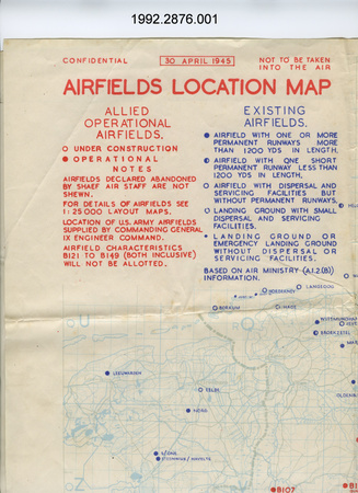
1992.2876.001
Permalink:
Ingenium is releasing this image under the Creative Commons licensing framework, and encourages downloading and reuse for non-commercial purposes. Please acknowledge Ingenium and cite the artifact number.
DOWNLOAD IMAGEPURCHASE THIS IMAGE
This image is free for non-commercial use.
For commercial use, please consult our Reproduction Fees and contact us to purchase the image.
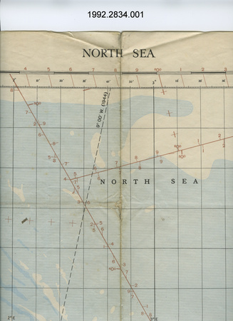
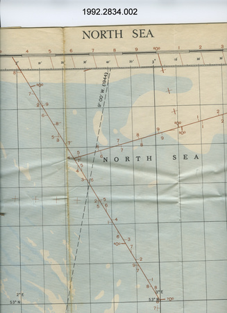
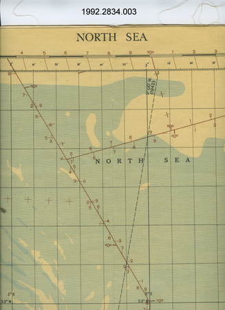
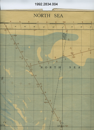
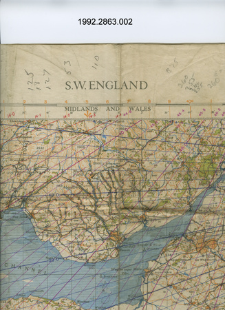
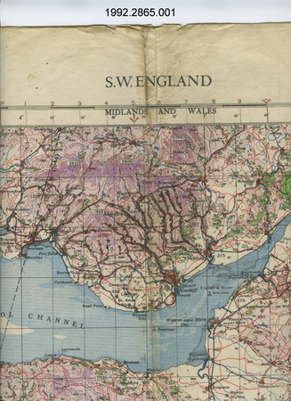
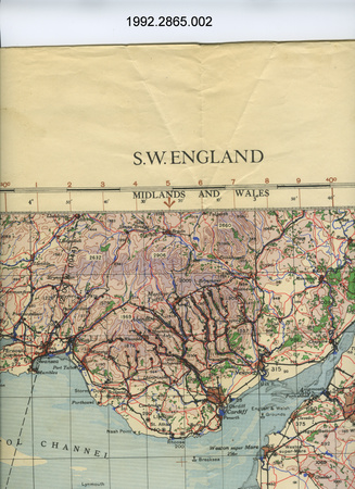
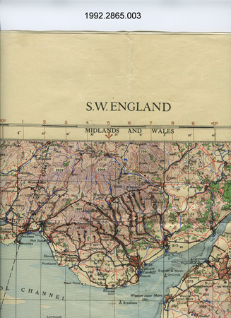
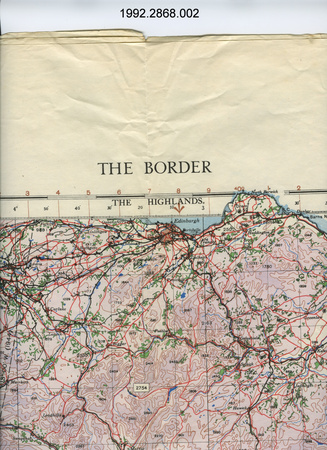
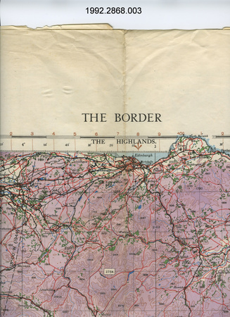
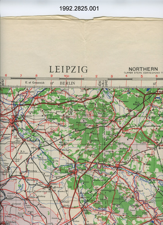
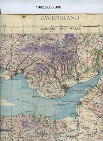
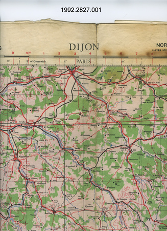
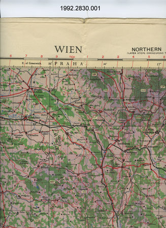
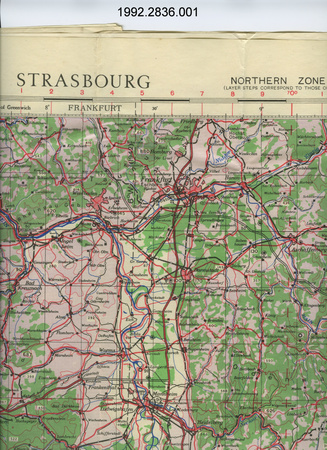
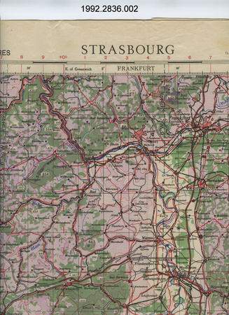
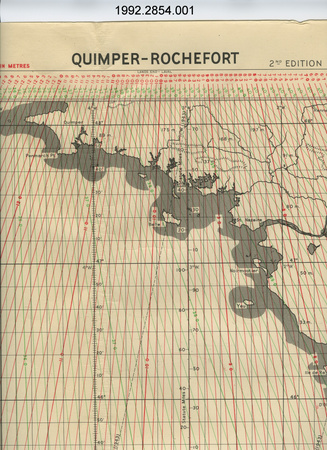
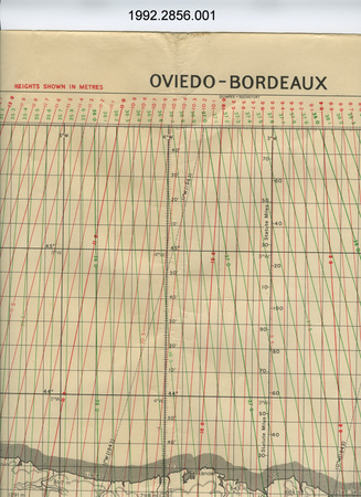
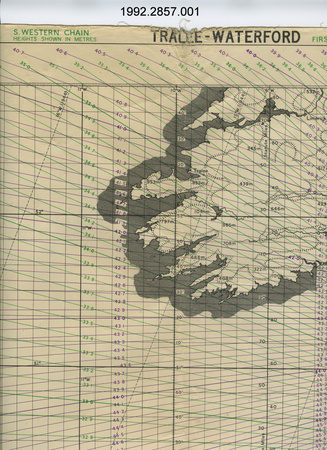
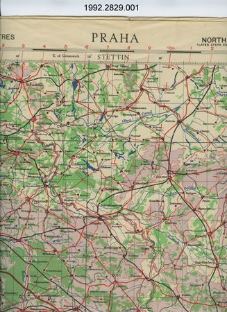
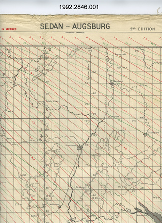
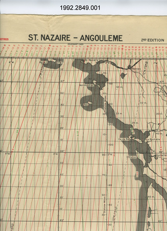
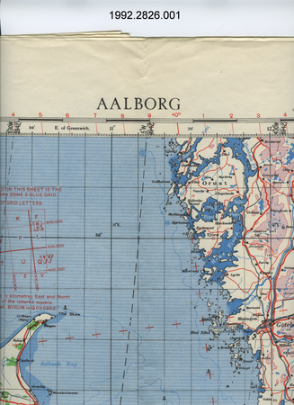
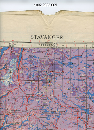
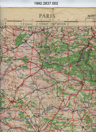
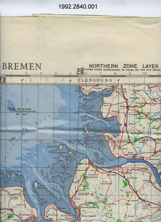
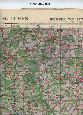
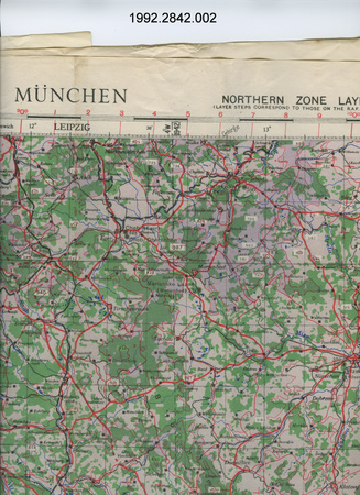
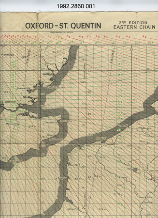
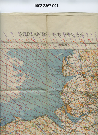
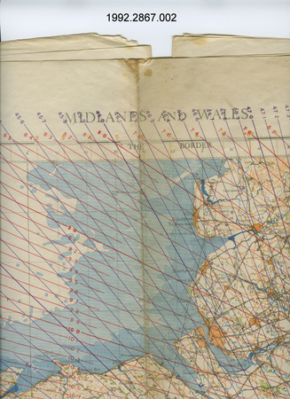
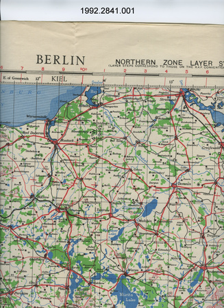
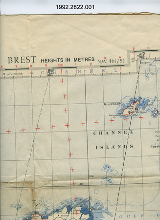
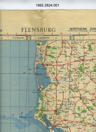
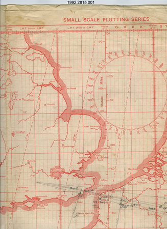
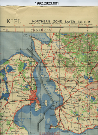
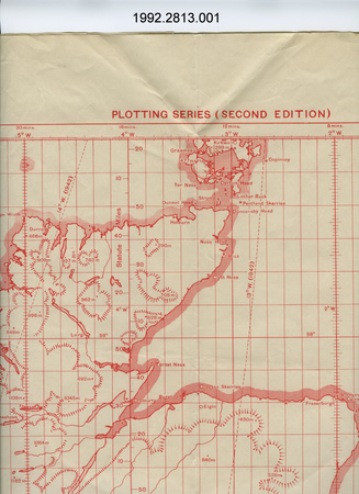
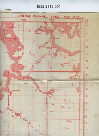
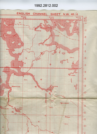
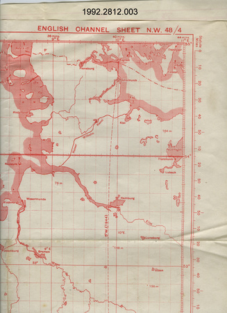
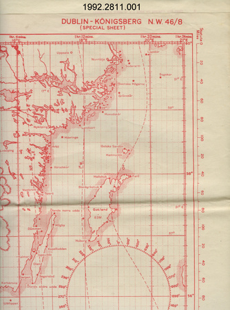
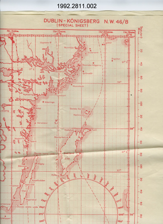
- OBJECT TYPE
- Airfields location
- DATE
- 1945
- ARTIFACT NUMBER
- 1992.2876.001
- MANUFACTURER
- Headquarters 21 Army Group
- MODEL
- Unknown
- LOCATION
- Unknown
More Information
General Information
- Serial #
- N/A
- Part Number
- 1
- Total Parts
- 1
- AKA
- N/A
- Patents
- N/A
- General Description
- paper
Dimensions
Note: These reflect the general size for storage and are not necessarily representative of the object's true dimensions.
- Length
- 89.0 cm
- Width
- 65.0 cm
- Height
- N/A
- Thickness
- N/A
- Weight
- N/A
- Diameter
- N/A
- Volume
- N/A
Lexicon
- Group
- Aviation
- Category
- Navigation instruments & equipment
- Sub-Category
- N/A
Manufacturer
- AKA
- Defence CA
- Country
- Unknown
- State/Province
- Unknown
- City
- Unknown
Context
- Country
- Europe
- State/Province
- Unknown
- Period
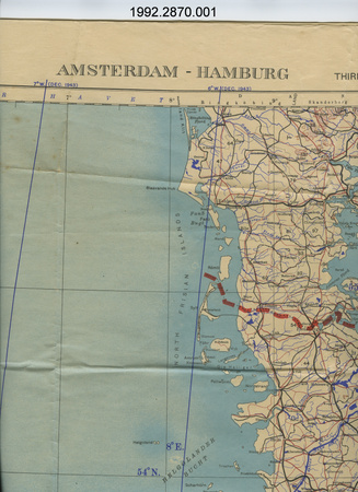
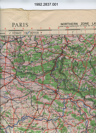
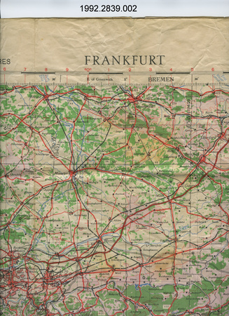
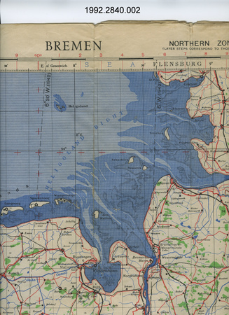
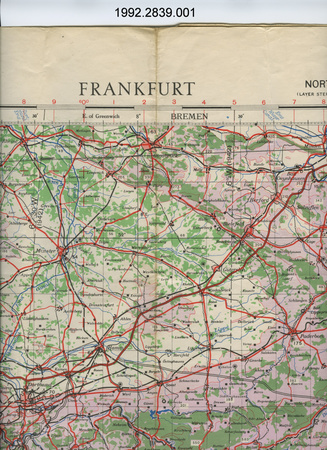
- WWII (1939-1945)/ map dated April 30, 1945
- Canada
-
many Canadians served as Navigators in RCAF squadrons attached to RAF commands during WWII - Function
-
2 dimensional graphic representation of a section of the earth's surface/ shows airfileds for purposes of planning military strategy, in particular bombing raids & military occupation & logistics - Technical
-
Unknown - Area Notes
-
Unknown
Details
- Markings
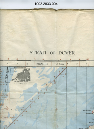
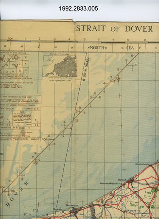
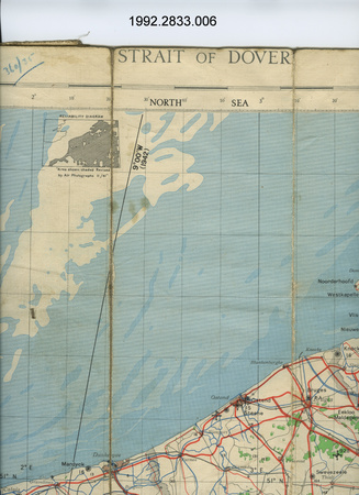
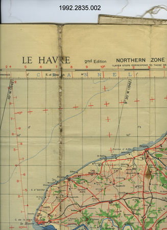
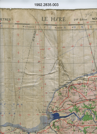
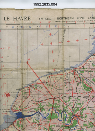
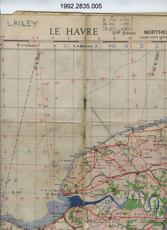
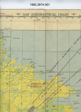
- lettering along top above edge of map reads: "CONFIDENTIAL 30 APRIL 1945 NOT TO BE TAKEN/INTO THE AIR/AIRFIELDS LOCATION MAP"; lettering along bottom below edge of map reads: "PREPARED BY CHIEF ENGINEER HEADQUARTERS 21 ARMY GROUP./21 A Gp No. 43 Adapted from AEAF 1,000000 (Sheets 2,5,7) Scale 1:1,000,000 WARNING - THE GRID ON THIS MAP IS APPROXIMATE ONLY AND [torn off]/PLUS OR MINUS I.K.M. IN ERROR WITH RESPECT TO LO[torn off]"
- Missing
- N/A
- Finish
- light blue on white background; existing airfields indicated in dark blue; allied operational airfields indicated in dark red
- Decoration
- N/A
CITE THIS OBJECT
If you choose to share our information about this collection object, please cite:
Headquarters 21 Army Group, Map, 1945, Artifact no. 1992.2876, Ingenium – Canada’s Museums of Science and Innovation, http://collection.ingenium.ca/en/id/1992.2876.001/
FEEDBACK
Submit a question or comment about this artifact.
More Like This


1992.2876.001
