Map

Use this image
Can I reuse this image without permission? Yes
Object images on the Ingenium Collection’s portal have the following Creative Commons license:
Copyright Ingenium / CC BY-NC-ND (Attribution-NonCommercial 4.0 International (CC BY-NC 4.0)
ATTRIBUTE THIS IMAGE
Ingenium,
1992.2777.001
Permalink:
Ingenium is releasing this image under the Creative Commons licensing framework, and encourages downloading and reuse for non-commercial purposes. Please acknowledge Ingenium and cite the artifact number.
DOWNLOAD IMAGEPURCHASE THIS IMAGE
This image is free for non-commercial use.
For commercial use, please consult our Reproduction Fees and contact us to purchase the image.
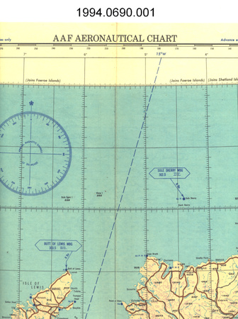
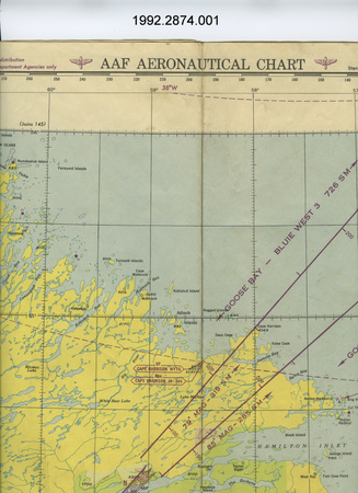
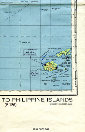
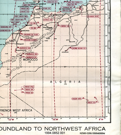
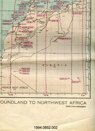
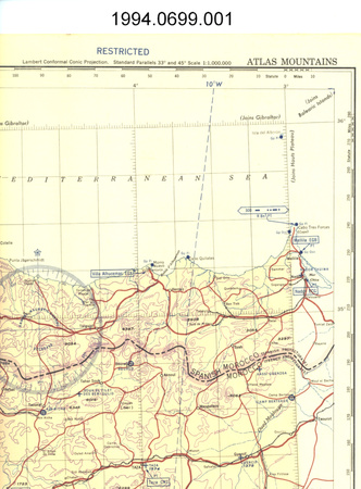
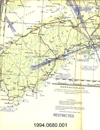
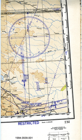
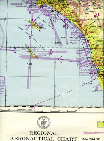
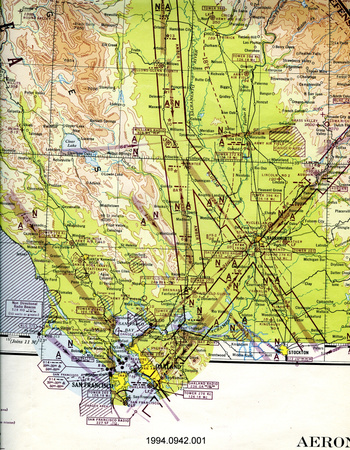
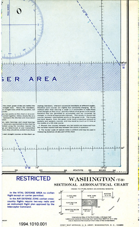
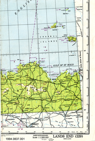
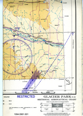
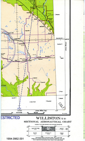
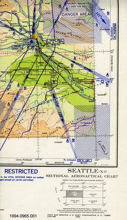
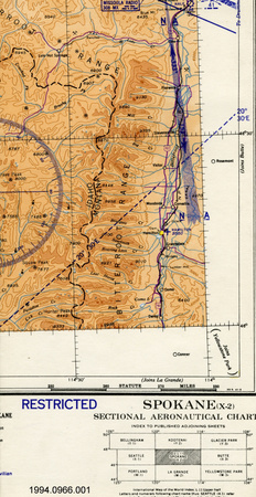
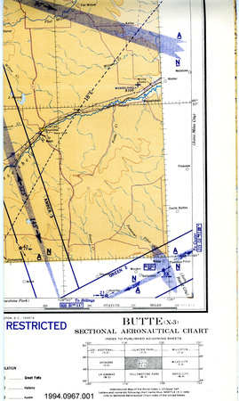
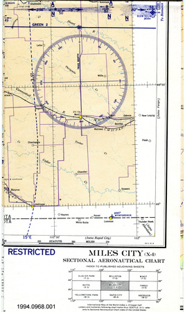
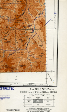
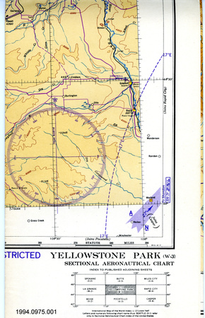
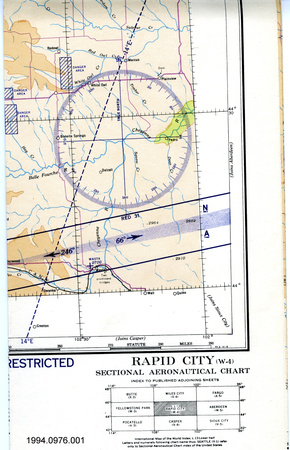
- OBJECT TYPE
- Special Air Navigation
- DATE
- 1945
- ARTIFACT NUMBER
- 1992.2777.001
- MANUFACTURER
- United States Army Air Forces
- MODEL
- Washington-Gander-Prestwick S-130
- LOCATION
- Washington, District of Columbia, United States of America
More Information
General Information
- Serial #
- N/A
- Part Number
- 1
- Total Parts
- 1
- AKA
- N/A
- Patents
- N/A
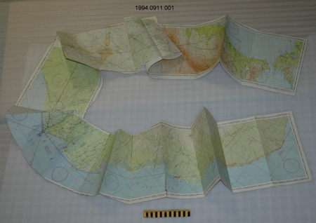
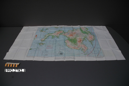
- General Description
- paper
Dimensions
Note: These reflect the general size for storage and are not necessarily representative of the object's true dimensions.
- Length
- 152.7 cm
- Width
- 106.5 cm
- Height
- N/A
- Thickness
- N/A
- Weight
- N/A
- Diameter
- N/A
- Volume
- N/A
Lexicon
- Group
- Aviation
- Category
- Navigation instruments & equipment
- Sub-Category
- N/A
Manufacturer
- AKA
- Defense US
- Country
- United States of America
- State/Province
- District of Columbia
- City
- Washington
Context
- Country
- Unknown
- State/Province
- Unknown
- Period
- dates on chart between 1943 & 1945
- Canada
-
Unknown - Function
-
graphic two-dimensional representation of a portion of the earth's surface/ used for aerial navigation & possibly planning military strategy - Technical
-
Unknown - Area Notes
-
Unknown
Details
- Markings
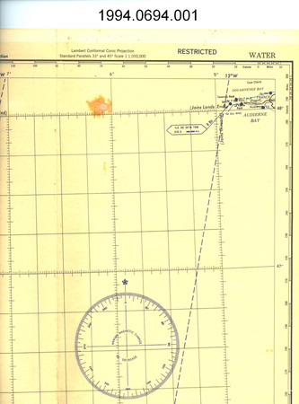
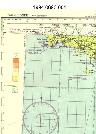
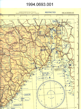
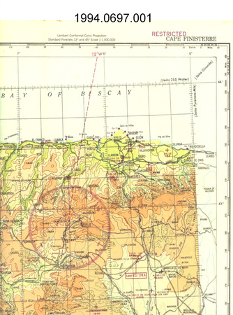
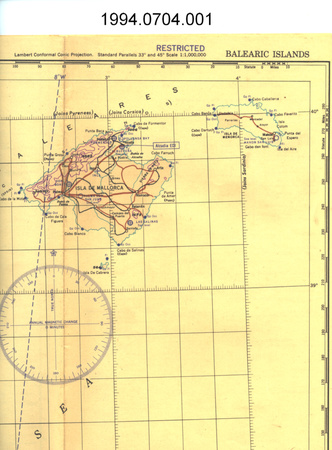
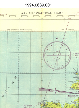
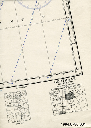
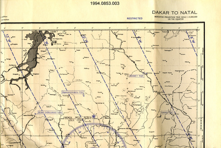
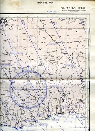
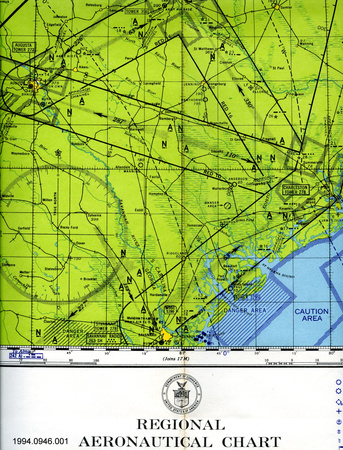
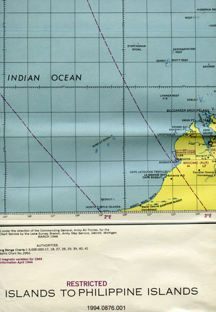
- lettering on top border reads: "WASHINGTON-GANDER-PRESTWICK/Not for sale or distribution/For use by War and Navy Department Agencies only/U.S. ARMY AIR FORCES/SPECIAL AIR NAVIGATION CHART/RESTRICTED/(NO. S-130) WASHINGTON-GANDER-PRESTWICK/MERCATOR PROJECTIONTRUE SCALE 1:3,000,000 ALONG/LATITUDE 60 [DEGREES] N"; lettering on bottom border includes: "Prepared under the direction of the Commanding General, Army Air Forces, for the/Aeronautical Chart Service by the Lake Survey Branch, Army Map Service, Detroit, Michigan/APRIL 1944...RESTRICTED/WASHINGTON-GANDER-PRESTWICK (NO. S-130)/Lines of equal magnetic variation for 1943/Aeronautical information MARCH 1945...NOTE: OFFICERS USING THIS CHART WILL MARK HEREON CORRECTIONS AND ADDITIONS WHICH COME TO THEIR ATTENTION AND/MAIL DIRECT TO THE AERONAUTICAL CHART SERVICE, HEADQUARTERS, ARMY AIR FORCES, WASHINGTON, D.C./ARMY MAP SERVICE U.S. ARMY, WASHINGTON, D.C. 340264/W.P. 1/45 1944/FIRST EDITION Subject to Correction/WASHINGTON-GANDER-PRESTWICK/(NO. S-130)"
- Missing
- N/A
- Finish
- colour map on white background
- Decoration
- N/A
CITE THIS OBJECT
If you choose to share our information about this collection object, please cite:
United States Army Air Forces, Map, circa 1945, Artifact no. 1992.2777, Ingenium – Canada’s Museums of Science and Innovation, http://collection.ingenium.ca/en/id/1992.2777.001/
FEEDBACK
Submit a question or comment about this artifact.
More Like This


1992.2777.001