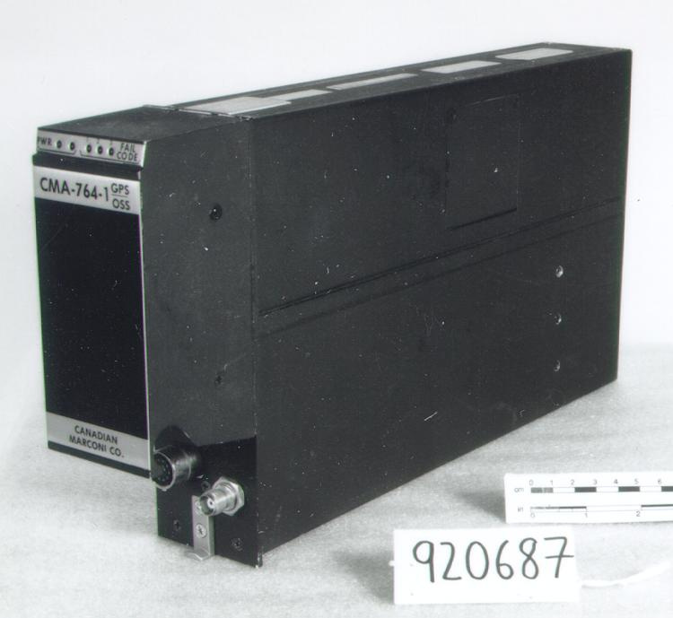
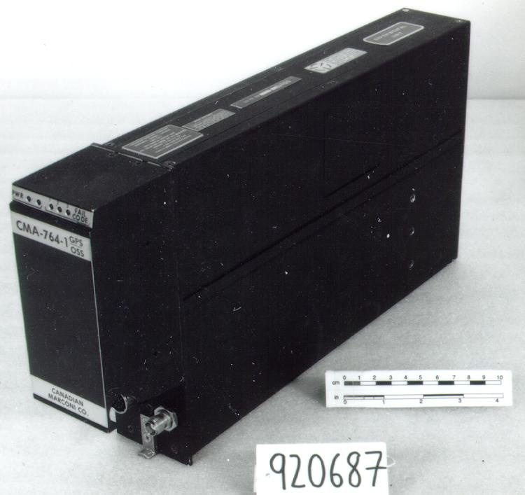
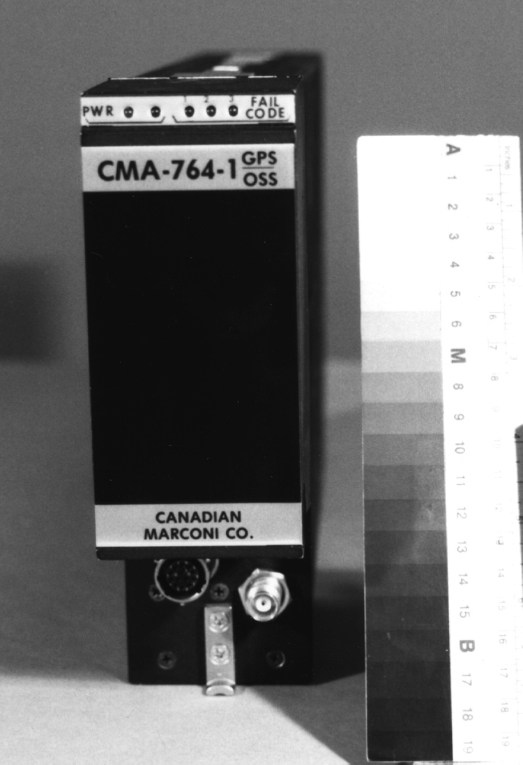
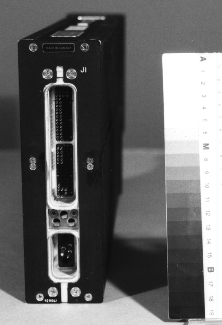
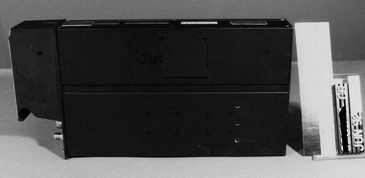
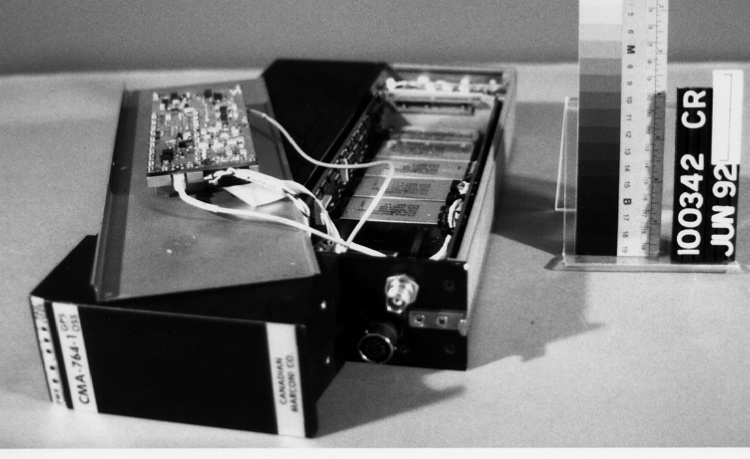
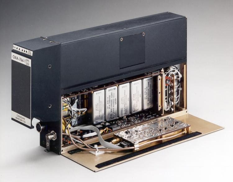
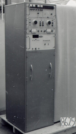
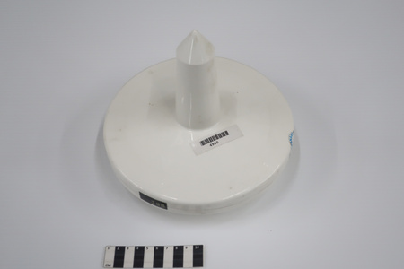
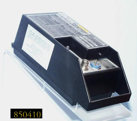
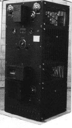
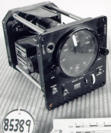
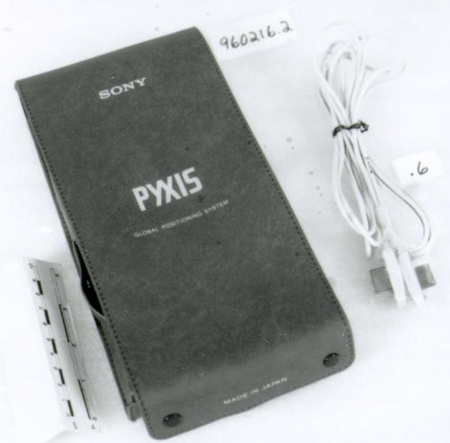
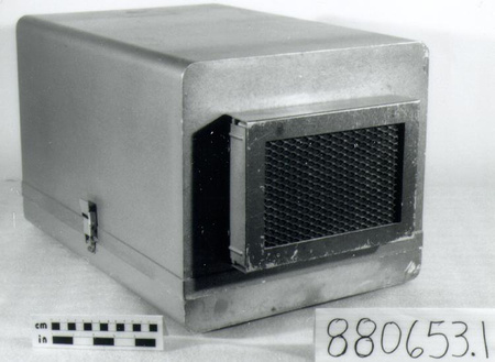
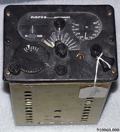
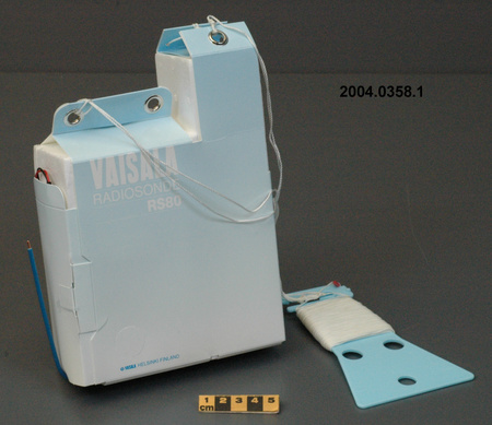
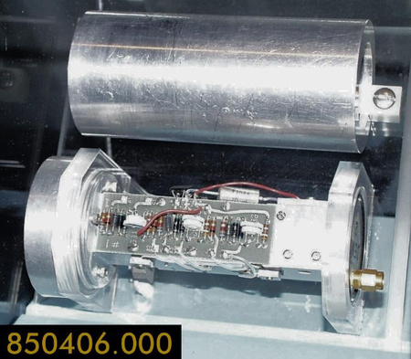
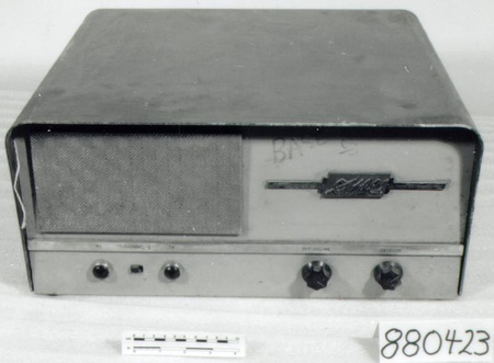
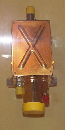
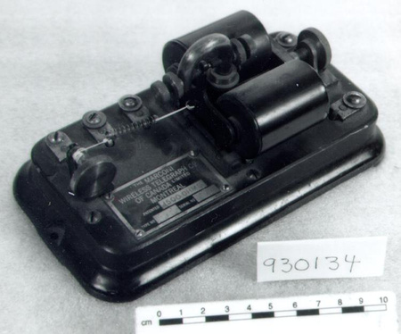
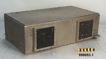
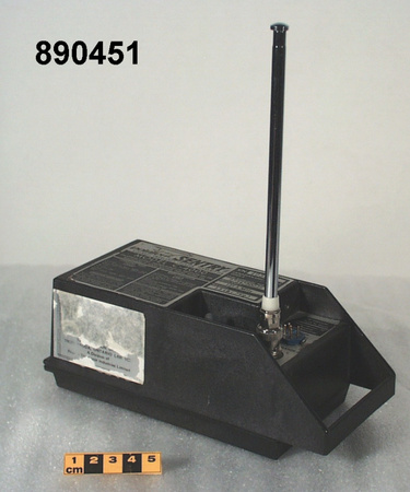
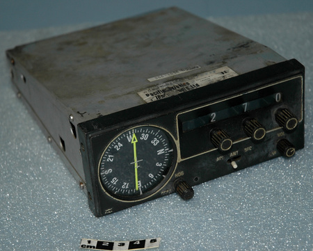
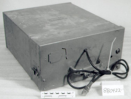
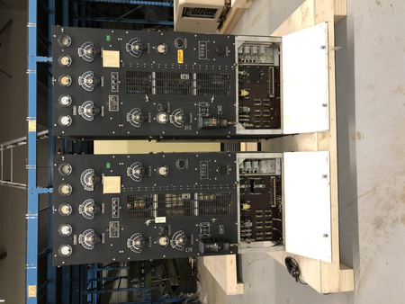
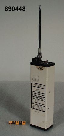
Receiver, positioning system


Use this image
Can I reuse this image without permission? Yes
Object images on the Ingenium Collection’s portal have the following Creative Commons license:
Copyright Ingenium / CC BY-NC-ND (Attribution-NonCommercial 4.0 International (CC BY-NC 4.0)
ATTRIBUTE THIS IMAGE
Ingenium,
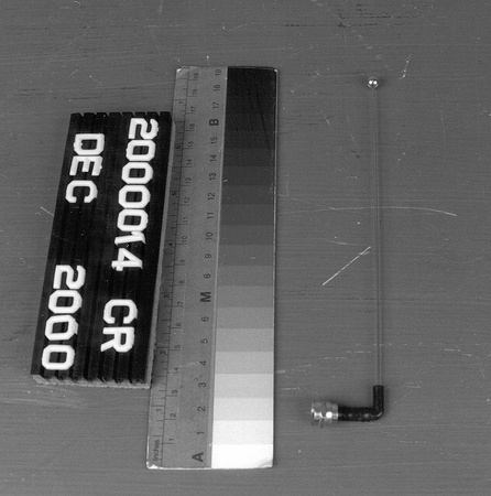
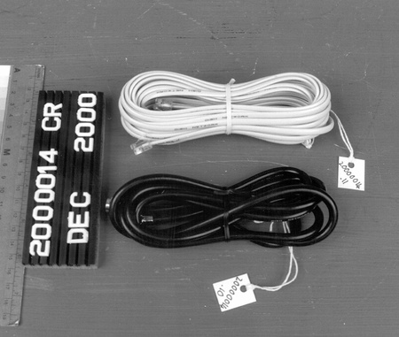
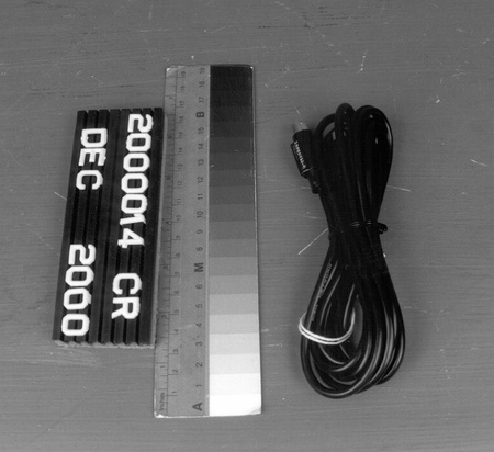
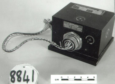
1992.0687.001
Permalink:
Ingenium is releasing this image under the Creative Commons licensing framework, and encourages downloading and reuse for non-commercial purposes. Please acknowledge Ingenium and cite the artifact number.
DOWNLOAD IMAGEPURCHASE THIS IMAGE
This image is free for non-commercial use.
For commercial use, please consult our Reproduction Fees and contact us to purchase the image.
- OBJECT TYPE
- NAVIGATIONAL SATELLITE/AIRCRAFT
- DATE
- Unknown
- ARTIFACT NUMBER
- 1992.0687.001
- MANUFACTURER
- Canadian Marconi Co.
- MODEL
- NAVSTAR GPS/OMEGA/ CMA-764-1
- LOCATION
- Montreal, Quebec, Canada
More Information
General Information
- Serial #
- 4X
- Part Number
- 1
- Total Parts
- 1
- AKA
- GPS
- Patents
- N/A
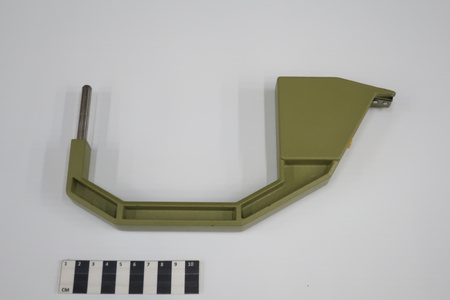
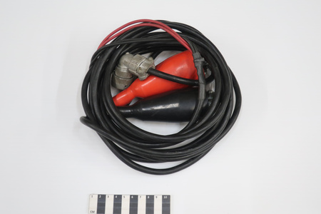
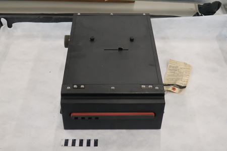
- General Description
- ALUMINUM CASING/ METAL & SYNTHETIC PARTS
Dimensions
Note: These reflect the general size for storage and are not necessarily representative of the object's true dimensions.
- Length
- 38.8 cm
- Width
- 6.2 cm
- Height
- 19.9 cm
- Thickness
- N/A
- Weight
- N/A
- Diameter
- N/A
- Volume
- N/A
Lexicon
- Group
- Marine Transportation
- Category
- Navigation instruments & equipment
- Sub-Category
- N/A
Manufacturer
- AKA
- Marconi
- Country
- Canada
- State/Province
- Quebec
- City
- Montreal
Context
- Country
- Unknown
- State/Province
- Unknown
- Period
- Unknown
- Canada
-
CANADIAN MANUFACTURED COMPONENT OF AMERICAN GPS SYSTEM. CANADIAN MARCONI HAS DELIVERED NEARLY 500 GPS & OMEGA/VLF SYSTEMS TO AIRFRAME & AVIONICS MANUFACTURERS IN OVER 90 COUNTRIES. THE CMA-764-1 IS THE RESULT OF OVER 15 YEARS OF MFR'S EXPERIENCE IN THE AIRBORNEGPS FIELD. - Function
-
AIRCRAFT UNIT RECEIVES SIGNALS BROADCAST BY WORLDWIDE OMEGA GROUND TRANSMITTER NETWORK & UP TO 8 GPS SATELLITES & CALCULATES LATITUDE, LONGITUDE, & ALTITUDE TO PROVIDE 3 DIMENSIONAL POSITION FIX, AS WELL AS VELOCITY & TIME PARAMETERS - Technical
-
A SPACE-BASED NAVIGATION SYSTEM MORE SOPHISTICATED THAN ITS PREDECESSOR, TRANSIT, PROVIDING NAVIGATIONAL ACCURACY TO BETTER THAN 100 M.DEVELOPED IN U.S. IN MID 1970'S FOR MILITARY USE, SOME YEARS LATER A CIVILIAN VERSION WAS OFFERED. PRESENTLY 18 GPS SATELLITES ARE IN ORBIT, EVENTUALLY 24 WILL BE IN USE. - Area Notes
-
Unknown
Details
- Markings
- PLATE ON TOP READING 'CANADIAN MARCONI COMPANY/ MONTREAL, QUEBEC, CANADA/ CMA-764-1/ GPS/OMEGA SENSOR UNIT/ P/N: 100-601200-100 SER. NO. 004X/ WEIGHT 7.9 lbs/ 3.6 Kg/ DO-160B ENV CAT/ F2A2/AMNO/YXXXXXZAAAA' IN SILVER LETTERING ON BLACK PLATE/ METALLIC PLATES READING 'CMA-764-1 GPS/OSS', & 'CANADIAN/ MARCONI CO.' IN BLACK/ BLACK DECALS WITH SILVER LETTERING READING 'EXPERIMENTAL UNIT' & 'MADE IN CANADA'
- Missing
- N/A
- Finish
- LIGHTLY TEXTURED BLACK ENAMEL PAINTED CASING/ GOLD COLOURED & METALLIC PARTS/ MULTICOLOURED SYNTHETIC
- Decoration
- N/A
CITE THIS OBJECT
If you choose to share our information about this collection object, please cite:
Canadian Marconi Co., Receiver, positioning system, Unknown Date, Artifact no. 1992.0687, Ingenium – Canada’s Museums of Science and Innovation, http://collection.ingenium.ca/en/id/1992.0687.001/
FEEDBACK
Submit a question or comment about this artifact.
More Like This


1992.0687.001