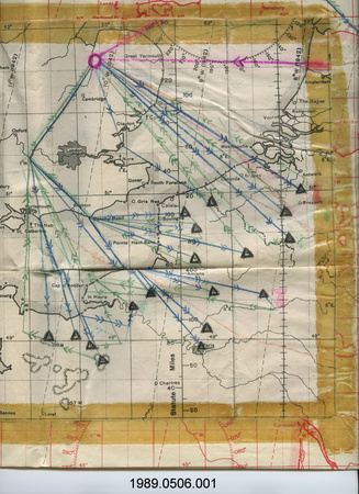
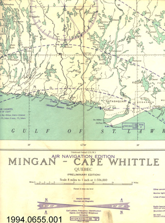
Map
Use this image
Can I reuse this image without permission? Yes
Object images on the Ingenium Collection’s portal have the following Creative Commons license:
Copyright Ingenium / CC BY-NC-ND (Attribution-NonCommercial 4.0 International (CC BY-NC 4.0)
ATTRIBUTE THIS IMAGE
Ingenium,
1988.1357.014
Permalink:
Ingenium is releasing this image under the Creative Commons licensing framework, and encourages downloading and reuse for non-commercial purposes. Please acknowledge Ingenium and cite the artifact number.
DOWNLOAD IMAGEPURCHASE THIS IMAGE
This image is free for non-commercial use.
For commercial use, please consult our Reproduction Fees and contact us to purchase the image.
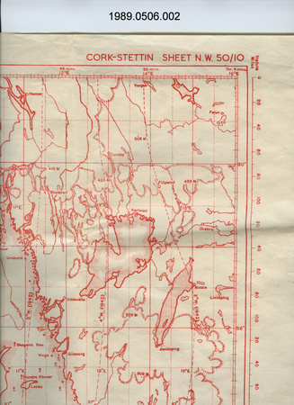
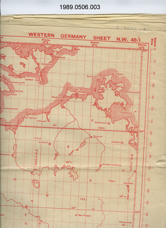
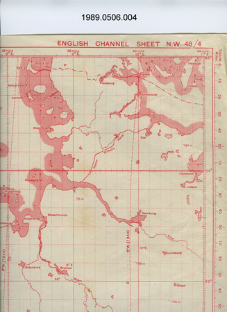
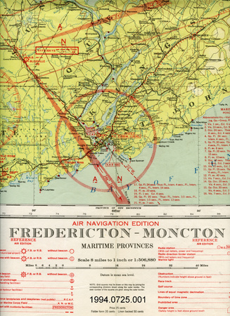
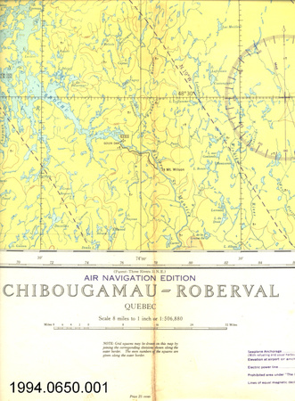
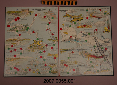
- OBJECT TYPE
- TOPOGRAPHICAL/WALL
- DATE
- 1942
- ARTIFACT NUMBER
- 1988.1357.014
- MANUFACTURER
- Dept. of Mines & Resources
- MODEL
- Training Schools Depots & Recruiting Centres
- LOCATION
- Ottawa, Ontario, Canada
More Information
General Information
- Serial #
- N/A
- Part Number
- 14
- Total Parts
- 16
- AKA
- N/A
- Patents
- N/A
- General Description
- paper
Dimensions
Note: These reflect the general size for storage and are not necessarily representative of the object's true dimensions.
- Length
- 91.5 cm
- Width
- 64.8 cm
- Height
- N/A
- Thickness
- N/A
- Weight
- N/A
- Diameter
- N/A
- Volume
- N/A
Lexicon
- Group
- Aviation
- Category
- Archives
- Sub-Category
- N/A
Manufacturer
- AKA
- Mines Resources CA
- Country
- Canada
- State/Province
- Ontario
- City
- Ottawa
Context
- Country
- Canada
- State/Province
- Unknown
- Period
- WWII (1939-1945); the BCATP existed 1940-1945; BCATP data added to this map as of March 3, 1942
- Canada
-
the British Commonwealth Training Plan operated exclusively in Canada to train flight crews for British Commonwealth air forces - Function
-
shows network of BCATP installations throughout Canada/ souvenir of the career of the donor, Mr. Ron E. Norman, a member of the Royal Flying Corps 21 Squadron during WWI; active in aviation & veterans associations throughout the remainder of his life - Technical
-
Unknown - Area Notes
-
Unknown
Details
- Markings
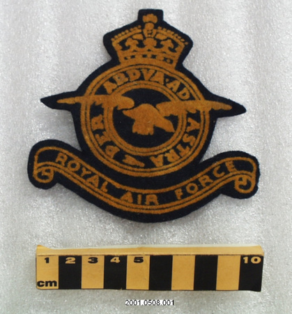
- legend for original map reads: "Department of Mines and Resources/HONOURABLE T.A. CRERAR, Minister; C. CAMSELL, Deputy Minister/SURVEYS AND ENTINEERING BRANCH/J.M. WARDLE, Director/DOMINION OF CANADA/SOUTH OF LATITUDE 75 [degrees]/Scale 1:6,336,000 or 100 Miles to 1 Inch./1937"; lettering along bottom right border reads: "REPRODUCED AND PRINTED AT THE OFFICE OF THE SURVEYOR GENERAL AND CHIEF, HYDROGRAPHIC SERVICE, OTTAWA, 1937, FROM WHOM ADDITIONAL COPIES OF THIS MAP MAY BE OBTAINED"; BCATP legend reads: "TRAINING SCHOOLS/DEPOTS AND RECRUITING CENTRES/Established under the/BRITISH COMMONWEALTH AIR TRAINING PLAN/as of March 3rd, 1942/NOT TO BE PUBLISHED"
- Missing
- N/A
- Finish
- original map colour (land = white; water = green; lettering = black); BCATP information superimposed in red
- Decoration
- map of Canada
CITE THIS OBJECT
If you choose to share our information about this collection object, please cite:
Dept. of Mines & Resources, Map, 1942, Artifact no. 1988.1357, Ingenium – Canada’s Museums of Science and Innovation, http://collection.ingenium.ca/en/id/1988.1357.014/
FEEDBACK
Submit a question or comment about this artifact.
More Like This

1988.1357.014