Map
Use this image
Can I reuse this image without permission? Yes
Object images on the Ingenium Collection’s portal have the following Creative Commons license:
Copyright Ingenium / CC BY-NC-ND (Attribution-NonCommercial 4.0 International (CC BY-NC 4.0)
ATTRIBUTE THIS IMAGE
Ingenium,
1984.1346.001
Permalink:
Ingenium is releasing this image under the Creative Commons licensing framework, and encourages downloading and reuse for non-commercial purposes. Please acknowledge Ingenium and cite the artifact number.
DOWNLOAD IMAGEPURCHASE THIS IMAGE
This image is free for non-commercial use.
For commercial use, please consult our Reproduction Fees and contact us to purchase the image.
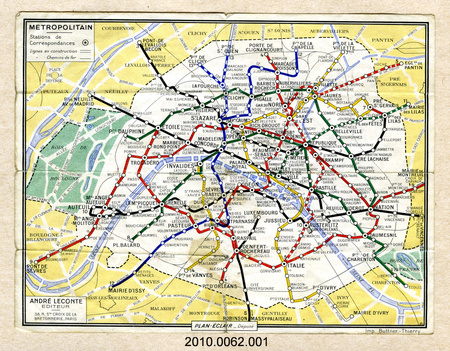
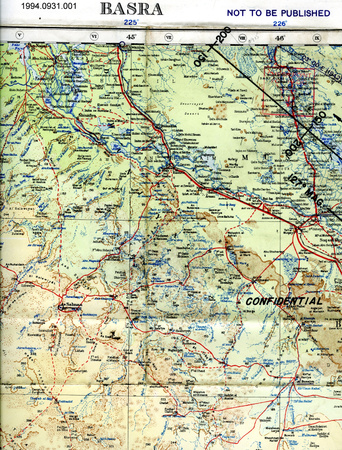
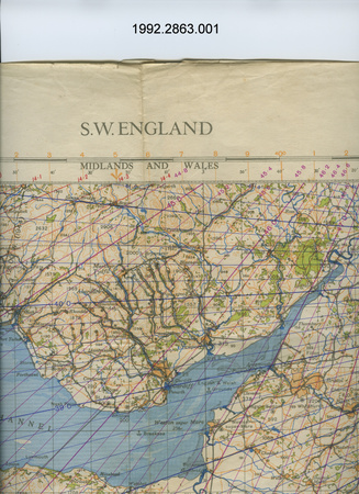
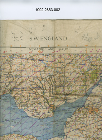
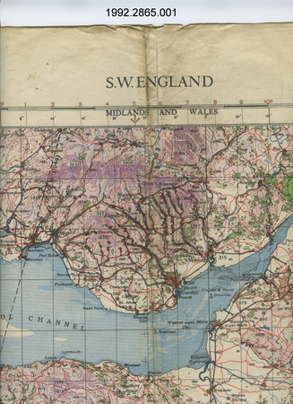
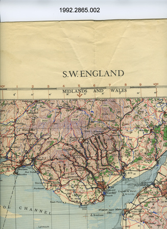
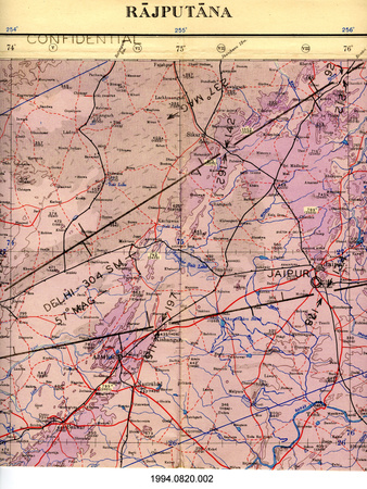
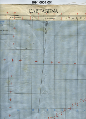
- OBJECT TYPE
- TOPOGRAPHICAL/FOLDING
- DATE
- 1917
- ARTIFACT NUMBER
- 1984.1346.001
- MANUFACTURER
- Federation des Automobile Clubs Regionaux de France
- MODEL
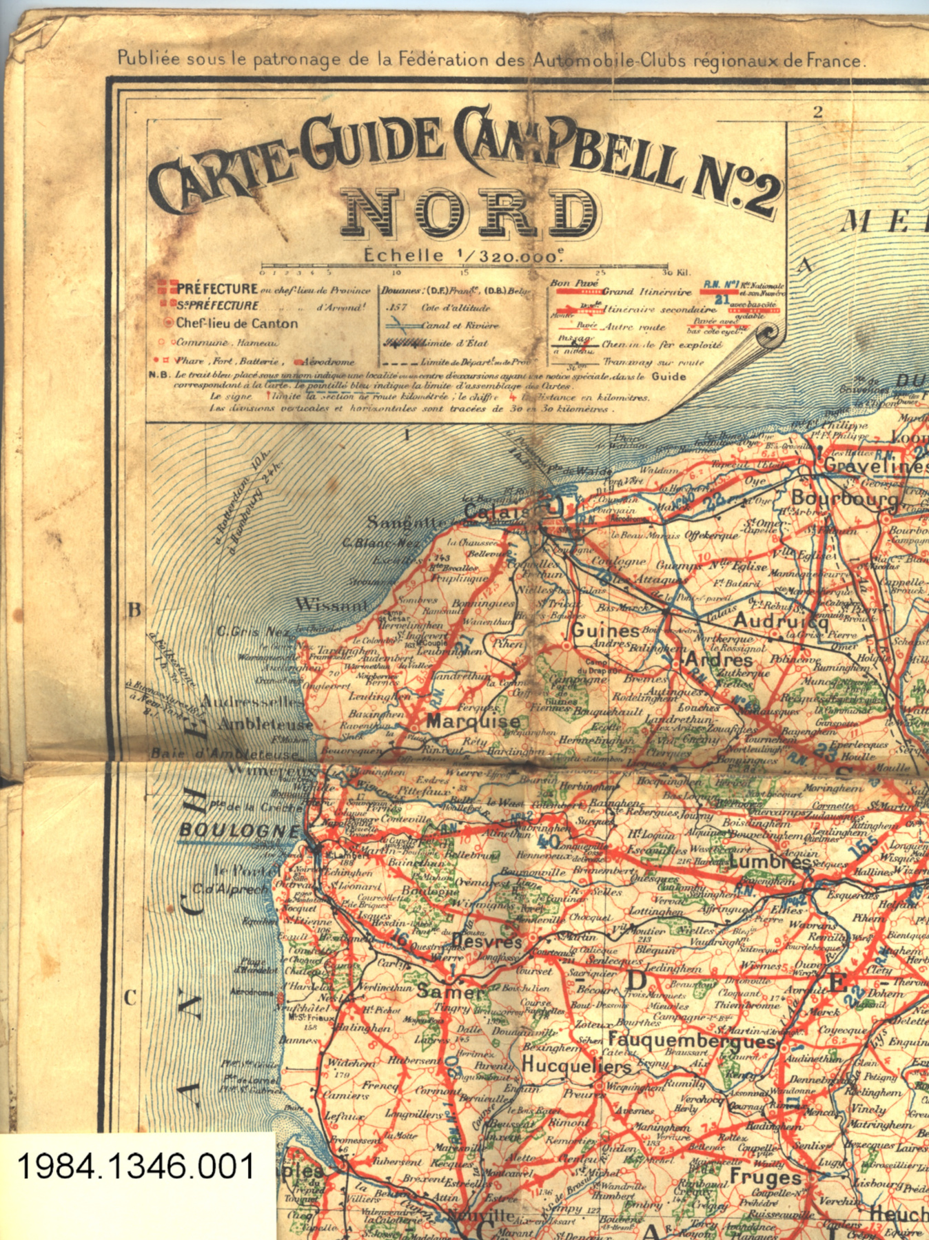
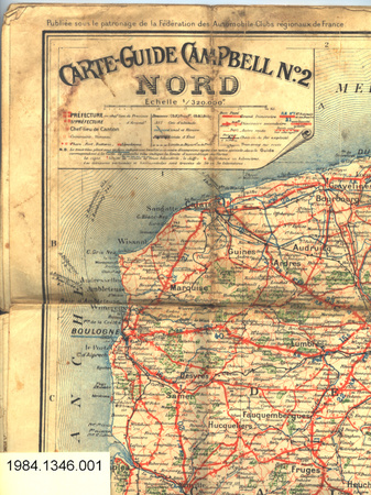
- Carte-Guide Campbell No. 2 Nord
- LOCATION
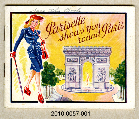
- Paris, France
More Information
General Information
- Serial #
- N/A
- Part Number
- 1
- Total Parts
- 2
- AKA
- N/A
- Patents
- N/A
- General Description
- paper
Dimensions
Note: These reflect the general size for storage and are not necessarily representative of the object's true dimensions.
- Length
- 97.2 cm
- Width
- 69.6 cm
- Height
- N/A
- Thickness
- N/A
- Weight
- N/A
- Diameter
- N/A
- Volume
- N/A
Lexicon
- Group
- Aviation
- Category
- Commemorative
- Sub-Category
- N/A
Manufacturer
- AKA
- Automobile Club
- Country
- France
- State/Province
- Unknown
- City
- Paris
Context
- Country
- Europe
- State/Province
- Unknown
- Period
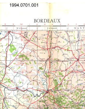
- WWI (1914-1918); this map shows the "front" as it existed between March 1 & July 15, 1917
- Canada
-
Unknown - Function
-
graphic 2-dimensional representation of a portion of the earth's surface/ likely used for planning military strategy/ can be folded & stored inside .2 case - Technical
-
Unknown - Area Notes
-
Unknown
Details
- Markings
- lettering along top reads: "Publiee sous le patronage de la Federation des Automobile-Clubs regionaux de France. Front au 1 Mars 1917 ---- au 15 Juillet 1917"; ledgend reads: "CARTE-GUIDE CAMPBELL No. 2/NORD/Echelle 1/320,000e."; lettering on border below map reads: "E. BLONDEL LA ROUGERY, Editeur,/7 Rue St. Lazare. - PARIS./AUTRES CARTES DE LA GUERRE/Editees par la maison/(Toutes ces cartes sont dressees, dessinees ou gravees/dans les ateliers cartographiques Ed. BLONDEL LA ROUGERY)/Assenblage des/CARTES CAMPBELL au 320,000e./pour suivre les/Operations militaires sur le/FRONT FRANCAIS/Cartes de 70/97 - 1f.50 chacune/CARTE GENERALE/du/FRONT FRANCAIS/Format 56/76 - Prix 1c."
- Missing
- N/A
- Finish
- colour map on white background
- Decoration
- N/A
CITE THIS OBJECT
If you choose to share our information about this collection object, please cite:
Federation des Automobile Clubs Regionaux de France, Map, 1917, Artifact no. 1984.1346, Ingenium – Canada’s Museums of Science and Innovation, http://collection.ingenium.ca/en/id/1984.1346.001/
FEEDBACK
Submit a question or comment about this artifact.
More Like This


1984.1346.001