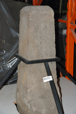
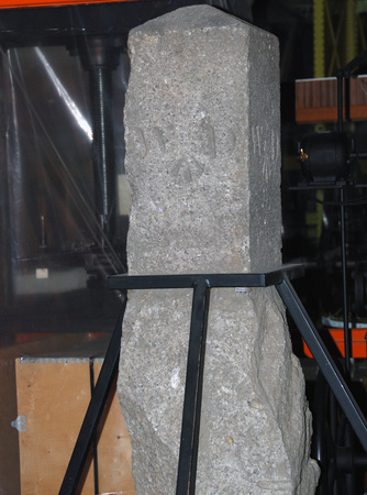
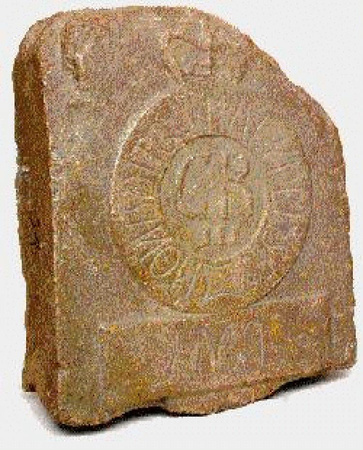
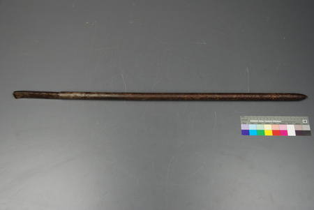
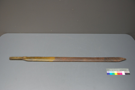
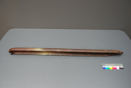
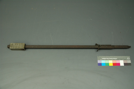
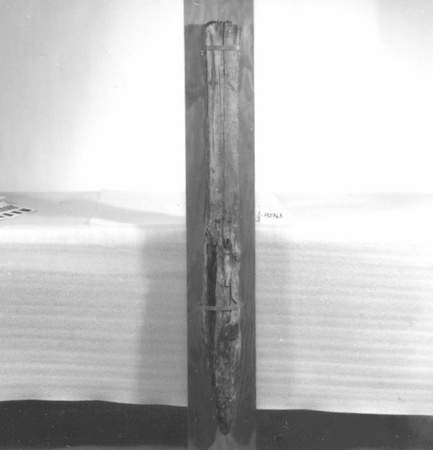
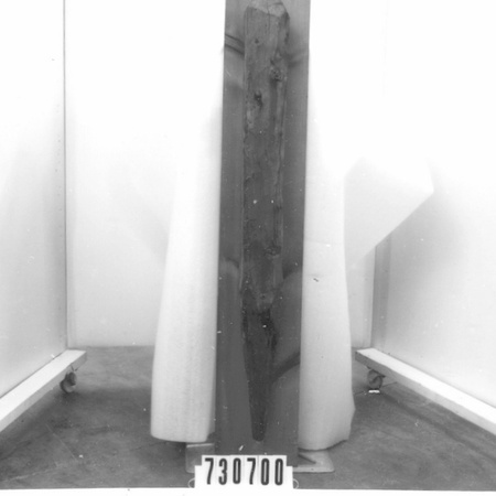
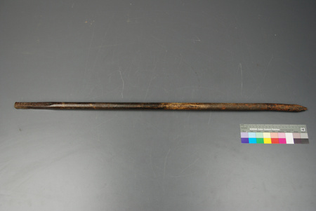
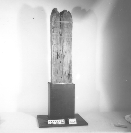
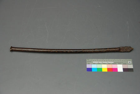
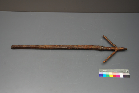
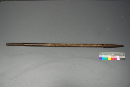
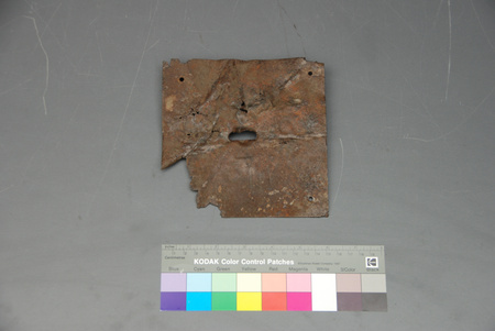
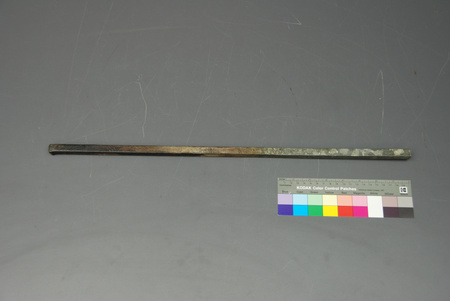
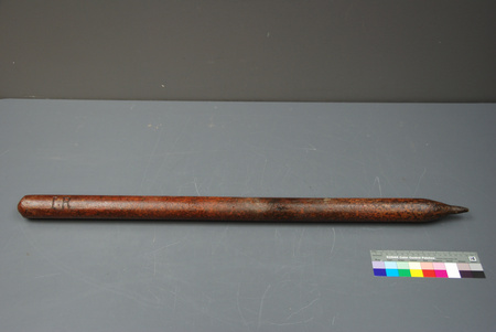
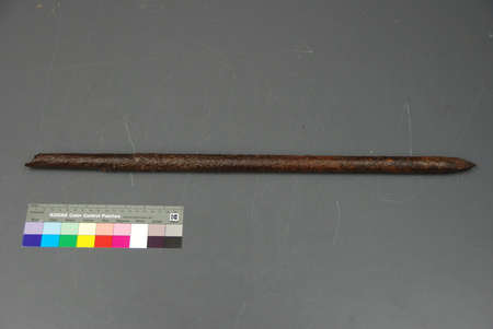
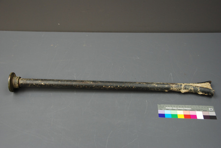
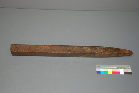
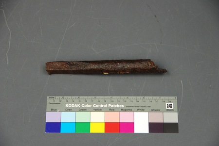
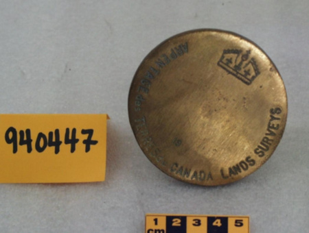
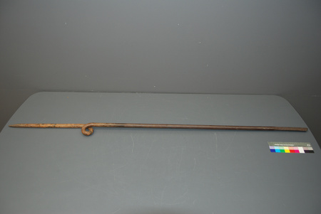
Marker, survey
Use this image
Can I reuse this image without permission? Yes
Object images on the Ingenium Collection’s portal have the following Creative Commons license:
Copyright Ingenium / CC BY-NC-ND (Attribution-NonCommercial 4.0 International (CC BY-NC 4.0)
ATTRIBUTE THIS IMAGE
Ingenium,
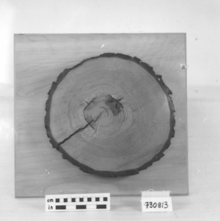
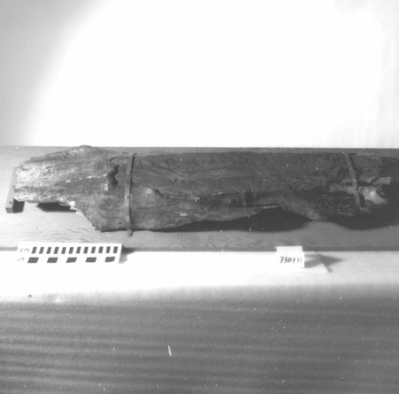
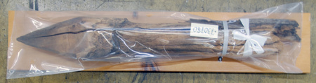
1973.0806.001
Permalink:
Ingenium is releasing this image under the Creative Commons licensing framework, and encourages downloading and reuse for non-commercial purposes. Please acknowledge Ingenium and cite the artifact number.
DOWNLOAD IMAGEPURCHASE THIS IMAGE
This image is free for non-commercial use.
For commercial use, please consult our Reproduction Fees and contact us to purchase the image.
- OBJECT TYPE
- MONUMENT/STONE/BOUNDARY/ORDNANCE LAND
- DATE
- 1850
- ARTIFACT NUMBER
- 1973.0806.001
- MANUFACTURER
- Unknown
- MODEL
- Unknown
- LOCATION
- Unknown
More Information
General Information
- Serial #
- N/A
- Part Number
- 1
- Total Parts
- 1
- AKA
- N/A
- Patents
- N/A
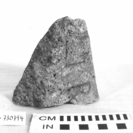
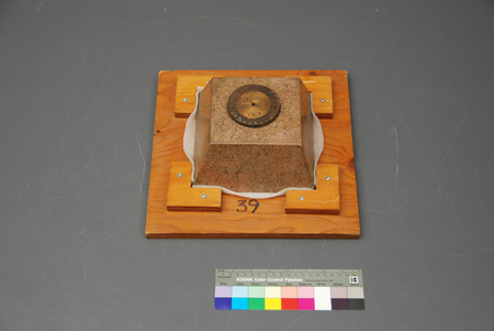
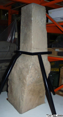
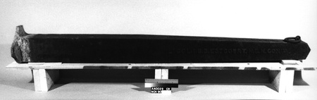
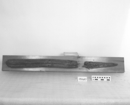
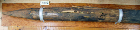
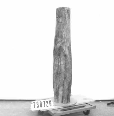
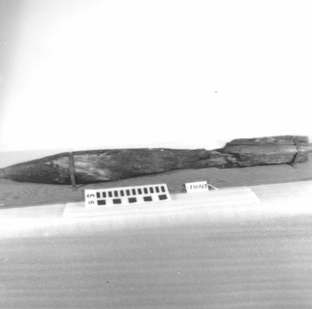
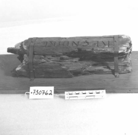
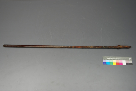
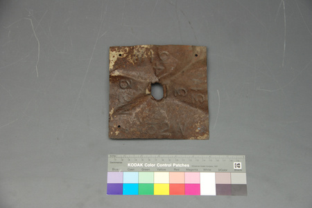
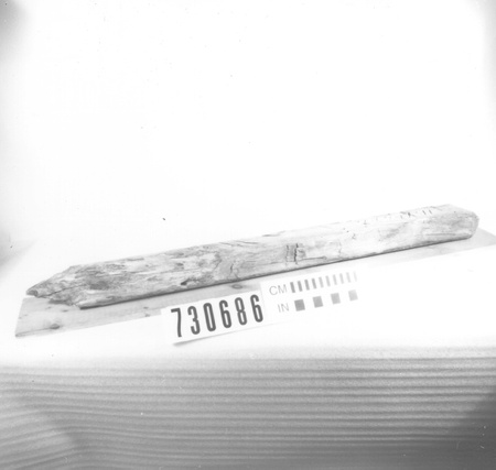
- General Description
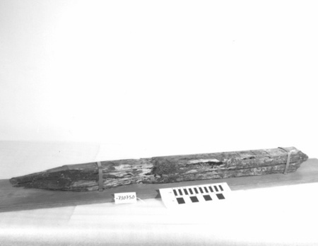
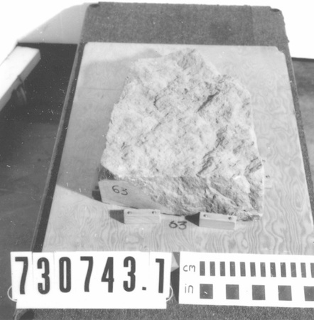
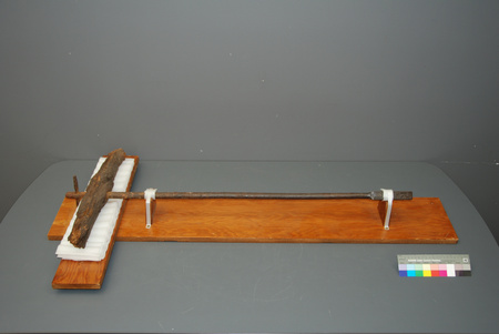
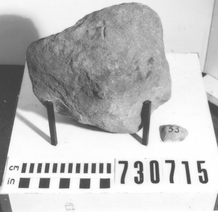
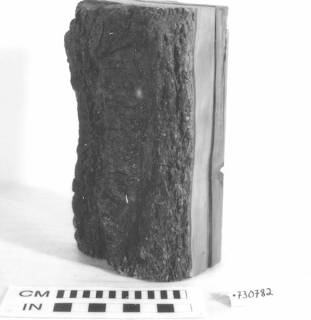
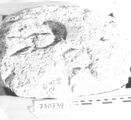
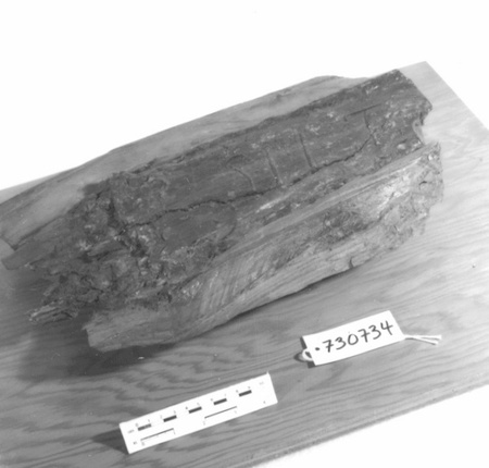
- LIMESTONE MONUMENT RESTS ON WOOD DISPLAY PLATFORM, METAL FRAME
Dimensions
Note: These reflect the general size for storage and are not necessarily representative of the object's true dimensions.
- Length
- 126.5 cm
- Width
- 126.0 cm
- Height
- 110.0 cm
- Thickness
- N/A
- Weight
- N/A
- Diameter
- N/A
- Volume
- N/A
Lexicon
- Group
- Exploration and Survey
- Category
- Landmarks
- Sub-Category
- N/A
Manufacturer
- AKA
- Unknown
- Country
- Unknown
- State/Province
- Unknown
- City
- Unknown
Context
- Country
- Canada
- State/Province
- Ontario
- Period
- C. 1850-1963. POSSIBLY AS EARLY AS 1830
- Canada
-
BOUNDARY STONE FROM ORDNANCE LAND (MILITARY RESERVE) NEAR SMITHS FALLS. THIS MONUMENT & 1850 SURVEY ORIGINALLY RECORDED IN ORDNACE OFFICE AT BYTOWN AS PLAN 11, PART SECOND, RIDEAU CANAL, BOOK 1851. DETAILS OF STONE'S PLACEMENT UNCERTAIN BUT RECORDS INDICATE LAND TAKEN FORSERVICE OF RIDEAU CANAL C. 1830 (REF.1 P.57) - Function
-
TO MARK & IDENTIFY A SPECIFIC SITE ON THE BOUNDARY LINE OF A SURVEYED AREA - Technical
-
EXAMPLE OF MARKER DATING PRE-CONFEDERATION. PART OF CDN LANDMARKS COLLECTION, EST'D IN 1952 BY R.W. CLARK, D.L.S., S.L.S. THESE MARKERS SPAN OVER 200 YRS. OF CANADIAN SURVEYING & INCLUDE ITEMS FROM EVERY PROVINCE & TERRITORY EXCEPT NFLD. - Area Notes
-
Unknown
Details
- Markings
- `[UP ARROW SYMBOL]' CARVED DEEPLY INTO ONE FACE OF SQUARED POST/ `\ II' CARVED INTO TOP SURFACE OF POST; RED PAINTED CIRCLE APPEARS IN SAME AREA AS CARVED LINES.
- Missing
- NONE From CA of 02/24/1994 by Tony Missio: No - Complete
- Finish
- UPPER TWO-THIRDS COARSE GREY STONE CUT & DRESSED/ BLACK METAL FRAME SUPPORTS STONE WHICH IS PARTIALLY INSET IN WOOD BASE
- Decoration
- APPEARS TO BE A DECORATIVE BORDER OF CLOSE-SPACED LINES CUT INTO FLAT FACES OF STONE
CITE THIS OBJECT
If you choose to share our information about this collection object, please cite:
Unknown Manufacturer, Marker, survey, before 1850, Artifact no. 1973.0806, Ingenium – Canada’s Museums of Science and Innovation, http://collection.ingenium.ca/en/id/1973.0806.001/
FEEDBACK
Submit a question or comment about this artifact.
More Like This


1973.0806.001
